Wandin North, Victoria
| Wandin North Victoria | |||||||||||||
|---|---|---|---|---|---|---|---|---|---|---|---|---|---|
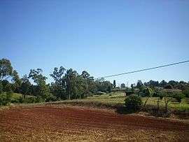 Pastoral property in Wandin North | |||||||||||||
 Wandin North | |||||||||||||
| Coordinates | 37°46′08″S 145°24′40″E / 37.769°S 145.411°ECoordinates: 37°46′08″S 145°24′40″E / 37.769°S 145.411°E | ||||||||||||
| Population | 2,911 (2011 census)[1] | ||||||||||||
| Postcode(s) | 3139 | ||||||||||||
| Elevation | 159 m (522 ft) | ||||||||||||
| Location | |||||||||||||
| LGA(s) | Shire of Yarra Ranges | ||||||||||||
| State electorate(s) | Evelyn | ||||||||||||
| Federal Division(s) | Casey | ||||||||||||
| |||||||||||||
Wandin North is a suburb in Melbourne, Victoria, Australia, 40 km east from Melbourne's central business district. Its local government area is the Shire of Yarra Ranges. At the 2011 census, Wandin North had a population of 2,911.
History
The Post Office opened around 1909. An earlier office (1884) named Wandin North was renamed Seville.[2] The Wandin North Primary School opened in 1915 and in 2016 had 240 students.[3]
Railway
Wandin North used to have a railway station simply called Wandin on the Warburton branch line which opened in 1901 and closed in 1965.
The town today
Wandin North contains a number of attractions such as Warratina Lavender Farm, Katandra Gardens, Native plant Garden, Mont De Lancey, Wild Cattle Creek Winery and the numerous fruit orchards.
Wandin North is the home of a vibrant shopping precinct.
References
- ↑ Australian Bureau of Statistics (31 October 2012). "Wandin North (State Suburb)". 2011 Census QuickStats. Retrieved 2016-10-05.
- ↑ Premier Postal History, Post Office List, retrieved 2008-04-11
- ↑ http://www.wandinnorthps.vic.edu.au/