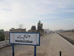
Wan Bhachran
| Wan Bhachran واں بهچراں | |
|---|---|
| Town and union council | |
|
Railway Station ... from the times of the British | |
 Wan Bhachran Location in Pakistan | |
| Coordinates: 32°24′57″N 71°41′38″E / 32.4159°N 71.6940°E | |
| Country | Pakistan |
| District | Mianwali District |
| Government | |
| Population | |
| • Total | 50,000 |
| Time zone | PST (UTC+5) |
Wan Bhachran (Urdu: واں بهچراں), is a town and union council, an administrative sub division, of Mianwali District in Punjab province of Pakistan.[1] It is part of Mianwali Tehsil. The word 'Wan' means 'a well' in the Punjabi language whereas 'Bhachran' refers to the Bhachar clan that is prevalent in this part of the region.
History
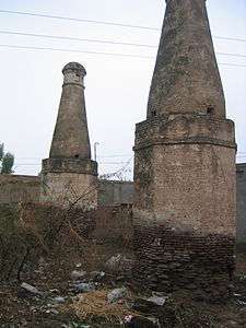
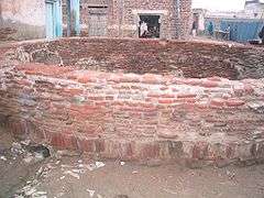
The word "Wan" means a water well referring to Baoli, built by Sher Shah Suri in the 16th century. He built similar structures on every route his army followed. This Baoli was source of fresh water not only for humans but it was built in a way that animals as huge as an elephants could go down to drink water directly from the Well. The people started settling in the area due to availability of fresh water and the first tribe which settled there was "Bachar Tribe", which contributed to the name of "Wan Bhachran" to this place meaning "The Well of Bhachars". According to reliable sources, the place was named as "Khichi" before the colonial period but was later recognized as "Wan Bhachran". Bhachar, very main tribes of this area.
Wan Bhacran is now a modern town with Higher Secondary School for Boys and Girls schools up to Matric. It has its own Digital Telephone Exchange and serves as a hub for many small villages around. The name of Wan Bhachran is well known in the politics of Mianwali District, as on several occasions, candidates from Wan Bhacran have been elected as member of Provincial Assembly.
The "Baoli" (water well) is still there, though water wells are no more in use and the condition of the Well is deteriorating. Appropriate measures should be taken to preserve the Well as a historical monument.
Images
| Pictures of Wan Bhachran | ||||||||
|---|---|---|---|---|---|---|---|---|
|