Waldport, Oregon
| Waldport, Oregon | |
|---|---|
| City | |
|
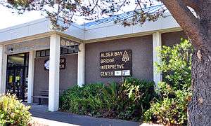
Alsea Bay Bridge Interpretive Center in Waldport | |
| Motto: Where the Forest Meets the Sea | |
 Location in Oregon | |
| Coordinates: 44°25′36″N 124°4′7″W / 44.42667°N 124.06861°WCoordinates: 44°25′36″N 124°4′7″W / 44.42667°N 124.06861°W | |
| Country | United States |
| State | Oregon |
| County | Lincoln |
| Incorporated | 1911 |
| Government | |
| • Mayor | Susan Woodruff |
| Area[1] | |
| • Total | 3.02 sq mi (7.82 km2) |
| • Land | 2.77 sq mi (7.17 km2) |
| • Water | 0.25 sq mi (0.65 km2) |
| Elevation | 12 ft (3.7 m) |
| Population (2010)[2] | |
| • Total | 2,033 |
| • Estimate (2012[3]) | 2,070 |
| • Density | 733.9/sq mi (283.4/km2) |
| Time zone | Pacific (UTC-8) |
| • Summer (DST) | Pacific (UTC-7) |
| ZIP code | 97394 |
| Area code(s) | 541 |
| FIPS code | 41-78000[4] |
| GNIS feature ID | 1151822[5] |
| Website | http://www.waldport.org |
Waldport is a city in Lincoln County, Oregon, United States. The population was 2,033 at the 2010 census. The city is located on the Alsea River and Alsea Bay, 18 miles (29 km) south of Newport and 8 miles (13 km) north of Yachats.
Geography
According to the United States Census Bureau, the city has a total area of 3.02 square miles (7.82 km2), of which, 2.77 square miles (7.17 km2) is land and 0.25 square miles (0.65 km2) is water.[1]
Climate
This region experiences warm (but not hot) and dry summers, with no average monthly temperatures above 71.6 °F. According to the Köppen Climate Classification system, Waldport has a warm-summer Mediterranean climate, abbreviated "Csb" on climate maps.[6]
History
Camp Angel, a Civilian Conservation Corps camp near Waldport, was home to World War II conscientious objectors involved in the arts.[7]
Demographics
| Historical population | |||
|---|---|---|---|
| Census | Pop. | %± | |
| 1920 | 181 | — | |
| 1930 | 367 | 102.8% | |
| 1940 | 630 | 71.7% | |
| 1950 | 689 | 9.4% | |
| 1960 | 667 | −3.2% | |
| 1970 | 700 | 4.9% | |
| 1980 | 1,274 | 82.0% | |
| 1990 | 1,595 | 25.2% | |
| 2000 | 2,050 | 28.5% | |
| 2010 | 2,033 | −0.8% | |
| Est. 2015 | 2,130 | [8] | 4.8% |
2010 census
As of the census[2] of 2010, there were 2,033 people, 974 households, and 530 families residing in the city. The population density was 733.9 inhabitants per square mile (283.4/km2). There were 1,196 housing units at an average density of 431.8 per square mile (166.7/km2). The racial makeup of the city was 91.2% White, 0.8% African American, 1.1% Native American, 1.0% Asian, 0.3% Pacific Islander, 0.5% from other races, and 5.1% from two or more races. Hispanic or Latino of any race were 3.3% of the population.
There were 974 households of which 19.3% had children under the age of 18 living with them, 42.2% were married couples living together, 7.9% had a female householder with no husband present, 4.3% had a male householder with no wife present, and 45.6% were non-families. 37.4% of all households were made up of individuals and 17.6% had someone living alone who was 65 years of age or older. The average household size was 2.08 and the average family size was 2.69.
The median age in the city was 53 years. 15.8% of residents were under the age of 18; 5% were between the ages of 18 and 24; 16.1% were from 25 to 44; 36.9% were from 45 to 64; and 26.2% were 65 years of age or older. The gender makeup of the city was 47.4% male and 52.6% female.
2000 census
As of the census[4] of 2000, there were 2,050 people, 909 households, and 540 families residing in the city. The population density was 956.8 people per square mile (369.9/km²). There were 1,099 housing units at an average density of 513.0 per square mile (198.3/km²). The racial makeup of the city was 93.41% White, 0.10% African American, 2.20% Native American, 1.17% Asian, 0.10% Pacific Islander, 0.34% from other races, and 2.68% from two or more races. Hispanic or Latino of any race were 3.71% of the population.
There were 909 households out of which 23.8% had children under the age of 18 living with them, 44.2% were married couples living together, 12.2% had a female householder with no husband present, and 40.5% were non-families. 34.0% of all households were made up of individuals and 17.2% had someone living alone who was 65 years of age or older. The average household size was 2.24 and the average family size was 2.81.
In the city the population was spread out with 23.9% under the age of 18, 4.2% from 18 to 24, 22.8% from 25 to 44, 25.7% from 45 to 64, and 23.5% who were 65 years of age or older. The median age was 45 years. For every 100 females there were 83.0 males. For every 100 females age 18 and over, there were 78.3 males.
The median income for a household in the city was $33,301, and the median income for a family was $38,571. Males had a median income of $29,904 versus $22,071 for females. The per capita income for the city was $15,939. About 9.4% of families and 17.3% of the population were below the poverty line, including 24.9% of those under age 18 and 9.6% of those age 65 or over.
Politics
On February 22, 2009, Mayor Herman Welch announced that he was leaving the Republican Party. Upon re-registering as a member of the Independent Party of Oregon, he became the first public official in Oregon to be a member of that party.[10][11]
Transportation
References
- 1 2 "US Gazetteer files 2010". United States Census Bureau. Retrieved 2012-12-21.
- 1 2 "American FactFinder". United States Census Bureau. Retrieved 2012-12-21.
- ↑ "Population Estimates". United States Census Bureau. Retrieved 2013-06-02.
- 1 2 "American FactFinder". United States Census Bureau. Retrieved 2008-01-31.
- ↑ "US Board on Geographic Names". United States Geological Survey. 2007-10-25. Retrieved 2008-01-31.
- ↑ Climate Summary for Waldport, Oregon
- ↑ Siuslaw National Forest; History Department; Portland State University. "Camp 56: An Oral History Project: World War II Conscientious Objectors and the Waldport, Oregon Civilian Public Service Camp" (PDF). Center for Columbia River History. Retrieved 2013-08-15.
- ↑ "Annual Estimates of the Resident Population for Incorporated Places: April 1, 2010 to July 1, 2015". Retrieved July 2, 2016.
- ↑ "Census of Population and Housing". Census.gov. Retrieved June 4, 2015.
- ↑ Letters to the editor: teacher pay, Sam Adams, fishing | OregonLive.com
- ↑ Waldport Mayor becomes first Independent to hold public office | Independent Party of Oregon
Further reading
- Siuslaw National Forest; History Department; Portland State University. "Camp 56: An Oral History Project: World War II Conscientious Objectors and the Waldport, Oregon Civilian Public Service Camp" (PDF). Center for Columbia River History. Retrieved 2013-08-15.
External links
- City of Waldport (official website)
- Entry for Waldport in the Oregon Blue Book
Municipalities and communities of Lincoln County, Oregon, United States | ||
|---|---|---|
| Cities | 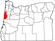 | |
| CDPs | ||
| Unincorporated communities | ||
| Indian reservation | ||