Vrata, Dravograd
| Vrata | |
|---|---|
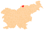
 Vrata Location in Slovenia | |
| Coordinates: 46°36′30.69″N 15°6′3.34″E / 46.6085250°N 15.1009278°ECoordinates: 46°36′30.69″N 15°6′3.34″E / 46.6085250°N 15.1009278°E | |
| Country |
|
| Traditional region | Styria |
| Statistical region | Carinthia |
| Municipality | Dravograd |
| Area | |
| • Total | 3.2 km2 (1.2 sq mi) |
| Elevation | 382.4 m (1,254.6 ft) |
| Population (2002) | |
| • Total | 106 |
| [1] | |
Vrata (pronounced [ˈwɾaːta]) is a dispersed settlement in the hills above the left bank of the Drava River in the Municipality of Dravograd, historically part of the Styria, and now included in the Carinthia Statistical Region in northern Slovenia.[2]
References
External links
| Settlements | Administrative centre: Dravograd
|  | ||||||
|---|---|---|---|---|---|---|---|---|
| Landmarks |
| |||||||
This article is issued from Wikipedia - version of the 6/23/2015. The text is available under the Creative Commons Attribution/Share Alike but additional terms may apply for the media files.