Virden, New Mexico
| Virden, New Mexico | |
|---|---|
| Village | |
 Location of Virden, New Mexico | |
 Virden, New Mexico Location in the United States | |
| Coordinates: 32°41′19″N 109°0′9″W / 32.68861°N 109.00250°WCoordinates: 32°41′19″N 109°0′9″W / 32.68861°N 109.00250°W | |
| Country | United States |
| State | New Mexico |
| County | Hidalgo |
| Area | |
| • Total | 0.2 sq mi (0.6 km2) |
| • Land | 0.2 sq mi (0.6 km2) |
| • Water | 0.0 sq mi (0.0 km2) |
| Elevation | 3,763 ft (1,147 m) |
| Population (2000) | |
| • Total | 143 |
| • Density | 640.1/sq mi (247.1/km2) |
| Time zone | Mountain (MST) (UTC-7) |
| • Summer (DST) | MDT (UTC-6) |
| Area code(s) | 505 |
| FIPS code | 35-83200 |
| GNIS feature ID | 0920732 |
Virden is a village in Hidalgo County, New Mexico, United States. The population was 143 at the 2000 census. The nearby community of Summit, essentially belongs to Virden, and is included in the population. Growth and new construction is almost non-existent, but together with the Arizona sister-village of Duncan, the consolidated area might experience minimal population and infrastructural growth in the next decade.
History
Known as Richmond prior to 1916, the area was originally owned by the New Mexico Mining Company, and was the location of a stamp mill for the silver ore mined in nearby Ralston. After the mine was closed, the site was sold in 1916 to Mormons who had left the Mormon Colonies in Chihuahua during the Mexican Revolution. The Mormons renamed the village after the rancher who sold them the land.
Geography
Virden is located at 32°41′19″N 109°0′9″W / 32.68861°N 109.00250°W (32.688626, -109.002585).[1]
According to the United States Census Bureau, the village has a total area of 0.2 square miles (0.52 km2), all of it land.
The town is located on the north bank of the Gila River.
Demographics
| Historical population | |||
|---|---|---|---|
| Census | Pop. | %± | |
| 1930 | 196 | — | |
| 1940 | 206 | 5.1% | |
| 1950 | 146 | −29.1% | |
| 1960 | 135 | −7.5% | |
| 1970 | 151 | 11.9% | |
| 1980 | 246 | 62.9% | |
| 1990 | 108 | −56.1% | |
| 2000 | 143 | 32.4% | |
| 2010 | 152 | 6.3% | |
| Est. 2015 | 137 | [2] | −9.9% |
As of the census[4] of 2000, there were 143 people, 48 households, and 38 families residing in the village. The population density was 640.1 people per square mile (251.0/km²). There were 63 housing units at an average density of 282.0 per square mile (110.6/km²). The racial makeup of the village was 95.10% White, 1.40% African American, 1.40% from other races, and 2.10% from two or more races. Hispanic or Latino of any race were 13.29% of the population.
There were 48 households out of which 39.6% had children under the age of 18 living with them, 77.1% were married couples living together, 2.1% had a female householder with no husband present, and 20.8% were non-families. 20.8% of all households were made up of individuals and 8.3% had someone living alone who was 65 years of age or older. The average household size was 2.98 and the average family size was 3.50.
In the village the population was spread out with 33.6% under the age of 18, 8.4% from 18 to 24, 18.2% from 25 to 44, 25.2% from 45 to 64, and 14.7% who were 65 years of age or older. The median age was 32 years. For every 100 females there were 113.4 males. For every 100 females age 18 and over, there were 115.9 males.
The median income for a household in the village was $29,375, and the median income for a family was $46,250. Males had a median income of $33,750 versus $0 for females. The per capita income for the village was $23,184. There were 2.6% of families and 14.1% of the population living below the poverty line, including 26.1% of under eighteens and 6.7% of those over 64.
References
- ↑ "US Gazetteer files: 2010, 2000, and 1990". United States Census Bureau. 2011-02-12. Retrieved 2011-04-23.
- ↑ "Annual Estimates of the Resident Population for Incorporated Places: April 1, 2010 to July 1, 2015". Retrieved July 2, 2016.
- ↑ "Census of Population and Housing". Census.gov. Retrieved June 4, 2015.
- ↑ "American FactFinder". United States Census Bureau. Retrieved 2008-01-31.
External links
- "The Virden L.D.S. Cemetery At Virden, New Mexico", Hidalgo County Webpage, USGenWeb Project
Municipalities and communities of Hidalgo County, New Mexico, United States | ||
|---|---|---|
| City | 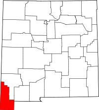 | |
| Village | ||
| CDPs | ||
| Other unincorporated communities | ||
| Ghost towns |
| |