Vine Grove, Kentucky
| Vine Grove, Kentucky | |
|---|---|
| City | |
 Location of Vine Grove, Kentucky | |
| Coordinates: 37°48′43″N 85°58′48″W / 37.81194°N 85.98000°WCoordinates: 37°48′43″N 85°58′48″W / 37.81194°N 85.98000°W | |
| Country | United States |
| State | Kentucky |
| County | Hardin |
| Area | |
| • Total | 5.9 sq mi (15.3 km2) |
| • Land | 5.9 sq mi (15.3 km2) |
| • Water | 0.0 sq mi (0.0 km2) |
| Elevation | 682 ft (208 m) |
| Population (2000) | |
| • Total | 4,169 |
| • Density | 707.6/sq mi (273.2/km2) |
| Time zone | Eastern (EST) (UTC-5) |
| • Summer (DST) | EDT (UTC-4) |
| ZIP code | 40175 |
| Area code(s) | 270 & 364 |
| FIPS code | 21-79734 |
| GNIS feature ID | 0506053 |
Vine Grove is a city in Hardin County, Kentucky, United States. The population was 4,169 at the 2000 census. It is part of the Elizabethtown, Kentucky Metropolitan Statistical Area.
Geography
Vine Grove is located at 37°48′43″N 85°58′48″W / 37.81194°N 85.98000°W (37.811971, -85.980006).[1]
According to the United States Census Bureau, the city has a total area of 5.9 square miles (15 km2), of which 5.9 square miles (15 km2) is land and 0.17% is water.
Demographics
| Historical population | |||
|---|---|---|---|
| Census | Pop. | %± | |
| 1890 | 397 | — | |
| 1900 | 427 | 7.6% | |
| 1910 | 570 | 33.5% | |
| 1920 | 594 | 4.2% | |
| 1930 | 523 | −12.0% | |
| 1940 | 822 | 57.2% | |
| 1950 | 1,252 | 52.3% | |
| 1960 | 2,435 | 94.5% | |
| 1970 | 2,987 | 22.7% | |
| 1980 | 3,648 | 22.1% | |
| 1990 | 3,586 | −1.7% | |
| 2000 | 4,169 | 16.3% | |
| 2010 | 4,520 | 8.4% | |
| Est. 2015 | 5,760 | [2] | 27.4% |
As of the census[4] of 2000, there were 4,169 people, 1,619 households, and 1,160 families residing in the city. The population density was 707.6 people per square mile (273.3/km²). There were 1,779 housing units at an average density of 302.0 per square mile (116.6/km²). The racial makeup of the city was 83.31% White, 10.63% African American, 0.55% Native American, 1.73% Asian, 0.31% Pacific Islander, 1.20% from other races, and 2.28% from two or more races. Hispanic or Latino of any race were 3.02% of the population.
There were 1,619 households out of which 37.4% had children under the age of 18 living with them, 55.9% were married couples living together, 12.2% had a female householder with no husband present, and 28.3% were non-families. 24.3% of all households were made up of individuals and 10.7% had someone living alone who was 65 years of age or older. The average household size was 2.57 and the average family size was 3.07.
In the city the population was spread out with 27.6% under the age of 18, 7.5% from 18 to 24, 30.3% from 25 to 44, 23.1% from 45 to 64, and 11.6% who were 65 years of age or older. The median age was 37 years. For every 100 females there were 92.5 males. For every 100 females age 18 and over, there were 87.2 males.
The median income for a household in the city was $38,581, and the median income for a family was $43,875. Males had a median income of $31,266 versus $24,634 for females. The per capita income for the city was $17,465. About 6.7% of families and 10.2% of the population were below the poverty line, including 14.7% of those under age 18 and 8.3% of those age 65 or over.
Notable residents
References
- ↑ "US Gazetteer files: 2010, 2000, and 1990". United States Census Bureau. 2011-02-12. Retrieved 2011-04-23.
- ↑ "Annual Estimates of the Resident Population for Incorporated Places: April 1, 2010 to July 1, 2015". Retrieved July 2, 2016.
- ↑ "Census of Population and Housing". Census.gov. Retrieved June 4, 2015.
- ↑ "American FactFinder". United States Census Bureau. Retrieved 2008-01-31.
Municipalities and communities of Hardin County, Kentucky, United States | ||
|---|---|---|
| Cities | 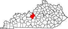 | |
| CDPs | ||
| Other unincorporated communities | ||
| Footnotes | ‡This populated place also has portions in an adjacent county or counties | |