Verosvres
| Verosvres | |
|---|---|
|
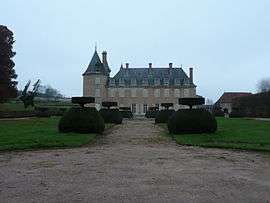
Chateau of Terreau | |
 Verosvres | |
|
Location within Bourgogne-Franche-Comté region  Verosvres | |
| Coordinates: 46°24′05″N 4°26′38″E / 46.4014°N 4.4439°ECoordinates: 46°24′05″N 4°26′38″E / 46.4014°N 4.4439°E | |
| Country | France |
| Region | Bourgogne-Franche-Comté |
| Department | Saône-et-Loire |
| Arrondissement | Charolles |
| Canton | Saint-Bonnet-de-Joux |
| Area1 | 22.96 km2 (8.86 sq mi) |
| Population (2006)2 | 596 |
| • Density | 26/km2 (67/sq mi) |
| Time zone | CET (UTC+1) |
| • Summer (DST) | CEST (UTC+2) |
| INSEE/Postal code | 71571 / 71220 |
| Elevation |
326–596 m (1,070–1,955 ft) (avg. 386 m or 1,266 ft) |
|
1 French Land Register data, which excludes lakes, ponds, glaciers > 1 km² (0.386 sq mi or 247 acres) and river estuaries. 2 Population without double counting: residents of multiple communes (e.g., students and military personnel) only counted once. | |
Verosvres is a commune in the Saône-et-Loire department in the region of Bourgogne in eastern France.
History
The name Verosvres is derived from the Gallic word Verobriga, vero meaning "true" or "good" and briga meaning "fortress": thus giving "Good castle".[1]
In 1920, the town of Verosvres formed "an agglomeration of about eighty houses, including one for the post office and telegraph." The town was then served by a railway line, now defunct, which connected Paray-le-Monial to Mâcon, and stopped at a station called "Les Terreaux — Verosvres".[2]
Notable people
- Verosvres is the birthplace of Saint Margaret Mary Alacoque, who first inspired devotion to the Sacred Heart of Jesus in the Roman Catholic Church.
- Pierre Albuisson (born in 1952), French postage stamp engraver and designer, presides the Art du timbre gravé association whose headquarters are located in Verosvres.
See also
References
| Wikimedia Commons has media related to Verosvres. |
This article is issued from Wikipedia - version of the 10/28/2016. The text is available under the Creative Commons Attribution/Share Alike but additional terms may apply for the media files.