Vasilika, Thessaloniki
| Vasilika Βασιλικά | |
|---|---|
 Vasilika | |
|
Location within the regional unit 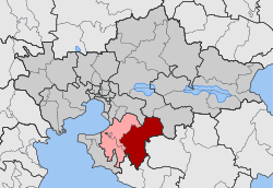 | |
| Coordinates: 40°28.8′N 23°8.2′E / 40.4800°N 23.1367°ECoordinates: 40°28.8′N 23°8.2′E / 40.4800°N 23.1367°E | |
| Country | Greece |
| Administrative region | Central Macedonia |
| Regional unit | Thessaloniki |
| Municipality | Thermi |
| • Municipal unit | 200.336 km2 (77.350 sq mi) |
| Elevation | 75 m (246 ft) |
| Population (2011)[1] | |
| • Rural | 3,762 |
| • Municipal unit | 9,911 |
| • Municipal unit density | 49/km2 (130/sq mi) |
| Community[1] | |
| • Population | 4,200 (2011) |
| • Area (km2) | 56.81 |
| Time zone | EET (UTC+2) |
| • Summer (DST) | EEST (UTC+3) |
| Postal code | 570 06 |
| Area code(s) | +30-2396-xxx-xxx |
| Vehicle registration | NAx-xxxx to NXx-xxxx |
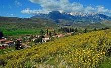
Vasilika and Mount Parnassos
Vasilika (Greek: Βασιλικά) is a community and a municipal unit of the Thermi municipality.[2] Before the 2011 local government reform the municipal unit of Vasilika was an independent municipality, with the respective community being the seat.[2] The 2011 census recorded 4,200 inhabitants in the community and 9,911 inhabitants in the municipal unit.[1] The community of Vasilika covers an area of 56.81 km2 while the respective municipal unit covers an area of 200.336 km2.[3]
Administrative division
The community of Vasilika consists of two separate settlements:[1]
- Lakkia (population 438)
- Vasilika (population 3,762)
The aforementioned population figures are as of 2011.[1]
See also
References
- 1 2 3 4 5 "Απογραφή Πληθυσμού - Κατοικιών 2011. ΜΟΝΙΜΟΣ Πληθυσμός" (in Greek). Hellenic Statistical Authority.
- 1 2 Kallikratis law Greece Ministry of Interior (Greek)
- ↑ "Population & housing census 2001 (incl. area and average elevation)" (PDF) (in Greek). National Statistical Service of Greece.
This article is issued from Wikipedia - version of the 11/29/2016. The text is available under the Creative Commons Attribution/Share Alike but additional terms may apply for the media files.