Van Hook Township, Mountrail County, North Dakota
| Van Hook Township, North Dakota | |
|---|---|
| Township | |
 Van Hook Township, North Dakota Location within the state of North Dakota | |
| Coordinates: 47°58′14″N 102°19′58″W / 47.97056°N 102.33278°WCoordinates: 47°58′14″N 102°19′58″W / 47.97056°N 102.33278°W | |
| Country | United States |
| State | North Dakota |
| County | Mountrail |
| Area[1] | |
| • Total | 36.5 sq mi (95 km2) |
| • Land | 32.9 sq mi (85 km2) |
| • Water | 3.6 sq mi (9 km2) |
| Elevation | 1,903 ft (580 m) |
| Population (2000)[2] | |
| • Total | 42 |
| • Density | 1.3/sq mi (0.5/km2) |
| Time zone | Central (CST) (UTC-6) |
| • Summer (DST) | CDT (UTC-5) |
| Area code(s) | 701 |
| FIPS code | 38-81420[3] |
| GNIS feature ID | 1037116[4] |
Van Hook Township is a township in Mountrail County in the U.S. State of North Dakota. At the time of the 2000 Census, its population was 42,[2] and estimated to be 41 as of 2009.[5]
History
The township is named for Fred Van Hook who helped survey the area in the early 1910s. A Soo Line Railroad station was established at Van Hook in 1914, resulting in rapid population growth. Van Hook Township's population grew from 65 in 1910 to 278 in 1920, at which time it was counted as an organized civil township.[6] The population peaked 1930.[7]
The village of Van Hook continued to grow, reaching a population of 380 in 1950. However, the town soon declined after it was flooded by Lake Sakakawea.[7] Most of the residents were relocated to the nearby city of New Town after the city disincorporated in 1953.[8]
Geography
Much of the township is part of the Fort Berthold Indian Reservation.[4] The township covers 36.5 square miles (95 km2), 10 percent (2.6 sq mi (6.7 km2)) of which is underwater. The southern portion of the township was flooded when Lake Sakakawea was created due to construction of Garrison Dam in the early 1950s. Lake Sakakawea's Van Hook Arm is named for the township.[4]
Demographics
As of the 2000 Census,[2] there were 42 individuals, 23 households, and 13 families living in the township. On average, the population density was 1.3 inhabitants per square mile (0.50/km2).[1] Racially, based on those who identified having only one race in their responses to the Census, the township was 31% White and 12% were American Indians. 57.1% of the township identified themselves as being from two or more races. The 2000 Census also allowed respondents to select more than one race.[9] When that is taken into account, 88.1% of the residents identified themselves as White and 14.3% identified themselves as American Indian.[2]
References
- 1 2 U.S. Census Bureau. Census 2000, Summary File 1. "GCT-PH1. Population, Housing Units, Area, and Density: 2000 - County -- Subdivision and Place". American FactFinder. <http://factfinder2.census.gov>. Retrieved 2008-01-31.
- 1 2 3 4 U.S. Census Bureau. Census 2000. "Census Demographic Profiles, Van Hook Township" (PDF). CenStats Databases. Retrieved 2009-01-31.
- ↑ "American FactFinder". United States Census Bureau. Retrieved 2008-01-31.
- 1 2 3 "US Board on Geographic Names". United States Geological Survey. 2007-10-25. Retrieved 2008-01-31.
- ↑ U.S. Census Bureau (2010). "Incorporated Places and Minor Civil Divisions: North Dakota" (CSV). 2009 Population Estimates. Retrieved 2010-06-22.
- ↑ U.S. Census Bureau (1921). "Number and Distribution of Inhabitants, North Dakota" (PDF). Fourteenth Census of the United States: 1920. Government Printing Office. Retrieved 2008-07-20.
- 1 2 U.S. Census Bureau (1952). "Number of Inhabitants, North Dakota" (PDF). Census of Population: 1950. Government Printing Office. Retrieved 2008-07-20.
- ↑ Wick, Douglas A. (1988). North Dakota Place Names. Bismarck, North Dakota: Hedemarken Collectibles. p. 10. ISBN 0-9620968-0-6. OCLC 191277027.
- ↑ U.S. Census Bureau. "Racial and Ethnic Classifications Used in Census 2000 and Beyond". Retrieved 2010-07-06.
Municipalities and communities of Mountrail County, North Dakota, United States | ||
|---|---|---|
| Cities | 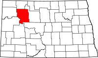 | |
| Townships |
| |
| Unorganized territory |
| |
| Unincorporated communities | ||
| Ghost town | ||