Valley Head, Alabama
| Valley Head, Alabama | |
|---|---|
| Town | |
 Location in DeKalb County and the state of Alabama | |
| Coordinates: 34°33′55″N 85°36′59″W / 34.56528°N 85.61639°W | |
| Country | United States |
| State | Alabama |
| County | DeKalb |
| Area | |
| • Total | 3.5 sq mi (9 km2) |
| • Land | 3.5 sq mi (9 km2) |
| • Water | 0 sq mi (0 km2) |
| Elevation | 1,014 ft (309 m) |
| Population (2009) | |
| • Total | 658 |
| • Density | 174.6/sq mi (67.9/km2) |
| Time zone | Central (CST) (UTC-6) |
| • Summer (DST) | CDT (UTC-5) |
| ZIP code | 35989 |
| Area code(s) | 256 |
| FIPS code | 01-78240 |
| GNIS feature ID | 0155288 |
Valley Head is a town in DeKalb County, Alabama, United States. Although the town incorporated in 1921, it was also listed as being incorporated on the 1890 U.S. Census. At the 2010 census the population was 558. Councilman Jacob Brown was nominated to serve in July 2015. He is the youngest councilman to serve Valley Head. Councilman Brown is currently seeking an education degree.
Geography
Valley Head is located at 34°33′55″N 85°36′59″W / 34.56528°N 85.61639°W (34.565301, -85.616426).[1]
According to the U.S. Census Bureau, the town has a total area of 3.5 square miles (9.1 km2), all land.
Climate
| Climate data for Valley Head, AL, 1981-2010 normals, extremes 1893-present | |||||||||||||
|---|---|---|---|---|---|---|---|---|---|---|---|---|---|
| Month | Jan | Feb | Mar | Apr | May | Jun | Jul | Aug | Sep | Oct | Nov | Dec | Year |
| Record high °F (°C) | 79 (26) |
80 (27) |
90 (32) |
92 (33) |
100 (38) |
104 (40) |
106 (41) |
105 (41) |
104 (40) |
98 (37) |
90 (32) |
78 (26) |
106 (41) |
| Average high °F (°C) | 49.3 (9.6) |
53.8 (12.1) |
62.1 (16.7) |
70.7 (21.5) |
78.2 (25.7) |
85.3 (29.6) |
88.5 (31.4) |
88.2 (31.2) |
82.5 (28.1) |
72.7 (22.6) |
64.4 (18) |
51.6 (10.9) |
70.61 (21.45) |
| Average low °F (°C) | 27.5 (−2.5) |
30.2 (−1) |
36.4 (2.4) |
43.5 (6.4) |
53.5 (11.9) |
62.4 (16.9) |
66.6 (19.2) |
65.9 (18.8) |
58.6 (14.8) |
46.2 (7.9) |
37.3 (2.9) |
30.0 (−1.1) |
46.51 (8.05) |
| Record low °F (°C) | −15 (−26) |
−17 (−27) |
2 (−17) |
19 (−7) |
29 (−2) |
35 (2) |
45 (7) |
45 (7) |
29 (−2) |
19 (−7) |
−2 (−19) |
−8 (−22) |
−17 (−27) |
| Average precipitation inches (mm) | 5.44 (138.2) |
5.53 (140.5) |
5.04 (128) |
4.54 (115.3) |
4.65 (118.1) |
4.13 (104.9) |
5.22 (132.6) |
3.52 (89.4) |
4.42 (112.3) |
3.43 (87.1) |
4.99 (126.7) |
4.06 (103.1) |
54.97 (1,396.2) |
| Average snowfall inches (cm) | 1.8 (4.6) |
1.3 (3.3) |
1.3 (3.3) |
0.4 (1) |
0 (0) |
0 (0) |
0 (0) |
0 (0) |
0 (0) |
0 (0) |
0.2 (0.5) |
0.9 (2.3) |
5.9 (15) |
| Average precipitation days | 12 | 12 | 12 | 11 | 11 | 12 | 12 | 10 | 9 | 8 | 11 | 12 | 132 |
| Source: | |||||||||||||
Demographics
| Historical population | |||
|---|---|---|---|
| Census | Pop. | %± | |
| 1890 | 233 | — | |
| 1930 | 430 | — | |
| 1940 | 439 | 2.1% | |
| 1950 | 418 | −4.8% | |
| 1960 | 424 | 1.4% | |
| 1970 | 470 | 10.8% | |
| 1980 | 609 | 29.6% | |
| 1990 | 577 | −5.3% | |
| 2000 | 611 | 5.9% | |
| 2010 | 558 | −8.7% | |
| Est. 2015 | 550 | [2] | −1.4% |
| U.S. Decennial Census[3] 2013 Estimate[4] | |||
As of the census[5] of 2000, there were 611 people, 244 households, and 175 families residing in the town. The population density was 175.3 people per square mile (67.6/km²). There were 269 housing units at an average density of 77.2 per square mile (29.8/km²). The racial makeup of the town was 92.47% White, 2.29% Black or African American, 0.65% Native American, 0.16% Asian, 0.16% Pacific Islander, and 4.26% from two or more races. 2.29% of the population were Hispanic or Latino of any race.
There were 244 households out of which 28.7% had children under the age of 18 living with them, 54.5% were married couples living together, 14.8% had a female householder with no husband present, and 27.9% were non-families. 25.0% of all households were made up of individuals and 11.9% had someone living alone who was 65 years of age or older. The average household size was 2.50 and the average family size was 2.98.
In the town the population was spread out with 24.2% under the age of 18, 9.3% from 18 to 24, 24.7% from 25 to 44, 25.2% from 45 to 64, and 16.5% who were 65 years of age or older. The median age was 38 years. For every 100 females there were 85.2 males. For every 100 females age 18 and over, there were 86.7 males.
The median income for a household in the town was $29,013, and the median income for a family was $36,250. Males had a median income of $28,558 versus $17,222 for females. The per capita income for the town was $13,582. About 12.2% of families and 15.9% of the population were below the poverty line, including 21.4% of those under age 18 and 21.5% of those age 65 or over.
Education
Valley Head School is home of the Tigers, is a member of the DeKalb County School System.
Notable people
- Raymond L. Atkins, fiction author. Spent his teenage years in Valley Head.
- Howard Finster, folk artist
- E. T. York, former director of the Alabama Cooperative Extension Service, administrator of the federal Extension Service, interim president of the University of Florida, and chancellor of the State University System of Florida
References
- ↑ "US Gazetteer files: 2010, 2000, and 1990". United States Census Bureau. 2011-02-12. Retrieved 2011-04-23.
- ↑ "Annual Estimates of the Resident Population for Incorporated Places: April 1, 2010 to July 1, 2015". Retrieved July 2, 2016.
- ↑ "U.S. Decennial Census". Census.gov. Retrieved June 6, 2013.
- ↑ "Annual Estimates of the Resident Population: April 1, 2010 to July 1, 2013". Retrieved June 3, 2014.
- ↑ "American FactFinder". United States Census Bureau. Retrieved 2008-01-31.
Coordinates: 34°33′55″N 85°36′59″W / 34.565301°N 85.616426°W
Municipalities and communities of DeKalb County, Alabama, United States | ||
|---|---|---|
| Cities | 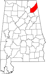 | |
| Towns | ||
| Unincorporated communities | ||
| Ghost towns | ||
| Footnotes | ‡This populated place also has portions in an adjacent county or counties | |