Upper Harbledown

Coordinates: 51°17′07″N 1°01′50″E / 51.2854°N 1.0306°E
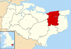
Upper Harbledown is a village in Harbledown and Rough Common civil parish about 2 miles (3 km) west of Canterbury, Kent, England. The population is roughly 400.
History
The village lies on[1] or very close to the ancient trackway known as Watling Street. This became the main A2 road from London to Canterbury and Dover, which ran through the centre of the village before it was bypassed.
Amenities
The village has a village green, a children's play area, and a village hall. It did have a public house, The Plough, and a garden centre, but these have both closed down.
References
- ↑ Codrington, T., Roman roads in Britain, SPCK, 1903
External links
![]() Media related to Upper Harbledown at Wikimedia Commons
Media related to Upper Harbledown at Wikimedia Commons
This article is issued from Wikipedia - version of the 1/23/2016. The text is available under the Creative Commons Attribution/Share Alike but additional terms may apply for the media files.