Union Township, Hancock County, Ohio
| Union Township, Hancock County, Ohio | |
|---|---|
| Township | |
|
Ottawa Creek south of Rawson | |
 Location of Union Township in Hancock County. | |
| Coordinates: 40°56′52″N 83°48′47″W / 40.94778°N 83.81306°WCoordinates: 40°56′52″N 83°48′47″W / 40.94778°N 83.81306°W | |
| Country | United States |
| State | Ohio |
| County | Hancock |
| Area | |
| • Total | 35.6 sq mi (92.3 km2) |
| • Land | 35.6 sq mi (92.2 km2) |
| • Water | 0.0 sq mi (0.1 km2) |
| Elevation[1] | 820 ft (250 m) |
| Population (2000) | |
| • Total | 1,726 |
| • Density | 48.5/sq mi (18.7/km2) |
| Time zone | Eastern (EST) (UTC-5) |
| • Summer (DST) | EDT (UTC-4) |
| FIPS code | 39-78330[2] |
| GNIS feature ID | 1086253[1] |

Union Township is one of the seventeen townships of Hancock County, Ohio, United States. The 2000 census found 1,726 people in the township, 1,058 of whom lived in the unincorporated portions of the township.[3]
Geography
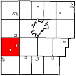
Located in the western part of the county, it borders the following townships:
- Blanchard Township - north
- Liberty Township - northeast corner
- Eagle Township - east
- Van Buren Township - southeast corner
- Orange Township - south
- Richland Township, Allen County - southwest
- Riley Township, Putnam County - west
- Blanchard Township, Putnam County - northwest corner
Two villages are located in Union Township: Mount Cory in the south, and Rawson in the east.
Name and history
It is one of twenty-seven Union Townships statewide.[4]
Union Township was organized in 1832.[5]
Government
The township is governed by a three-member board of trustees, who are elected in November of odd-numbered years to a four-year term beginning on the following January 1. Two are elected in the year after the presidential election and one is elected in the year before it. There is also an elected township fiscal officer,[6] who serves a four-year term beginning on April 1 of the year after the election, which is held in November of the year before the presidential election. Vacancies in the fiscal officership or on the board of trustees are filled by the remaining trustees.
References
- 1 2 "US Board on Geographic Names". United States Geological Survey. 2007-10-25. Retrieved 2008-01-31.
- ↑ "American FactFinder". United States Census Bureau. Archived from the original on September 11, 2013. Retrieved 2008-01-31.
- ↑ Hancock County, Ohio — Population by Places Estimates Ohio State University, 2007. Accessed 15 May 2007.
- ↑ "Detailed map of Ohio" (PDF). United States Census Bureau. 2000. Retrieved 2007-02-16.
- ↑ History of Hancock County, Ohio. Warner, Beers. 1886. p. 485.
- ↑ §503.24, §505.01, and §507.01 of the Ohio Revised Code. Accessed 4/30/2009.
External links
Municipalities and communities of Hancock County, Ohio, United States | ||
|---|---|---|
| Cities | 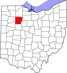 | |
| Villages | ||
| Townships | ||
| Unincorporated communities | ||
| Footnotes | ‡This populated place also has portions in an adjacent county or counties | |