Union, Mississippi
| Union, Mississippi | |
|---|---|
| Town | |
| Nickname(s): u.town | |
 Location of Union, Mississippi | |
 Union, Mississippi Location in the United States | |
| Coordinates: 32°34′17″N 89°7′5″W / 32.57139°N 89.11806°WCoordinates: 32°34′17″N 89°7′5″W / 32.57139°N 89.11806°W | |
| Country | United States |
| State | Mississippi |
| Counties | Newton, Neshoba |
| Area | |
| • Total | 3.4 sq mi (8.9 km2) |
| • Land | 3.4 sq mi (8.9 km2) |
| • Water | 0.0 sq mi (0.0 km2) |
| Elevation | 482 ft (147 m) |
| Population (2000) | |
| • Total | 2,021 |
| • Density | 589.0/sq mi (227.4/km2) |
| Time zone | Central (CST) (UTC-6) |
| • Summer (DST) | CDT (UTC-5) |
| ZIP code | 39365 |
| Area code(s) | 601 |
| FIPS code | 28-75360 |
| GNIS feature ID | 0679032 |
Union is a town in Neshoba and Newton counties, Mississippi. The population was 2,021 at the 2000 census.
Geography
Union is located at 32°34′17″N 89°7′5″W / 32.57139°N 89.11806°W (32.571320, -89.118118).[1] Most of the town is in Newton County with a portion extending north into adjacent Neshoba County.[2] In the 2000 census, 1,496 of the town's 2,021 residents (74.0%) lived in Newton County and 525 (26.0%) in Neshoba County.[3]
According to the United States Census Bureau, the town has a total area of 3.4 square miles (8.9 km²), all land.
Demographics
| Historical population | |||
|---|---|---|---|
| Census | Pop. | %± | |
| 1910 | 693 | — | |
| 1920 | 1,012 | 46.0% | |
| 1930 | 1,705 | 68.5% | |
| 1940 | 1,543 | −9.5% | |
| 1950 | 1,559 | 1.0% | |
| 1960 | 1,726 | 10.7% | |
| 1970 | 1,856 | 7.5% | |
| 1980 | 1,931 | 4.0% | |
| 1990 | 1,875 | −2.9% | |
| 2000 | 2,021 | 7.8% | |
| 2010 | 1,988 | −1.6% | |
| Est. 2015 | 1,987 | [4] | −0.1% |
As of the census[6] of 2000, there were 2,021 people, 780 households, and 509 families residing in the town. The population density was 589.0 people per square mile (227.5/km²). There were 884 housing units at an average density of 257.6 per square mile (99.5/km²). The racial makeup of the town was 62.84% White, 35.53% African American, 0.35% Native American, 0.20% Asian, 0.05% from other races, and 1.04% from two or more races. Hispanic or Latino of any race were 0.64% of the population.
There were 780 households out of which 31.8% had children under the age of 18 living with them, 43.1% were married couples living together, 18.8% had a female householder with no husband present, and 34.7% were non-families. 32.3% of all households were made up of individuals and 18.1% had someone living alone who was 65 years of age or older. The average household size was 2.46 and the average family size was 3.12.
In the town the population was spread out with 27.2% under the age of 18, 8.6% from 18 to 24, 23.1% from 25 to 44, 19.7% from 45 to 64, and 21.5% who were 65 years of age or older. The median age was 38 years. For every 100 females there were 79.0 males. For every 100 females age 18 and over, there were 74.0 males.
The median income for a household in the town was $21,696, and the median income for a family was $28,542. Males had a median income of $26,667 versus $17,328 for females. The per capita income for the town was $12,176. About 28.4% of families and 35.2% of the population were below the poverty line, including 49.7% of those under age 18 and 37.4% of those age 65 or over.
Education
The Town of Union is served by the Union Public School District.
References
- ↑ "US Gazetteer files: 2010, 2000, and 1990". United States Census Bureau. 2011-02-12. Retrieved 2011-04-23.
- ↑ American FactFinder Reference Map
- ↑ "Subcounty population estimates: Mississippi 2000-2006" (CSV). United States Census Bureau, Population Division. 2007-06-28. Retrieved 2007-07-21.
- ↑ "Annual Estimates of the Resident Population for Incorporated Places: April 1, 2010 to July 1, 2015". Retrieved July 2, 2016.
- ↑ "Census of Population and Housing". Census.gov. Retrieved June 4, 2015.
- ↑ "American FactFinder". United States Census Bureau. Retrieved 2008-01-31.
Municipalities and communities of Neshoba County, Mississippi, United States | ||
|---|---|---|
| Cities | 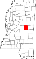 | |
| Town | ||
| CDPs | ||
| Other communities | ||
| Footnotes | ‡This populated place also has portions in an adjacent county or counties | |
Municipalities and communities of Newton County, Mississippi, United States | ||
|---|---|---|
| Cities | 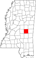 | |
| Towns | ||
| CDPs | ||
| Other unincorporated communities | ||
| Footnotes | ‡This populated place also has portions in an adjacent county or counties | |