Arizona State Route 89A
| ||||
|---|---|---|---|---|
 | ||||
| Route information | ||||
| Maintained by ADOT | ||||
| Length: | 83.85 mi[1] (134.94 km) | |||
| Existed: | 1993[2] – present | |||
| History: | Originally designated as SR 79 in 1927;[3] redesignated as US 89A by 1941[4] | |||
| Major junctions | ||||
| South end: |
| |||
| North end: |
| |||
| Highway system | ||||
| ||||

State Route 89A (SR 89A) is an 83.85-mile (134.94 km) state highway that runs from Prescott north to Flagstaff in the U.S. state of Arizona. The highway begins at SR 89 and heads northward from Prescott, entering Jerome. From Jerome, the route then heads to Cottonwood and Sedona. The highway is notable for its scenic value as it passes through Sedona and the Oak Creek Canyon. The route then enters Flagstaff, where it crosses Interstate 17 (I-17) and I-40. The highway ends at I-40 Business in Flagstaff. What is now SR 89A became a state highway in the late 1920s as SR 79. The highway was extended and improved several times through 1938. SR 79 was renumbered to U.S. Route 89A (US 89A) in 1941 and then to SR 89A in the early 1990s.
Route description
SR 89A runs from its southern terminus in Prescott northward through the towns of Jerome, Cottonwood and Sedona to its northern terminus in Flagstaff.[1] The highway is known for its scenic views as it passes through the Sedona and Oak Creek Canyon.[5]
Prescott to Jerome
The southern terminus of SR 89A is located at a junction with SR 89 north of Prescott near the Antelope Hills Golf Course and Ernest A. Love Field.[6] The road heads east from the junction with SR 89 as a four-lane divided highway with diamond interchanges located at most intersections. It continues as a divided highway until it reaches Fain Road in Prescott Valley.[7] The route continues beyond this intersection as a two-lane undivided highway.[1][8]

As SR 89A moves to the northeast, it begins to ascend the Black Hills mountain range. The roadway follows the terrain through a series of hairpin turns as it climbs in elevation. Once SR 89A reaches passes over the mountains, it begins its descent into the Verde Valley. During its descent, SR 89A enters the town of Jerome. In Jerome, the highway provides access to the nearby Jerome State Historic Park.[1][8]
Jerome to Sedona
Upon exiting Jerome, SR 89A heads northeast through the Verde Valley. After it enters the town of Clarkdale, it turns southeast at a roundabout with Clarkdale Parkway. The route continues towards the southeast through Clarkdale before entering the town of Cottonwood. There, the highway starts heading east at Cottonwood Street before reaching an intersection with Main Street.[1][8]
The historic route of 89A from Clarkdale to Cottonwood, when it was called U.S. Route 89A, ran through the old downtown areas of each city. From Jerome, the route continued along 11th Street (now Clarkdale Parkway), turning right at Main Street in Clarkdale, and then right again at Broadway. It continued past Tuzigoot National Monument, becoming Main Street in Cottonwood, and providing access to Dead Horse Ranch State Park. The route intersects Cottonwood Street, where the bypass route now intersects Main Street. This portion is now signed as "Historic U.S. 89A."[1][8]

Following the intersection with Cottonwood Street, the road follows Main Street to an intersection with SR 260, which heads to the south toward Camp Verde and I-17. SR 89A then moves northeastward towards Sedona.[1][8]
As the highway leaves Cottonwood, it again becomes a divided highway north of Rocking Chair Road, heading into desert. Before reaching Sedona, SR 89A provides access to Red Rock State Park. The route remains a divided highway until it reaches Sedona, an arts and resort community known for its red sandstone formations.[5] As it enters the city of Sedona, the route is known as the Si Birch Memorial Highway. The route continues east through Sedona, providing access to the Sedona Airport.[9] SR 89A continues towards the east through Sedona to an intersection with SR 179, which heads south from this intersection through the southern part of Sedona to provide access to I-17.[1][8]

Sedona to Flagstaff
The highway heads northeast into a wooded area from Sedona and follows Oak Creek as it enters Oak Creek Canyon. SR 89A then curves to the north as it follows the creek and provides access to Slide Rock State Park along this portion of the highway. The roadway leaves the creek as it begins to ascend through the canyon. Upon ascending, the road goes through a series of hairpin turns (no trucks over 50 ft.) towards the Mogollon Rim. The roadway continues northward away from the canyon towards Flagstaff. It curves northeastward as it passes to the west of the Forest Highlands Golf Club. The route continues to the northeast towards I-17 near Flagstaff Pulliam Airport. SR 89A begins to run concurrently with I-17 as a freeway northward. The two highways continue north to an interchange with I-40, where I-17 terminates. The route continues north along Milton Road, passing to the west of Northern Arizona University before reaching its northern terminus at Interstate 40 Business in Flagstaff.[1][8]
History

| |
|---|---|
| Location: | Prescott to Flagstaff |
| Existed: | 1927–1941 |
The routing of SR 89A was first defined as a state highway in 1927 as SR 79 by the Arizona Department of Transportation (ADOT). At the time, only the portion from Prescott to Clarkdale was built, but the remaining portion to Flagstaff had been planned.[3] By 1929, the highway had been extended north to Sedona, although the entire highway was not paved at this time.[10] A graded dirt road was built the following year between Flagstaff and Sedona.[11] The southern half of the section between Sedona and Flagstaff had been improved to a gravel road by 1934, with the northern half under construction.[12] The next year, the construction on the northern section near Flagstaff was complete. The southern end of the highway near Prescott and the section between Jerome and Cottonwood had been paved by this time.[13] By 1938, the entire route had been paved.[14]
By 1941, the highway was redesignated from SR 79 to US 89A. Before the establishment of the route for I-17, the only route to Flagstaff was through Prescott. There were two routes available: US 89A through Jerome, Cottonwood, Clarkdale, Sedona and Oak Creek Canyon or north through Chino Valley via US 89 to US 66.[4] The route was redesignated from US 89A to SR 89A in 1993.[2]
Before 2001 SR 89A had veered south into the granite dells near Watson Lake, but due to an aging granite creek bridge and increased traffic, Yavapai County acquired the necessary land to realign SR 89A away from the dells and near the airport.[15]
Junction list
| County | Location | mi[1] | km | Exit[1] | Destinations | Notes |
|---|---|---|---|---|---|---|
| Yavapai | Prescott | 0.00 | 0.00 | Southern terminus; exit 317 on Pioneer Pkwy. | ||
| 0.96 | 1.54 | 318 | Larry Caldwell Drive | No exit number northbound | ||
| 1.42 | 2.29 | 319 | Granite Dells Parkway | |||
| Prescott Valley | 4.21 | 6.78 | 322 | Glassford Hill Road | ||
| 4.96 | 7.98 | 323 | Viewpoint Drive | |||
| 5.62 | 9.04 | — | SR 89A Spur south (Fain Road) | North end of freeway; SR 89A Spur (unsigned) continues 7.2 miles (11.6 km) south to meet SR 69 | ||
| Cottonwood | 36.23 | 58.31 | Western terminus of SR 260 | |||
| | 49.33 | 79.39 | Lower Red Rock Loop Road | To Red Rock State Park | ||
| Sedona | 50.60 | 81.43 | Upper Red Rock Loop Road | To Red Rock State Park | ||
| Coconino | 54.80 | 88.19 | Roundabout; northern terminus of SR 179 | |||
| Flagstaff | 79.66 | 128.20 | South end of I-17 overlap; south end of freeway for SR 89A; I-17 exit 337 | |||
| 339 | Lake Mary Road – Mormon Lake | Northbound exit only; exit number follows I-17 | ||||
| 82.62 | 132.96 | 340A-B | North end of I-17 overlap; exit number follows I-17, signed as exits 340A (east) and 340B (west); northbound left entrance from eastbound I-40; I-40 exit 195 | |||
| 82.74 | 133.16 | 401 | McConnell Drive | Northbound exit and southbound entrance; north end of freeway; ADOT signs it as exit 341 | ||
| 83.85 | 134.94 | Northern terminus | ||||
1.000 mi = 1.609 km; 1.000 km = 0.621 mi
| ||||||
Spur route
State Route 89A Spur (SR 89A Spur or SS 89A) is a 7.22-mile-long (11.62 km)[16] unsigned highway routed along Fain Road in Prescott Valley.[17] The road was originally two lanes wide, but it has since been widened to a four-lane divided highway.[18] Its primary purpose is as an eastern bypass around Prescott. The Central Yavapai Metropolitan Planning Organization has planned a freeway to connect SR 169 and SR 89A via Fain Road/SR 89A Spur as part of their 2025 regional plan.[19]
See also
 Arizona portal
 U.S. Roads portal
References
- 1 2 3 4 5 6 7 8 9 10 11 Arizona Department of Transportation (2008). "2008 ADOT Highway Log" (PDF). Phoenix: Arizona Department of Transportation. Retrieved July 16, 2008.
- 1 2 Arizona Department of Transportation. "ADOT Right-of-Way Resolution 1993-02-A-008". Phoenix: Arizona Department of Transportation. Retrieved May 12, 2008.
- 1 2 Arizona Highway Department (1927). Official State Routes and State Highways of the State of Arizona (Map). Scale not given. Phoenix: Arizona Highway Department. Retrieved May 12, 2008 – via AARoads.
- 1 2 Arizona Highway Department (1941). Road Map of Arizona (Map). Scale not given. Phoenix: Arizona Highway Department. Retrieved May 12, 2008 – via AARoads.
- 1 2 Green, Stewart (2003). Scenic Driving Arizona. Falcon Guide (2nd ed.). Guilford, CT: Falcon. p. 107. ISBN 0-7627-2701-2. OCLC 879119760.
- ↑ Arizona Department of Transportation. "State Route 89 and State Route 89A". Arizona Department of Transportation. Archived from the original on December 29, 2010. Retrieved February 12, 2011.
- ↑ "ADOT Closes Viewpoint at Hwy. 89A this Weekend". Prescott Daily Courier. April 7, 2011. Retrieved February 12, 2011.
- 1 2 3 4 5 6 7 Google (May 5, 2008). "Overview Map of SR 89A" (Map). Google Maps. Google. Retrieved May 5, 2008.
- ↑ Michael Maresh (July 16, 2010). "City Considers Route Transfer of SR 89A". Sedona Red Rock News. Retrieved February 12, 2011.
- ↑ Arizona Highway Department (1929). Map of Arizona (Map). Scale not given. Phoenix: Arizona Highway Department. Retrieved May 12, 2008 – via AARoads.
- ↑ Arizona Highway Department (1930). Condition Map of State Highway System (Map). Scale not given. Phoenix: Arizona Highway Department. Retrieved May 12, 2008 – via AARoads.
- ↑ Arizona Highway Department (1934). Condition Map of State Highway System (Map). Scale not given. Phoenix: Arizona Highway Department. Retrieved May 12, 2008 – via AARoads.
- ↑ Arizona State Highway Department (1935). Road Map of Arizona (Map). Scale not given. Phoenix: Arizona State Highway Department. Retrieved May 12, 2008 – via Arizona Roads.
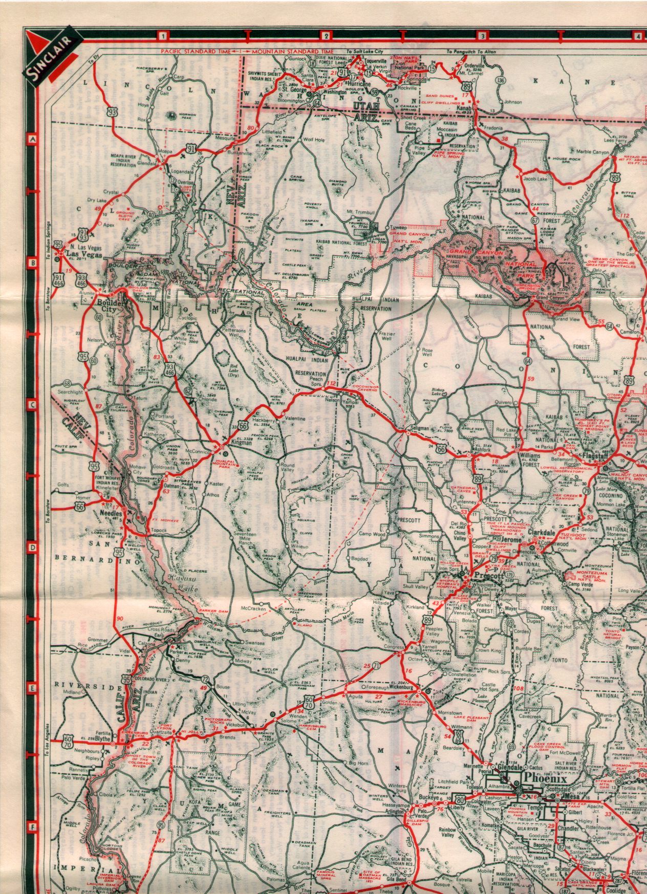
- ↑ Sinclair Oil; Rand McNally (1938). Road Map of Arizona and New Mexico (Map). Scale not given. Chicago: Rand McNally. Retrieved May 12, 2008 – via Arizona Roads.
- ↑ Yavapai County (March 16, 2001). "Resolution No. 1282" (PDF). Yavapai County. Retrieved October 21, 2016.
- ↑ Arizona Department of Transportation (December 31, 2015). "Centerline Miles of Roadway by Route" (PDF). Phoenix: Arizona Department of Transportation. p. 2. Retrieved October 13, 2016.
- ↑ Arizona Department of Transportation (December 31, 2012). "2012 State Highway System Log" (PDF). Phoenix: Arizona Department of Transportation. p. 522. Retrieved October 13, 2016.
- ↑ Barks, Cindy (December 5, 2011). "ADOT: Start of Fain Road Widening Imminent". Prescott Valley Tribune. Retrieved October 13, 2016.
- ↑ Central Yavapai Metropolitan Planning Organization (February 7, 2013). "Exhibit CIR-11: Roadway System" (PDF) (Map). Prescott Valley General Plan 2025: A Community Blueprint for the Future. Prescott, AZ: Central Yavapai Metropolitan Planning Organization. p. 139. Retrieved October 13, 2016.
External links
| Wikimedia Commons has media related to Arizona State Route 89A. |