Townsend Historic District
|
Townsend Historic District | |
|
House on Main Street | |
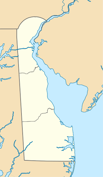  | |
| Location | Roughly bounded by Gray, Ginn and South, Lattamus and Main Sts., and Commerce St. and Cannery Ln. and Railroad Ave., Townsend, Delaware |
|---|---|
| Coordinates | 39°23′39″N 75°41′33″W / 39.39417°N 75.69250°WCoordinates: 39°23′39″N 75°41′33″W / 39.39417°N 75.69250°W |
| Area | 46 acres (19 ha) |
| Built by | Maloney, Thomas; et al. |
| Architectural style | Late 19th And 20th Century Revivals, Bungalow/craftsman, Late Victorian |
| NRHP Reference # | 86001029[1] |
| Added to NRHP | May 8, 1986 |

Townsend Historic District is a national historic district located at Townsend, New Castle County, Delaware. It encompasses 216 contributing buildings and 5 contributing structures in the crossroads and railroad village of Townsend. It includes a mix of commercial and residential buildings primarily dating to the late-19th century and early-20th century. Notable buildings include the Immanuel M. E. Church and Parsonage, Lattamus store (1851), Dr. Niles house (c. 1910), Maloney Store, Townsend-Dickenson Hotel/Harmon's Drug Store, Evan's Store (c. 1900), Hart's Grain, Seed and Coal Store, S. Townsend house (c. 1840), Winfield Cottage (c. 1870), school (1932), and the former St. Mary's Episcopal Church.[2]
It was listed on the National Register of Historic Places in 1986.[1]
 Immanuel Church
 304 Main St.
 314 Main St.
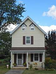 637 Commerce St.
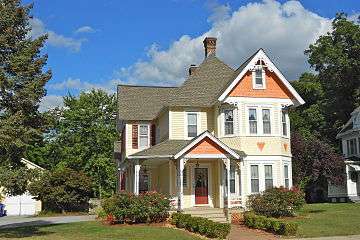 607 Commerce St.
 611 Commerce St.
References
- 1 2 National Park Service (2010-07-09). "National Register Information System". National Register of Historic Places. National Park Service.
- ↑ Valerie Cesna and Hubert F. Jicha, III (August 1985). "National Register of Historic Places Inventory/Nomination: Townsend Historic District" (PDF). National Park Service. and accompanying 39 photos
External links
| Wikimedia Commons has media related to Townsend Historic District (Delaware). |
- Historic American Engineering Record (HAER) No. DE-24, "Townsend Water Tower, Lattomus Avenue, Townsend, New Castle, DE"
| Topics |   | |
|---|---|---|
| Lists by county | ||
| Lists by city | ||
| Other lists | ||
| ||