City of Coburg
| City of Coburg Victoria | |||||||||||||
|---|---|---|---|---|---|---|---|---|---|---|---|---|---|
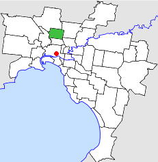 Location in Melbourne | |||||||||||||
| Population | 52,500 (1992)[1] | ||||||||||||
| • Density | 2,701/km2 (6,995/sq mi) | ||||||||||||
| Established | 1856 | ||||||||||||
| Area | 19.44 km2 (7.5 sq mi) | ||||||||||||
| Council seat | Coburg | ||||||||||||
| Region | Melbourne | ||||||||||||
| County | Bourke | ||||||||||||
 | |||||||||||||
The City of Coburg was a local government area about 10 kilometres (6 mi) north of Melbourne, the state capital of Victoria, Australia. The city covered an area of 19.44 square kilometres (7.51 sq mi), and existed from 1859 until 1994.
History
Initial efforts at local government saw the Sydney Road Trust set up in 1840, which boasted John Fawkner as a founding member, but the first incorporation in the area was the Pentridge District Road Board in 1859, which was renamed Coburg on 21 January 1869, after a Royal visit from Prince Alfred, Duke of Saxe-Coburg and Gotha.[2] It became a shire on 24 December 1874, before increasing urbanisation in the late 19th century led to it being reclassified a Borough in January 1905. Coburg then became a town on 18 September 1912, and was proclaimed a city on 29 March 1922.[3]
Between 1947 and 1981, the percentage of overseas-born residents of the City of Coburg increased from 9% to 34%, with significant proportions being of Italian or Greek origins.[2]
On 22 June 1994, the City of Coburg was abolished, and, along with the City of Brunswick, was merged into the newly created City of Moreland. A tiny strip on the eastern boundary was transferred to the new City of Darebin, which incorporated the Cities of Preston and Northcote.[4]
Council meetings were held at the Coburg City Hall, on Bell Street, Coburg. The hall is still used for this purpose by the City of Moreland.
Wards
The City of Coburg was divided into four wards, each electing three councillors:
- East Ward
- West Ward
- North Ward
- Central Ward
Suburbs
- Coburg
- Coburg North
- Pascoe Vale (shared with the City of Broadmeadows)
- Pascoe Vale South
Population
| Year | Population |
|---|---|
| 1861 | 1,033 |
| 1891 | 5,272 |
| 1911 | 9,505 |
| 1933 | 33,118 |
| 1954 | 62,077 |
| 1958 | 68,900* |
| 1961 | 70,771 |
| 1966 | 68,578 |
| 1971 | 65,662 |
| 1976 | 58,379 |
| 1981 | 55,035 |
| 1986 | 52,885 |
| 1991 | 50,625 |
* Estimate in the 1958 Victorian Year Book.
References
- ↑ Australian Bureau of Statistics, Victoria Office (1994). Victorian Year Book. p. 49. ISSN 0067-1223.
- 1 2 Monash University (1999). "Australian Places - Coburg". Archived from the original on 2003-10-03. Retrieved 2008-01-04.
- ↑ Victorian Municipal Directory. Brunswick: Arnall & Jackson. 1992. pp. 340–341. Accessed at State Library of Victoria, La Trobe Reading Room.
- ↑ Australian Bureau of Statistics (1 August 1995). Victorian local government amalgamations 1994-1995: Changes to the Australian Standard Geographical Classification (PDF). Commonwealth of Australia. p. 5,10. ISBN 0-642-23117-6. Retrieved 2007-12-16.
Coordinates: 37°44′17″S 144°58′55″E / 37.738°S 144.982°E