Toongabbie, Victoria
| Toongabbie Victoria | |
|---|---|
 Toongabbie | |
| Coordinates | 38°03′0″S 146°37′0″E / 38.05000°S 146.61667°ECoordinates: 38°03′0″S 146°37′0″E / 38.05000°S 146.61667°E |
| Population | 915 (2011 census)[1] |
| Established | 1844 |
| Postcode(s) | 3856 |
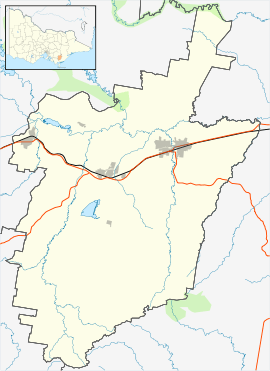
| Location | |
| LGA(s) | City of Latrobe |
| State electorate(s) | Morwell |
| Federal Division(s) | Gippsland, McMillan |
Toongabbie is a small country town located in South Eastern Victoria Australia, 177 kilometres (110 mi) from Melbourne and just north of Traralgon. The railway station was closed in 1986 and the former railway line has now been absorbed into the Gippsland Plains Rail Trail. At the 2011 census, Toongabbie had a population of 915.[1]
The main attraction in Toongabbie is the Ned Stringer Memorial located on Hower Street. Toongabbie Primary School opened in 1856 and the school is still open to date. The hotel in Toongabbie known as the club hotel closed down in 1913.
Toongabbie Post Office opened on 1 December 1865.[2] Toongabbie had an Aussie Rules club which quit in 1999.
History
The history of Toongabbie has been captured in the book "Toongabbie, Gippsland A Gateway to the Walhalla Goldfields" by Alan Harding and Roger Ries. Additional information on Toongabbie Victoria can be found on the community website: toongabbie.vic.au and associated Facebook page. Toongabbie was an important town that acted as a supply depot en route to the Walhalla Goldfields. Initially, goods were transported between Toongabbie and Walhalla by horse and as Walhalla boomed, Toongabbie’s carrying industry boomed as well. With the advent of railways in the 1870s and 1880s transportation of goods into Toongabbie was mostly via train and then local carriers to Walhalla. Walhalla then decided that a railway direct to Walhalla was needed and it was decided that Moe would be the starting point. This was bad news for Toongabbie which over the coming years saw many local carriers selling their horses and the town returned to farming. Toongabbie did try to find alternative income sources in oil, marble and gold but these were not successful long term.
Ned Stringer
There is a memorial for Ned Stringer on the corner of Hower and O’Meara St Toongabbie. Ned Stringer discovered gold in 1862 in a creek which was later named Stringers Creek. This was an important gold discovery that started the gold rush at Walhalla.
Toongabbie Today
Toongabbie is approximately 2 hours east of Melbourne, nestled in the foothills of the Great Divide. The current population of Toongabbie is estimated at 1100. Toongabbie crosses over two shires - Latrobe City and Wellington Shire. Today, Toongabbie is a quiet town close to several business districts. Toongabbie has a Primary School and easy access to kindergartens, public and private schooling, in surrounding towns. There are numerous tourist attractions within and surrounding the Toongabbie township. Toongabbie is a peaceful town with many community and sporting groups, a wetlands, affordable properties, V/line bus and train connections from township and is one of the towns on the Gippsland Plains Rail Trail.
Places of Worship
St David’s Church is located on Victoria St and was constructed in 1884. The church has been lovingly restored and still holds weekly Sunday services. St Davids Church is popular with weddings due to its quaintness and size.
Sporting and Recreation
Sports and recreation in Toongabbie include; Toongabbie wetlands, Gippsland Plains Rail Trail, tennis club, Toongabbie Golf Course, Cricket Club, Badminton, Carpet Bowls, Toongabbie & District Pony Club, Toongabbie & District Horse Riders Club Inc and Aerobics & Weights training. Community Toongabbie boasts a strong community focus with groups including the Wellington/Latrobe Lions Club, Country Women’s Association (CWA), Toongabbie Playgroup and singing group "Slightly Out of Toon". Halls and venues include the restored Toongabbie Mechanics Institute & Free Library, Toongabbie Recreation Hall and meeting room, golf club social rooms and cricket social rooms. Schooling Toongabbie Primary School (TPS) is located on Victoria Street.
References
- 1 2 Australian Bureau of Statistics (31 October 2012). "Toongabbie (L) (Urban Centre/Locality)". 2011 Census QuickStats. Retrieved 12 February 2016.
- ↑ Premier Postal History, Post Office List, retrieved 2008-04-11
Harding, A and Ries, R (2003)Toongabbie, Gippsland A Gateway to the Walhalla Goldfields