Tilshead
| Tilshead | |
 The Rose and Crown public house and Tilshead Baptist Chapel, Tilshead |
|
 Tilshead |
|
| Population | 358 (in 2011)[1] |
|---|---|
| OS grid reference | SU035479 |
| Unitary authority | Wiltshire |
| Ceremonial county | Wiltshire |
| Region | South West |
| Country | England |
| Sovereign state | United Kingdom |
| Post town | Salisbury |
| Postcode district | SP3 |
| Dialling code | 01980 |
| Police | Wiltshire |
| Fire | Dorset and Wiltshire |
| Ambulance | South Western |
| EU Parliament | South West England |
| UK Parliament | Salisbury |
| Website | Parish Council |
Coordinates: 51°13′49″N 1°57′03″W / 51.2302°N 1.9508°W
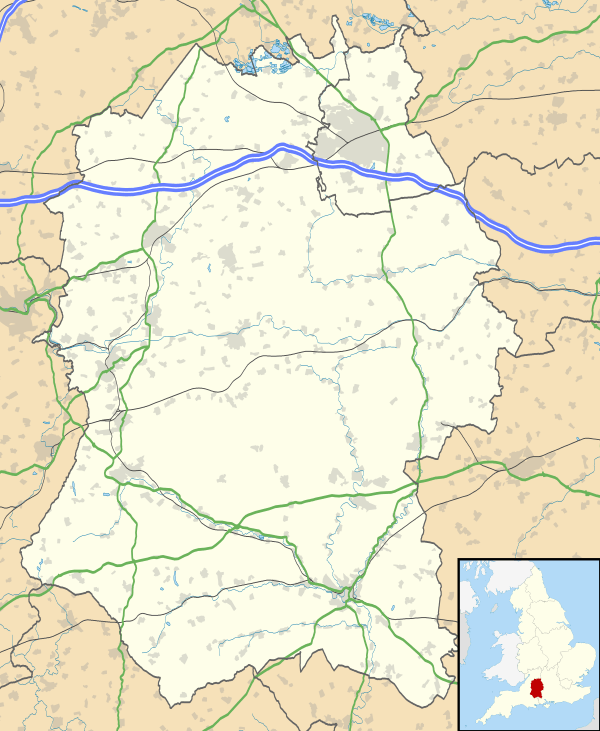
Tilshead /ˈtɪls.hɛd/ is a village and civil parish in the county of Wiltshire in southern England. It is close to the geographical centre of Salisbury Plain, on the A360 road approximately midway between the villages of Shrewton and Market Lavington, and is near the source of the River Till. Its population in 2011 was 358, down from a peak of 989 inhabitants in 1951.[2]
History
The White Barrow, a Neolithic long barrow is nearby.
In 1086 Tilshead was a borough and a large royal estate.[3] The tithing of South Tilshead was a manor of Romsey Abbey until the dissolution of the Monasteries, which is probably how it came to be a detached part of the hundred of Whorwellsdown.
Tilshead Lodge was built in the mid 17th century to the southwest of the village and became known for racehorse training. It was demolished in the early 1950s.
Local government
The civil parish elects a parish council. It is in the area of Wiltshire Council unitary authority, which is responsible for all significant local government functions.
Amenities
The Anglican Church of St Thomas à Becket is Grade I listed.[4] In part dating from the 12th century, it was restored in 1846 by T.H. Wyatt.[5]
A Baptist chapel was built next to the main road in 1882[6] and closed in 2015.[7]
Tilshead has a primary school, St Thomas à Becket C of E (Aided) Primary School,[8] which was built next to the church in 1905.[9]
There is a pub, the Rose and Crown, and a village hall.[10]
Military land
Much of Salisbury Plain is used by the Ministry of Defence for military training. Westdown Camp, 0.4 miles (0.64 km) to the east of the village, is an accommodation centre for the Salisbury Plain Training Area.
RAF Tilshead, to the southwest of the village, was in use from 1925 to 1941.
References
- ↑ "Parish population 2011". Office for National Statistics. Retrieved 16 March 2015.
- ↑ "Census". Wiltshire Community History. Wiltshire Council. Retrieved 31 May 2015.
- ↑ "Victoria County History - Wiltshire - Vol 15 pp263-275 - Parishes: Tilshead". British History Online. University of London. Retrieved 31 May 2015.
- ↑ Historic England. "Church of St Thomas a Becket, Tilshead (1023968)". National Heritage List for England. Retrieved 31 May 2015.
- ↑ "Church of St Thomas à Becket, Tilshead". Wiltshire Community History. Wiltshire Council. Retrieved 31 May 2015.
- ↑ "Baptist Chapel, Tilshead". Wiltshire Community History. Wiltshire Council. Retrieved 31 May 2015.
- ↑ "Tilshead Baptist Chapel". Tilshead Parish Council.
- ↑ "St Thomas à Becket C of E (Aided) Primary School - Tilshead". Retrieved 31 May 2015.
- ↑ "Tilshead School". Wiltshire Community History. Wiltshire Council. Retrieved 31 May 2015.
- ↑ "Tilshead Village Hall". Charity Commission. Retrieved 31 May 2015.
External links
- "Tilshead". Wiltshire Community History. Wiltshire Council. Retrieved 31 May 2015.
- http://tilsheadvillage.com/ - Parish website
![]() Media related to Tilshead at Wikimedia Commons
Media related to Tilshead at Wikimedia Commons