Théniet El Had National Park
| EL MEDDAD | |
|---|---|
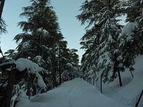 photo presenting a way to PARASOLE , inside the forêst | |
| Highest point | |
| Peak | Ras el Braret |
| Elevation | 1,787 m (5,863 ft) |
| Geography | |
| Country | Algeria |
|
IUCN category II (national park) | |
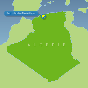 EL MEDDAD National Park in Algeria | |
| Location | Tissemsilt Province, Algeria |
| Nearest city | Théniet El Haâd |
| Coordinates | 35°40′N 01°49′E / 35.667°N 1.817°ECoordinates: 35°40′N 01°49′E / 35.667°N 1.817°E |
| Area | 36,16 km² |
| Established | 1983 |
The Théniet El Had National Park is one of the 10 national parks of Algeria. It is located in Tissemsilt Province, named after Théniet El Haâd, a town near this park.
Description
It has several forests, and it is located in the foothills of the highest peak (1.985 meter/ 6.512 feet high) of the Ouarsenis mountain chain in the Tell Atlas; home to a diversified flora and fauna. The park is a popular hiking destination for many Algerians.
External links
- (French) Official Website
- (French) Official website (dead link)
- Taza National Park on UNESCO.org(dead link)
- Park data on UNEP-WPMC (dead link)
This article is issued from Wikipedia - version of the 11/18/2016. The text is available under the Creative Commons Attribution/Share Alike but additional terms may apply for the media files.