Texas State Highway 37
| ||||
|---|---|---|---|---|
 | ||||
| Route information | ||||
| Maintained by TxDOT | ||||
| Length: | 92.3 mi[1] (148.5 km) | |||
| Existed: | 1961 – present | |||
| Major junctions | ||||
| South end: |
| |||
|
| ||||
| North end: |
| |||
| Highway system | ||||
| ||||

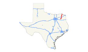
State Highway 37 is a state highway that runs from the Oklahoma border near Albion to Mineola in the northeast corner of the state.
Previous Route

SH 37 was originally proposed in 1919 as a route from Clarksville to Lufkin. By 1926, it was pared back, with the portion from Jacksonville to Lufkin transferred to SH 40. Everything north of Mt. Vernon was either cancelled or transferred to SH 66. By 1933, it was extended north to the Oklahoma border, replacing SH 66. By 1938, the stretch from Mineola to Tyler was transferred to U.S. Highway 69, with the remaining route continuing to the present.
SH 37A was designated by 1926 as a spur from Tyler to Troup. By 1933, this became an extension of SH 110.
Junction list
| County | Location | mi | km | Destinations | Notes |
|---|---|---|---|---|---|
| Wood | Mineola | Southern terminus | |||
| | |||||
| Quitman | |||||
| South end of SH 154 overlap | |||||
| North end of SH 154 overlap | |||||
| | |||||
| Winnsboro | |||||
| Franklin | | ||||
| | |||||
| | |||||
| Mount Vernon | |||||
| | |||||
| | |||||
| Red River | | ||||
| Bogata | |||||
| | |||||
| | |||||
| | |||||
| Clarksville | |||||
| | |||||
| | |||||
| | |||||
| | |||||
| | |||||
| | Northern terminus; Continuation into Oklahoma | ||||
1.000 mi = 1.609 km; 1.000 km = 0.621 mi
| |||||
References
This article is issued from Wikipedia - version of the 3/3/2016. The text is available under the Creative Commons Attribution/Share Alike but additional terms may apply for the media files.