Texas Park Road 2
| ||||
|---|---|---|---|---|
 | ||||
| Route information | ||||
| Maintained by TxDOT | ||||
| Length: | 1.110 mi[1] (1.786 km) | |||
| Existed: | September 26, 1939[1] – present | |||
| Major junctions | ||||
| South end: |
| |||
| North end: | Numerous small in-park roads | |||
| Location | ||||
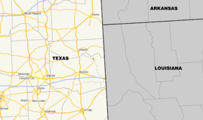
| Counties: | Harrison | |||
| Highway system | ||||
| ||||

Park Road 2 (PR 2) is a 1.110-mile-long (1.786 km) road that connects Caddo Lake State Park to Farm to Market Road 2198 (FM 2198). Park Road 2 is located in Harrison County, in the northeastern region of the U.S. state of Texas. The Civilian Conservation Corps constructed the road in the 1930s, and the road was designated in 1939. Most major roads inside the park carry the PR 2 designation.
Route description

PR 2 begins at its southern terminus, an intersection with FM 2198, as an undivided, two-lane, paved road. The highway proceeds north into Caddo Lake State Park, passing around the park headquarters building, and continuing towards cabin sites. The road proceeds north, past the cabins, and splits into a large loop. The route passes Saw Mill Pond, and a small parking lot for the pond, before continuing down a steep slope back to the beginning of the loop. The PR 2 designation also includes three small roads that serve the main park campgrounds.[2][3]
History
In 1927, a small area of land near Caddo Lake was donated to create a public park. In 1929 and later in 1931 Caddo Lake itself and some of the surrounding areas were designated by the state of Texas to become state parkland. Between 1933 and 1937, the Civilian Conservation Corps (CCC) rebuilt the park and created many of the park's structures. The National Park Service designated landspace designers Joe W. Westbrook and Fred R. Carpentar, as well as others, to design the park's road system.[4] On September 26, 1939, approximately 2.0 miles (3.2 km) of the roads inside the park were designated as PR 2. On August 15, 1968, a short road traveling from a boat-launch ramp to the park boundary was removed from PR 2, shortening the route by approximately 0.5 miles (0.80 km).[1]
Major intersections
The entire highway is in the Caddo Lake State Park, Harrison County.
| mi[5] | km | Destinations | Notes | ||
|---|---|---|---|---|---|
| 0.000 | 0.000 | Southern terminus | |||
| 1.110 | 1.786 | Numerous in-park roads | Northern terminus | ||
| 1.000 mi = 1.609 km; 1.000 km = 0.621 mi | |||||
See also
 U.S. Roads portal
 Texas portal
References
- 1 2 3 Transportation Planning and Programming Division (n.d.). "Park Road No. 2". Highway Designation Files. Texas Department of Transportation. Retrieved August 31, 2012.
- ↑ Caddo Lake State Park (PDF) (Map). Texas Parks and Wildlife Department. 2012. Retrieved September 7, 2012.
- ↑ Transportation Planning and Programming Division (2012). Texas County Map Book (PDF) (Map) (2012 ed.). 1:120,000. Texas Department of Transportation. p. 589. OCLC 867856197. Retrieved September 7, 2012.
- ↑ Staff. "Caddo Lake State Park". The Look of Nature: Designing Texas State Parks During the Great Depression. Texas Parks and Wildlife Department. Retrieved September 1, 2012.
- ↑ Statewide Planning Map (Map). Cartography by Transportation Planning and Programming Division. Texas Department of Transportation. Retrieved August 31, 2012.