Templepatrick, County Westmeath (civil parish)
| Templepatrick Teampall Phádraig | |
|---|---|
| Civil parish | |
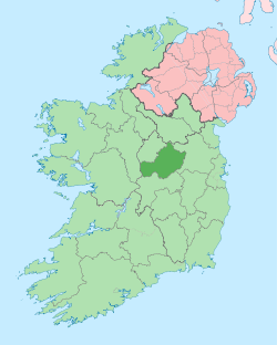
 Templepatrick Location of Templepatrick within County Westmeath in the Republic of Ireland | |
| Coordinates: 53°32′4″N 7°37′48″W / 53.53444°N 7.63000°WCoordinates: 53°32′4″N 7°37′48″W / 53.53444°N 7.63000°W | |
| Country |
|
| Province | Leinster |
| County | County Westmeath |
| Irish grid reference | N245538 |
Templepatrick (Irish: Teampall Phádraig)[1] is a civil parish in County Westmeath, Ireland. It is located about 18.91 kilometres (12 mi) west of Mullingar.
Templepatrick is one of 9 civil parishes in the barony of Rathconrath in the Province of Leinster. The civil parish covers 2,148.2 acres (8.693 km2).
Piercetown civil parish comprises the small village of Moyvore and 5 townlands: Beltacken, Moyvore, Rahadorrish, Templepatrick and Tonlemony.
The neighbouring civil parishes are: Piercetown to the north, Ballymorin to the south–east, Killare to the south–west and Forgney (County Longford) to the west.[1][2][3]
References
- 1 2 Templepatrick civil parish The Placenames Database of Ireland. Retrieved on 3 August 2015.
- ↑ Templepatrick civil parish, Co. Westmeath townlands.ie Retrieved on 3 August 2015.
- ↑ Templepatrick civil parish, Co. Westmeath The IreAtlas Townland Data Base. Retrieved on 3 August 2015.
External links
- Templepatrick civil parish at the IreAtlas Townland Data Base
- Templepatrick civil parish at townlands.ie
- Templepatrick civil parish at The Placenames Database of Ireland
This article is issued from Wikipedia - version of the 8/3/2015. The text is available under the Creative Commons Attribution/Share Alike but additional terms may apply for the media files.