Moyashel and Magheradernon
| Moyashel and Magheradernon Maigh Asail agus Machaire Ó dTiarnáin | |
|---|---|
| Barony | |
|
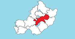
Location of Moyashel and Magheradernon on a map of Westmeath | |
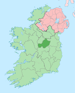
 Moyashel and Magheradernon Location in Ireland | |
| Coordinates: 53°31′57″N 7°19′53″W / 53.5325°N 7.3314°WCoordinates: 53°31′57″N 7°19′53″W / 53.5325°N 7.3314°W | |
| Country | Ireland |
| Province | Leinster |
| County | Westmeath |
| Area | |
| • Total | 177.2 km2 (68.4 sq mi) |
| Time zone | WET (UTC+0) |
| • Summer (DST) | IST (WEST) (UTC+1) |
| Irish Grid Reference | N443538 |
Moyashel and Magheradernon (Irish: Maigh Asail agus Machaire Ó dTiarnáin)[1] is a barony in the centre of County Westmeath, in the Republic of Ireland, formed by 1672.[2] It is bordered by eight other baronies: Corkaree and Fore (to the north), Delvin and Farbill (to the east), Fartullagh and Moycashel (to the south) and Rathconrath and Moygoish (to the west). (Note that the town of Delvin and the village of Rathconrath are not synonymous with the baronies of the same name).
Geography
Moyashel and Magheradernon has an area of 43,779.6 acres (177.170 km2).[2] The barony contains parts of two large lakes; Lough Ennell, shared with the barony of Fartullagh, and Lough Owel, an internationally recognised Ramsar waterfowl habitat. The River Brosna, rises in Lough Owel[3] and is a tributary of the River Shannon. The N4, a national primary road passes though the barony to the north of Mullingar, connecting Dublin with the northwest of Ireland and the coastal town of Sligo. Railway lines carrying the national rail company Iarnród Éireann's Dublin to Longford commuter service and Dublin to Sligo intercity service[4] stop in the barony at Mullingar railway station. The Royal Canal passes through the town of Mullingar connecting the River Liffey in Dublin to Longford town.
Civil parishes of the barony
This table[5] lists an historical geographical sub-division of the barony known as the civil parish (not to be confused with an Ecclesiastical parish).
| Name in English | Name in Irish |
|---|---|
| Dysart | An Díseart |
| Mullingar | An Muileann gCearr |
| Rathconnell | Rú Chonaill |
Towns, villages and townlands
- Ballina, a small village on the R390. Ballinea Bridge crosses over the Royal Canal.
- Mullingar (Irish: An Muileann gCearr, meaning "the left-handed mill") is the county town of County Westmeath.
There are 100 townlands in the barony of Moyashel and Magheradernon.[2]
Buildings of Interest
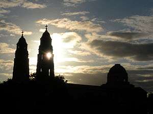
- Christ The King Cathedral, Mullingar
References
- ↑ Barony of Moyashel and Magheradernon The Placenames Database of Ireland Retrieved 24 May 2015
- 1 2 3 "Moyashel and Maheradermon". townlands.ie. Retrieved 24 May 2015.
- ↑ Lough Owel askaboutireland.ie Retrieved 24 May 2015
- ↑ Irish Rail Printable Timetables irishrail.ie Retrieved 24 May 2015
- ↑ Civil parishes of the barony of Moyashel and Magheradernon. The Placenames Database of Ireland Retrieved 8 Jun 2015
External links
- Map of Moyashel and Magheradernon at openstreetmap.org
- Barony of Moyashel and Magheradernon, Co. Westmeath at townlands.ie