Tazekka National Park
| Tazekka National Park | |
|---|---|
|
IUCN category II (national park) | |
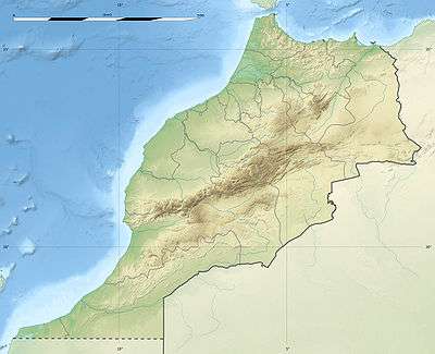 | |
| Location | Morocco |
| Nearest city | Taza |
| Coordinates | 34°6′0″N 4°11′0″W / 34.10000°N 4.18333°WCoordinates: 34°6′0″N 4°11′0″W / 34.10000°N 4.18333°W |
| Established | 1950 |
The Tazekka National Park of Morocco was created in 1950 with an initial area of 6.8 km². It was created to protect the natural resources at the top from Jbel Tazekka, particularly the grove of cedars (Cedrus atlantica), which are isolated on this peak in the Middle Atlas range. The park includes the mountain Jbel Tazekka (elev. 1,980 m) which dominates the surrounding area.
In 1989, the park was extended to include nearly 120 km² of ecological importance (forests of cork oak, holm oak, as well as canyons and caves, cascades, and rural landscapes).
Access
Tazekka National Park is located in the Middle Atlas, near the city of Taza.
Climate
Atmospheric moisture condenses as it is orographically lifted over the mountain. As a result, the mountain frequently shows a cap cloud and annually receives approximately 180 cm of precipitation, particular in the form of snow.
Fauna
Mammals are represented by North African boars (Sus scrofa algira), porcupines (Hystrix cristata), otters (Lutra lutra), Small-spotted genets (Genetta genetta), hares (Lepus capensis), Algerian wolves (Canis anthus algirensis), and red foxes (Vulpes vulpes).
Barbary leopards (Panthera pardus panthera), striped hyenas (Hyaena hyaena) and caracals (Caracal caracal), which were found once in the area, are extinct. The Barbary stag (Cervus elaphus barbarus) was extinct as well, but has been reintroduced recently.[1]
References
- ↑ Flora and Fauna - Park National de Tazekka, (official web page of the National Park).
External links
- (French) Official website