Tarkio Township, Atchison County, Missouri
| Tarkio Township | |
|---|---|
| Township | |
 | |
| Coordinates: 40°26′59″N 095°23′13″W / 40.44972°N 95.38694°WCoordinates: 40°26′59″N 095°23′13″W / 40.44972°N 95.38694°W | |
| Country | United States |
| State | Missouri |
| County | Atchison |
| Area | |
| • Total | 47.93 sq mi (124.14 km2) |
| • Land | 47.90 sq mi (124.05 km2) |
| • Water | 0.03 sq mi (0.09 km2) 0.07% |
| Elevation[1] | 991 ft (302 m) |
| Population (2010) | |
| • Total | 1,752 |
| • Density | 37/sq mi (14.1/km2) |
| FIPS code | 29-72358[2] |
| GNIS feature ID | 0766239 |
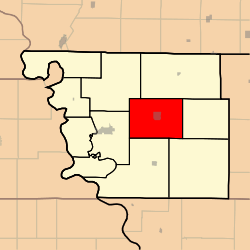
Tarkio Township is one of eleven townships in Atchison County, Missouri, United States. As of the 2010 census, its population was 1,752.[3]
Tarkio Township was organized in 1845, and named after the nearby Tarkio River.[4]
Geography
Tarkio Township covers an area of 47.9 square miles (124.1 km2) and contains one incorporated settlement, Tarkio. It contains one cemetery, Home.
The streams of Middle Tarkio Creek and West Tarkio Creek run through this township.
Transportation
Tarkio Township contains one airport, Gould Peterson Municipal Airport.
References
- ↑ "US Board on Geographic Names". United States Geological Survey. 2007-10-25. Retrieved 2008-01-31.
- ↑ "American FactFinder". United States Census Bureau. Retrieved 2008-01-31.
- ↑ "Geographic Identifiers: 2010 Demographic Profile Data (G001): Tarkio township, Atchison County, Missouri". U.S. Census Bureau, American Factfinder. Retrieved June 25, 2013.
- ↑ "Atchison County Place Names, 1928-1945 (archived)". The State Historical Society of Missouri. Retrieved 30 August 2016.
External links
Municipalities and communities of Atchison County, Missouri, United States | ||
|---|---|---|
| Cities |  | |
| Village | ||
| Townships | ||
| CDPs | ||
| Unincorporated communities | ||
| Ghost towns | ||
This article is issued from Wikipedia - version of the 9/3/2016. The text is available under the Creative Commons Attribution/Share Alike but additional terms may apply for the media files.