Taff Trail

The Taff Trail (Welsh: Taith Taf) is a popular walking and cycle path that runs for 55 miles (89 km) between Cardiff Bay and Brecon in Wales. It is named so because it follows the course of the River Taff. Along much of its length, it follows the National Cycle Network Route 8 (Lôn Las Cymru) that continues to Holyhead, and is substantially off-road.
History
The trail was launched in September 1988 by Sir Wyn Roberts, Minister of State for the Welsh Office. The project was initiated and co-ordinated by the Merthyr and Cynon Groundwork Trust, with the co-operation of the local councils that the trail passes through. Financial and logistical support has been given by the Welsh Development Agency and Sustrans, a sustainable transport charity.
Before the trail was conceived, several similar and disjointed facilities existed in the area. Taff Ely borough council had created cycling routes within its boundaries, Cardiff city council had provided the Three Castles Cycle Route from Caerphilly into Cardiff, and the Brecon Beacons National Park was developing leisure trails to encourage the use of the park. The Groundwork Trust for Merthyr Tydfil and Rhondda Cynon Taf saw a need for the co-ordination of these efforts, and the Taff Trail was born.
Equipment
The entire route is signposted, but a route map is also recommended as the signs can be easy to miss or can be turned in wrong directions by vandals. A pack of strip maps can be bought from Sustrans. Free leaflets showing the route are sometimes available from bicycle shops, tourist information centres and sports centres in Cardiff, and can be downloaded in pdf from Sustrans here.
Parts of the route are surfaced with sharp loose stones, and other parts run over bumpy rocky tracks. A hybrid bicycle or mountain bike is highly recommended. Tricycles and recumbents are best avoided due to a number of "foot scraper" barriers with very narrow gaps (which are there to deter motorcyclists).
Cyclists aiming to cross the Brecon Beacons mountains between Merthyr and Brecon should also carry whatever they need to be self-sufficient in case of a breakdown or bad weather, as the mountain is remote and can be a long walk from civilisation. This might include a mobile phone (though reception for all networks is limited), puncture repair kits and a pump.
The route
The trail makes much use of an abandoned branch of the Taff Vale Railway and the Glamorganshire Canal. These had been built in the 18th and 19th centuries to transport coal and iron ore from Merthyr Tydfil, the Cynon Valley and the Rhondda valley to the docks at Cardiff and Barry. The canals had become disused due to competition from the railways, and the railways in turn had become surplus to requirement as the heavy industries upon which they depended had been wound down. These routes, which although disused had remained largely intact, proved ideal for the needs of the trail, providing a convenient path along the narrow Taff valley.
Cardiff

inside The Celtic Ring sculpture.
It begins in Roald Dahl Plass in Cardiff Bay, at a sculpture named The Celtic Ring, created especially for the trail by Harvey Hood (51°27′48″N 3°09′51″W / 51.4632°N 3.1641°W). Travelling west, it crosses the Taff and follows the river north through the centre of Cardiff along the Taff Embankment. It passes within 50 yards (46 m) of Cardiff Central railway station and of the Millennium Stadium in the city centre, before winding through Sophia Gardens, passing the home of Glamorgan County Cricket Club.
The trail continues along the Taff through Bute Park and Pontcanna Fields, near Llandaff Fields, and crosses the pedestrian bridge at Blackweir. It then follows the eastern bank of the Taff past Blackweir Lodge, under the A48 road flyover, past Llandaff Weir (Llandaff Rowing Club is visible on the opposite bank) near Howell's School, Llandaff Cathedral and the BBC Wales studios, and through Hailey Park in Llandaff North. In this area (as most of the path within Cardiff Council boundaries) pedestrians have been given priority, despite the national cycle route status of the trail. Especially on days with fair weather, this can make navigating the Trail close to impossible due to pedestrian congestion and dog walkers. [1]
It then moves inland for a short distance, until rejoining the river back close to Forest Farm, to continue along the river past Radyr Weir and under the M4 motorway.
Tongwynlais
After passing underneath the A470 dual-carriageway, the Trail reaches the village of Tongwynlais. As well as shops, pubs, a cafe, and a cycle shop, it is home to the gothic fantasy castle, Castell Coch. At Tongwynlais, the trail splits into two. The high-level route climbs the steep hill to Castell Coch, then up a very steep path (best avoided in muddy conditions), and along a forest track of sharp stones. The low-level route is tarmacked and runs below the castle, adjacent to Taff's Well railway station and then climbs steadily for 1.5 miles (2.4 km) along the former Rhymney Railway, until it rejoins the high-level route just before the Nantgarw bypass.
Here the route turns left off the main path - an easy turn to miss - and crosses the bypass, joining National Cycle Network Route 4 (known within Wales as the Celtic Trail). Route 4 stretches from London in the east to St David's in the west, and runs along with the Taff Trail as far as Pontypridd.
Pontypridd

The trail proceeds along the former Alexandra (Newport Docks) Docks & Railway Company line towards Rhydyfelin. At Rhydyfelin, the Trail emerges briefly to cross a minor road, before continuing through the Glyntaff Farm housing estate and passing along the length of Glyntaff Cemetery.

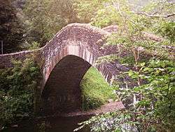
After the Cemetery, the Trail joins Cilfynydd Road. The former route continued along the road for half a mile, before leading into the northern end of Pontypridd town centre. However, the trail is now signposted to cross a pedestrian bridge and pass through Ynysyngharad Park. Cyclists may prefer to continue along the old road, as cyclists are instructed to dismount inside the park. At the northern exit from the park, users may wish to take a short (100 yards) detour to visit the Old Bridge in Pontypridd.
Abercynon
The Trail continues north-west on-road through Trallwng, before becoming traffic-free for a stretch, rejoining the Taff along the way. North of Cilfynydd, a permissive path alongside the Taff has been opened to avoid the previous road route between Cilfynydd and Abercynon. At Abercynon, the Trail travels along the route of the Merthyr Tramroad, the route used by Richard Trevithick's Penydarren steam locomotive. This stretch has been recently upgraded, but the original stone tramroad sleepers can be seen at the side of the gravel track.
Aberfan
At Pontygwaith, the Trail climbs steeply above the A470 by means of some steps. It then follows above the A470 as far as Aberfan, where it descends below the road and continues through the mainly residential areas of Aberfan. At this point, it passes the cemetery containing the memorial to the children and teachers who died in the Aberfan disaster. The stretch from Pontygwaith to Merthyr Tydfil follows the route of the former Glamorganshire Canal.
Merthyr Tydfil
After Aberfan, the trail passes through Troedyrhiw and Abercanaid, before arriving in Merthyr Tydfil at the Rhydycar Leisure Centre. From this point, the town centre is around 200 yards (180 m) away over the Taff. It is very easy to get lost in Merthyr, and travellers may find it easier to ignore the Route 8 signs, and follow their road map instead.
Brecon
From Merthyr, the trail continues across Cefn Coed Viaduct, through Cefn-coed-y-cymmer, then following the Taf Fechan (the smaller of the 2 main tributaries of the River Taff) past Pontsticill Reservoir. From Pontsticill to Brecon is about 25 miles (40 km) of remote scenery crossing the Brecon Beacons mountains - partly pretty forest tracks and partly wide open, expansive moorland. There are very steep roads on both sides of the mountain, and cyclists should allow extra time to get off and walk. Descending the mountain, cyclists can avoid the slow rough track on the east side of Talybont Reservoir by taking the road along the west bank, on which traffic is normally very sparse. The route continues along the track-bed of the former Brecon and Merthyr Railway to Talybont-on-Usk, then towards Brecon (51°56′40″N 3°23′19″W / 51.9444°N 3.3885°W), in the last few kilometres following alongside the Monmouthshire and Brecon Canal.
A second route exists - also called the Taff Trail - from Cefn Coed to Brecon along the Taf Fawr (more or less parallel to the A470 road, but often on the opposite side of the valley) via the Garwnant Visitors Centre. This route is most suitable for walking and horse-riding. Although cycling (pref. mountain bike) is possible in places it is not nearly so well sign-posted as the Taf Fechan route.
See also
References
- ↑ "Taff Trail users urged to observe Code of Conduct and be considerate to others sharing path". Farrelly Atkinson. 30 October 2011. Retrieved 29 June 2014.
External links
| Wikimedia Commons has media related to Taff Trail. |
- Official Taff Trail Leaflet
- Sustrans Routes2Ride: Cycling the Taff Trail - Cardiff to Castell Coch
- Sustrans Route2Ride: Cycling the Taff Trail - Merthyr Tydfil to Brecon
- Brecon Beacons Bike Bus. Gives timetable details of buses from Cardiff to Brecon with attached bike trailer so cyclists can be dropped off at the start of the trail and cycle home.
- Unofficial Cycling the Taff Trail
Coordinates: 51°41′47″N 3°20′50″W / 51.6964°N 3.3471°W
| Coastal footpaths & trails | |
|---|---|
| Non-coastal footpaths & trails | |

Transport in Caerphilly County Borough | ||
|---|---|---|
| Road |  | |
| Bus |
| |
| Railway lines | ||
| Railway stations | ||
| Cycle | ||
| Walk | ||
| Waterways | ||
Transport in Powys | |||||||||||
|---|---|---|---|---|---|---|---|---|---|---|---|
| Road |  | ||||||||||
| Footpaths | |||||||||||
| Cycle routes | |||||||||||
| Railway stations |
| ||||||||||
