Sylvan, Wisconsin
| Sylvan, Wisconsin | |
|---|---|
| Town | |
 Location of Sylvan, Wisconsin | |
| Coordinates: 43°24′20″N 90°36′11″W / 43.40556°N 90.60306°W | |
| Country | United States |
| State | Wisconsin |
| County | Richland |
| Area | |
| • Total | 36.1 sq mi (93.5 km2) |
| • Land | 36.1 sq mi (93.5 km2) |
| • Water | 0.0 sq mi (0.0 km2) |
| Elevation[1] | 1,135 ft (346 m) |
| Population (2000) | |
| • Total | 547 |
| • Density | 15.2/sq mi (5.9/km2) |
| Time zone | Central (CST) (UTC-6) |
| • Summer (DST) | CDT (UTC-5) |
| Area code(s) | 608 |
| FIPS code | 55-78825[2] |
| GNIS feature ID | 1584263[1] |
Sylvan is a town in Richland County, Wisconsin, United States. The population was 547 at the 2000 census. The unincorporated communities of Bosstown, Sabin, and Sylvan are located within the town. The ghost town of Mill Creek was also located in the town.
History
The first settlement in what became the town of Sylvan occurred in 1853. The next year Sylvan was detached from the town of Forest, and in April 1855 the newly organized town held its first election at which thirty-two votes were cast.[3]
Geography
According to the United States Census Bureau, the town has a total area of 36.1 square miles (93.5 km²), of which, 36.1 square miles (93.4 km²) of it is land and 0.03% is water.
Demographics
As of the census[2] of 2000, there were 547 people, 183 households, and 146 families residing in the town. The population density was 15.2 people per square mile (5.9/km²). There were 222 housing units at an average density of 6.2 per square mile (2.4/km²). The racial makeup of the town was 97.44% White, 1.28% Native American, 0.55% from other races, and 0.73% from two or more races. Hispanic or Latino of any race were 4.57% of the population.
There were 183 households out of which 37.2% had children under the age of 18 living with them, 73.2% were married couples living together, 5.5% had a female householder with no husband present, and 19.7% were non-families. 16.4% of all households were made up of individuals and 6.6% had someone living alone who was 65 years of age or older. The average household size was 2.99 and the average family size was 3.41.
In the town the population was spread out with 30.3% under the age of 18, 8.0% from 18 to 24, 25.2% from 25 to 44, 22.3% from 45 to 64, and 14.1% who were 65 years of age or older. The median age was 36 years. For every 100 females there were 106.4 males. For every 100 females age 18 and over, there were 101.6 males.
The median income for a household in the town was $37,917, and the median income for a family was $43,438. Males had a median income of $27,321 versus $20,694 for females. The per capita income for the town was $14,287. About 8.2% of families and 9.1% of the population were below the poverty line, including 10.3% of those under age 18 and 10.0% of those age 65 or over.
Notable people
- John H. Babb, Wisconsin State Assemblyman, farmer, and teacher, was born in the town; Babb served as chairman of the Sylvan Town Board.[4]
Coordinates: 43°25′21″N 90°37′41″W / 43.42250°N 90.62806°W
References
- 1 2 "US Board on Geographic Names". United States Geological Survey. 2007-10-25. Retrieved 2008-01-31.
- 1 2 "American FactFinder". United States Census Bureau. Retrieved 2008-01-31.
- ↑ Kepler, Twylah Shaw. Sabin: A History. Richland Center, Wis.: Brewer Public Library, 1981.
- ↑ 'Wisconsin Blue Book 1901,' Biographical Sketch of John H. Babb, pg. 762
Municipalities and communities of Richland County, Wisconsin, United States | ||
|---|---|---|
| City | 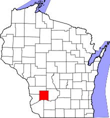 | |
| Villages | ||
| Towns | ||
| CDPs | ||
| Unincorporated communities |
| |
| Ghost towns | ||
| Footnotes | ‡This populated place also has portions in an adjacent county or counties | |