Suntarsky District
| Suntarsky District Сунтарский улус (Russian) Сунтаар улууhа (Sakha) | |
|---|---|
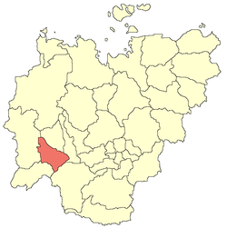 Location of Suntarsky District in the Sakha Republic | |
.png) |
.png) |
|
| |
| Location | |
| Country | Russia |
| Federal subject | Sakha Republic[1] |
| Administrative structure (as of June 2009) | |
| Administrative center | selo of Suntar[2] |
| Administrative divisions:[2] | |
| rural okrug | 26 |
| Inhabited localities:[2] | |
| Rural localities | 39 |
| Municipal structure (as of December 2008) | |
| Municipally incorporated as | Suntarsky Municipal District[3] |
| Municipal divisions:[4] | |
| Urban settlements | 0 |
| Rural settlements | 26 |
| Statistics | |
| Area (June 2009) | 57,800 km2 (22,300 sq mi)[2] |
| Population (2010 Census) | 25,140 inhabitants[5] |
| • Urban | 0% |
| • Rural | 100% |
| Density | 0.43/km2 (1.1/sq mi)[6] |
| Time zone | YAKT (UTC+09:00)[7] |
| Established | January 9, 1930[8] |
| Suntarsky District on WikiCommons | |
Suntarsky District (Russian: Сунта́рский улу́с; Yakut: Сунтаар улууһа, Suntaar uluuha, IPA: [suntaːɾ uluːha]) is an administrative[1] and municipal[3] district (raion, or ulus), one of the thirty-four in the Sakha Republic, Russia. It is located in the western central part of the republic and borders with Nyurbinsky District in the north and northeast, Verkhnevilyuysky District in the east, Olyokminsky District in the southeast, Lensky District in the southwest, and with Mirninsky District in the west. The area of the district is 57,800 square kilometers (22,300 sq mi).[2] Its administrative center is the rural locality (a selo) of Suntar.[2] Population: 25,140 (2010 Census);[5] 25,485 (2002 Census);[9] 26,035 (1989 Census).[10] The population of Suntar accounts for 39.9% of the district's total population.[5]
Geography
The main river in the district is the Vilyuy.
Climate
Average January temperature ranges from −34 to −50 °C (−29 to −58 °F) and average July temperature ranges from +17 to +18 °C (63 to 64 °F).[8] Annual precipitation is about 250–300 millimeters (9.8–11.8 in).[8]
History
The district was established on January 9, 1930.[8]
Demographics
As of the 1989 Census, the ethnic composition was as follows:[8]
Economy
The economy of the district is mostly based on agriculture.[8] There are deposits of gold, brown coal, gypsum, anhydrite, construction materials, and others minerals.
Transportation
The Vilyuy Highway runs through the district, connecting it with Yakutsk, Vilyuysk, and Mirny. There is an airport in Suntar.
Inhabited localities
| Rural settlements | Population | Male | Female | Rural localities in jurisdiction* |
|---|---|---|---|---|
| Allaginsky Nasleg (Аллагинский) |
447 | 224 (50.1%) | 223 (49.9%) | |
| Arylakhsky Nasleg (Арылахский) |
667 | 319 (47.8%) | 348 (52.2%) |
|
| Bordonsky Nasleg (Бордонский) |
904 | 461 (51.0%) | 443 (49.0%) |
|
| Vilyuchansky Nasleg (Вилючанский) |
672 | 327 (48.7%) | 345 (51.3%) | |
| Zharkhansky Nasleg (Жарханский) |
513 | 253 (49.3%) | 260 (50.7%) |
|
| Ilimnirsky Nasleg (Илимнирский) |
250 | 140 (56.0%) | 110 (44.0%) |
|
| Kempendyaysky Nasleg (Кемпендяйский) |
448 | 204 (45.5%) | 244 (54.5%) |
|
| Krestyakhsky Nasleg (Крестяхский) |
882 | 453 (51.4%) | 429 (48.6%) |
|
| Kuokuninsky Nasleg (Куокунинский) |
591 | 310 (52.5%) | 281 (47.5%) |
|
| Kutaninsky Nasleg (Кутанинский) |
1,013 | 498 (49.2%) | 515 (50.8%) | |
| Kyukyaisky Nasleg (Кюкяйский) |
394 | 206 (52.3%) | 188 (47.7%) |
|
| Kyundyayinsky Nasleg (Кюндяйинский) |
832 | 416 (50.0%) | 416 (50.0%) |
|
| Mar-Kyuyolsky Nasleg (Мар-Кюёльский) |
506 | 249 (49.2%) | 257 (50.8%) |
|
| Nakharinsky Nasleg (Нахаринский) |
113 | 62 (54.9%) | 51 (45.1%) |
|
| Suntarsky Nasleg (Сунтарский) |
10,034 | 4,661 (46.5%) | 5,373 (53.5%) |
|
| Tenkinsky Nasleg (Тенкинский) |
93 | 50 (53.8%) | 43 (46.2%) |
|
| Toybokhoysky Nasleg (Тойбохойский) |
1,600 | 769 (48.1%) | 831 (51.9%) |
|
| Tolonsky Nasleg (Толонский) |
127 | 67 (52.8%) | 60 (47.2%) |
|
| Tuoydakhsky Nasleg (Туойдахский) |
157 | 92 (58.6%) | 65 (41.4%) |
|
| Tyubyaysky Nasleg (Тюбяйский) |
305 | 154 (50.5%) | 151 (49.5%) |
|
| Tyubyay-Zharkhansky Nasleg (Тюбяй-Жарханский) |
664 | 330 (49.7%) | 334 (50.3%) | |
| Ustinsky Nasleg (Устьинский) |
337 | 163 (48.4%) | 174 (51.6%) |
|
| Khadansky Nasleg (Хаданский) |
436 | 232 (53.2%) | 204 (46.8%) | |
| Khorinsky Nasleg (Хоринский) |
272 | 133 (48.6%) | 139 (51.1%) |
|
| Sheinsky Nasleg (Шеинский) |
851 | 422 (49.6%) | 429 (50.4%) |
|
| Elgyaysky Nasleg (Эльгяйский) |
2,032 | 974 (47.9%) | 1,058 (52.7%) |
|
Divisional source:[11]
Population source:[5]
*Administrative centers are shown in bold
References
Notes
- 1 2 Constitution of the Sakha Republic
- 1 2 3 4 5 6 Registry of the Administrative-Territorial Divisions of the Sakha Republic
- 1 2 Law #172-Z #351-III
- ↑ Law #173-Z #354-III
- 1 2 3 4 Russian Federal State Statistics Service (2011). "Всероссийская перепись населения 2010 года. Том 1" [2010 All-Russian Population Census, vol. 1]. Всероссийская перепись населения 2010 года (2010 All-Russia Population Census) (in Russian). Federal State Statistics Service. Retrieved June 29, 2012.
- ↑ The value of density was calculated automatically by dividing the 2010 Census population by the area specified in the infobox. Please note that this value is only approximate as the area specified in the infobox does not necessarily correspond to the area of the entity proper or is reported for the same year as the population.
- ↑ Правительство Российской Федерации. Федеральный закон №107-ФЗ от 3 июня 2011 г. «Об исчислении времени», в ред. Федерального закона №271-ФЗ от 03 июля 2016 г. «О внесении изменений в Федеральный закон "Об исчислении времени"». Вступил в силу по истечении шестидесяти дней после дня официального опубликования (6 августа 2011 г.). Опубликован: "Российская газета", №120, 6 июня 2011 г. (Government of the Russian Federation. Federal Law #107-FZ of June 31, 2011 On Calculating Time, as amended by the Federal Law #271-FZ of July 03, 2016 On Amending Federal Law "On Calculating Time". Effective as of after sixty days following the day of the official publication.).
- 1 2 3 4 5 6 Center of the Socioeconomic and Political Monitoring. Suntarsky District (Russian)
- ↑ Russian Federal State Statistics Service (May 21, 2004). "Численность населения России, субъектов Российской Федерации в составе федеральных округов, районов, городских поселений, сельских населённых пунктов – районных центров и сельских населённых пунктов с населением 3 тысячи и более человек" [Population of Russia, Its Federal Districts, Federal Subjects, Districts, Urban Localities, Rural Localities—Administrative Centers, and Rural Localities with Population of Over 3,000] (XLS). Всероссийская перепись населения 2002 года [All-Russia Population Census of 2002] (in Russian). Retrieved August 9, 2014.
- ↑ Demoscope Weekly (1989). "Всесоюзная перепись населения 1989 г. Численность наличного населения союзных и автономных республик, автономных областей и округов, краёв, областей, районов, городских поселений и сёл-райцентров" [All Union Population Census of 1989: Present Population of Union and Autonomous Republics, Autonomous Oblasts and Okrugs, Krais, Oblasts, Districts, Urban Settlements, and Villages Serving as District Administrative Centers]. Всесоюзная перепись населения 1989 года [All-Union Population Census of 1989] (in Russian). Институт демографии Национального исследовательского университета: Высшая школа экономики [Institute of Demography at the National Research University: Higher School of Economics]. Retrieved August 9, 2014.
- ↑ Suntarsky Ulus (Raion) Official website of the Sakha Republic
Sources
- Верховный Совет Республики Саха (Якутия). 4 апреля 1992 г. «Конституция (основной закон) Республики Саха (Якутия)», в ред. Конституционного закона №1077-З №1035-IV от 8 июня 2012 г. «О внесении изменений и дополнений в Конституцию (основной закон) Республики Саха (Якутия)». Опубликован: "Якутские ведомости", №7, 26 апреля 1992 г. (Supreme Council of the Sakha (Yakutia) Republic. April 4, 1992 Constitution (Basic Law) of the Sakha (Yakutia) Republic, as amended by the Constitutional Law #1077-Z No. 1035-IV of June 8, 2012 On Amending and Supplementing the Constitution (Basic Law) of the Sakha (Yakutia) Republic. ).
- Государственное Собрание (Ил Тумэн) Республики Саха (Якутия). Закон №172-З №351-III от 30 ноября 2004 г. «Об установлении границ и о наделении статусом муниципального района муниципальных образований Республики Саха (Якутия)», в ред. Закона №1535-З №597-V от 27 ноября 2015 г. «О внесении изменений в статьи 1 и 2 Закона Республики Саха (Якутия) "Об установлении границ и о наделении статусом муниципального района муниципальных образований Республики Саха (Якутия)"». Вступил в силу со дня официального опубликования. Опубликован: "Якутия", №245, 31 декабря 2004 г. (State Assembly (Il Tumen) of the Sakha (Yakutia) Republic. Law #172-Z No. 351-III of November 30, 2004 On Establishing the Borders and on Granting the Municipal District Status to the Municipal Formations of the Sakha (Yakutia) Republic, as amended by the Law #1535-Z No. 597-V of November 27, 2015 On Amending Articles 1 and 2 of the Law of the Sakha (Yakutia) Republic "On Establishing the Borders and on Granting the Municipal District Status to the Municipal Formations of the Sakha (Yakutia) Republic". Effective as of the day of the official publication.).
- Государственное Собрание (Ил Тумэн) Республики Саха (Якутия). Закон №173-З №353-III от 30 ноября 2004 г. «Об установлении границ и о наделении статусом городского и сельского поселений муниципальных образований Республики Саха (Якутия)», в ред. Закона №1058-З №1007-IV от 25 апреля 2012 г. «О внесении изменений в Закон Республики Саха (Якутия) "Об установлении границ и о наделении статусом городского и сельского поселений муниципальных образований Республики Саха (Якутия)"». Вступил в силу со дня официального опубликования. Опубликован: "Якутия", №245, 31 декабря 2004 г. (State Assembly (Il Tumen) of the Sakha (Yakutia) Republic. Law #173-Z No. 353-III of November 30, 2004 On Establishing the Borders and on Granting the Urban and Rural Settlement Status to the Municipal Formations of the Sakha (Yakutia) Republic, as amended by the Law #1058-Z No. 1007-IV of April 25, 2012 On Amending the Law of the Sakha (Yakutia) Republic "On Establishing the Borders and on Granting the Urban and Rural Settlement Status to the Municipal Formations of the Sakha (Yakutia) Republic". Effective as of the day of the official publication.).
Coordinates: 62°09′27″N 117°38′39″E / 62.15750°N 117.64417°E