Sunnyslope Mountain
| Sunnyslope Mountain | |
|---|---|
| S Mountain | |
 | |
| Highest point | |
| Elevation | c. 1,500 ft (460 m) |
| Coordinates | 33°34′28″N 112°04′36″W / 33.57446°N 112.07653°WCoordinates: 33°34′28″N 112°04′36″W / 33.57446°N 112.07653°W |
| Geography | |
 Sunnyslope Mountain
| |
| Location |
City of Phoenix Maricopa County, Arizona, U.S. |
| Topo map | USGS Sunnyslope |
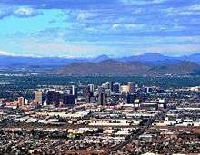
Sunnyslope Mountain also known as "S" Mountain[1] is a large, rocky, nearly symmetric hill in the Sunnyslope section of Phoenix, Arizona. It is located near Central Avenue and Hatcher. The southern slope of the mountain is adorned with a 150-foot white majuscule "S". The mountain, in particular the large "S", can be seen from thirty miles away on a clear day, and is distinctly visible to nearby airplane passengers. Although the mountain is part of the Phoenix Mountains, the mountain is most closely associated with Sunnyslope High School. Each year, the freshmen class is assigned the task of hiking up the mountain and giving the "S" a fresh coat of white paint. At the end of the Homecoming football game, the "S" is traditionally outlined with red flares which are ignited by members of the freshmen football team. In June 2004, students organized to change the "S" into a "J" in honor of Josh Conard, a member of the Sunnyslope basketball team who was killed by a drunk driver. When the school was remodeled in the mid-1990s, the view of Sunnyslope Mountain from the home football stands was partially obstructed. However, Sunnyslope Mountain remains one of the most visible, artificial features of the northern skyline of the Valley of the Sun.
The name of the mountain is derived from the bordering Sunnyslope district of Phoenix. Sunnyslope is generally defined as the area east and south of North Mountain and north of the Arizona Canal. The diverse working-class neighborhood has a small downtown strip along 7th Street (with other commercial development centering on Central Avenue and Dunlap Road, including the John C. Lincoln North Mountain Medical Center) and features some of the city's most distinctive architecture.
The John C. Lincoln healthcare network began in the 1920s as the Desert Mission, a faith-based social services complex which provided medical services (and other services, including a food pantry, child care and a library) to Sunnyslope residents, many of whom relocated to Arizona to recover from tuberculosis in the dry desert climate; as the decades progressed and the neighborhood grew tremendously in population, the medical center became a separate entity, but the Desert Mission continues its social service functions for the Sunnyslope and North Phoenix area to this day as a subsidiary of the John C. Lincoln medical group. John C. Lincoln, an Ohio inventor and industrialist who founded Lincoln Electric, relocated to the Sunnyslope district in 1931 with his wife Helen, to treat her tuberculosis; almost immediately, the Lincolns became major financial supporters of Desert Mission and took on key leadership roles in the organization for most of the remainder of their lives. Helen Lincoln lived to the age of 102, after initially being given just two more years to live by doctors.
Historic Sunnyslope Mountain
| Historic Sunnyslope Mountain (PHPR = Phoenix Historic Property Register) (Sunnyslope Historical Society and Museum) [2] | ||||||||
|---|---|---|---|---|---|---|---|---|
|


References
- ↑ The Arizona Republic, November 2, 2001
- ↑ Sunnyslope Historical Society and Museum
External links
- "A Brief History Of Sunnyslope". Sunnyslope Historical Society.