Sullivant Township, Ford County, Illinois
| Sullivant Township | |
|---|---|
| Township | |
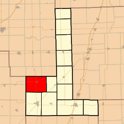 Location in Ford County | |
 Ford County's location in Illinois | |
| Coordinates: 40°34′31″N 88°23′02″W / 40.57528°N 88.38389°WCoordinates: 40°34′31″N 88°23′02″W / 40.57528°N 88.38389°W | |
| Country | United States |
| State | Illinois |
| County | Ford |
| Established | September 9, 1867 |
| Area | |
| • Total | 47.39 sq mi (122.7 km2) |
| • Land | 47.28 sq mi (122.5 km2) |
| • Water | 0.11 sq mi (0.3 km2) 0.23% |
| Elevation | 814 ft (248 m) |
| Population (2010) | |
| • Total | 510 |
| • Density | 10.8/sq mi (4.2/km2) |
| Time zone | CST (UTC-6) |
| • Summer (DST) | CDT (UTC-5) |
| ZIP codes | 61720, 61731, 61773 |
| GNIS feature ID | 0429813 |
Sullivant Township is one of twelve townships in Ford County, Illinois, USA. As of the 2010 census, its population was 510 and it contained 238 housing units.[1]
History
The township was formed from Dix Township on September 9, 1867. It is named for Michael L. Sullivant, who in the 1860s was reputedly "the world's most successful farmer." Sullivant owned 80,000 acres (324 km2) in Champaign, Ford, Piatt, and Livingston counties and used his land to raise corn and to graze large herds of cattle; he was one of a select group of wealthy men who dominated the state's booming livestock industry in the middle to late 19th century. An 1876 map of Ford County by Warner and Beers of the Union Atlas Co. shows Sullivant owning 42,000 acres (170 km2) in Ford County, including all of Sullivant Township.
Geography
According to the 2010 census, the township has a total area of 47.39 square miles (122.7 km2), of which 47.28 square miles (122.5 km2) (or 99.77%) is land and 0.11 square miles (0.28 km2) (or 0.23%) is water.[1]
Cities, towns, villages
Cemeteries
The township contains Mount Hope Cemetery.
Major highways
School districts
- Gibson City-Melvin-Sibley Community Unit School District 5
- Prairie Central Community Unit School District 8
Political districts
- Illinois' 15th congressional district
- State House District 105
- State Senate District 53
References
- "Sullivant Township, Ford County, Illinois". Geographic Names Information System. United States Geological Survey. Retrieved 2010-01-16.
- United States Census Bureau 2007 TIGER/Line Shapefiles
- United States National Atlas
- 1 2 "Population, Housing Units, Area, and Density: 2010 - County -- County Subdivision and Place -- 2010 Census Summary File 1". United States Census. Retrieved 2013-05-28.
External links

Municipalities and communities of Ford County, Illinois, United States | ||
|---|---|---|
| Cities | ||
| Villages | ||
| Townships | ||
| Unincorporated communities | ||
| Footnotes | ‡This populated place also has portions in an adjacent county or counties | |