Sublette, Illinois
| Sublette | |
| Hanno (1850-1854) | |
| Village | |
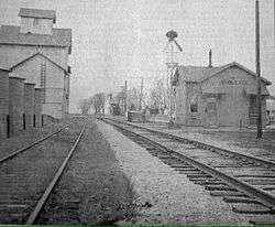
 Sublette Farmers Co grain silo in downtown Sublette | |
| Country | United States |
|---|---|
| State | Illinois |
| County | Lee |
| Coordinates | 41°38′35″N 89°13′50″W / 41.64306°N 89.23056°WCoordinates: 41°38′35″N 89°13′50″W / 41.64306°N 89.23056°W |
| Area | 0.35 sq mi (1 km2) |
| - land | 0.35 sq mi (1 km2) |
| - water | 0.00 sq mi (0 km2) |
| Population | 432 (2014) |
| Density | 1,234/sq mi (476/km2) |
| Founded | 1857 |
| Date | February 18, 1857[1] |
| Village president | John Stenzel[2] |
| Timezone | CST (UTC-6) |
| - summer (DST) | CDT (UTC-5) |
| Postal code | 61367 |
| Area code | 815 |
  Location of Sublette within Illinois | |
| Wikimedia Commons: Sublette, Illinois | |
| Website: www.subletteweb.com | |
Sublette is a village in Lee County, Illinois, United States. The population is estimated at 432 as of 2014.[3] Sublette is home to a private camping resort known as Woodhaven Lakes.
History
The earliest references to Sublette as a town are from plat maps dating to the 1850s. At this point in time, Sublette was known as Hanno (named for Hanau, Prussia), it was a small cluster of houses just north of the settlement at Knox Grove.
In 1854, the Illinois Central Railroad built a line running through the settlement known as Hanno and constructed a depot there for passenger and freight services. A plat map from the following year lists the town's name as being "Soublette" or the "Town of Soublett". The town name was officially changed to Sublette by an act of Legislation in 1857.[1] The name is unaffiliated with the town being sub-let by the railroad, it likely traces back to an Americanized spelling of the French surname Soblet.
Geography

Sublette is located at 41°38′35″N 89°13′50″W / 41.64306°N 89.23056°W (41.643141, -89.230460).[4]
According to the 2010 census, Sublette has a total area of 0.35 square miles (0.91 km2), all land.[5]
Demographics
| Historical population | |||
|---|---|---|---|
| Census | Pop. | %± | |
| 1900 | 306 | — | |
| 1910 | 287 | −6.2% | |
| 1920 | 262 | −8.7% | |
| 1930 | 261 | −0.4% | |
| 1940 | 282 | 8.0% | |
| 1950 | 290 | 2.8% | |
| 1960 | 306 | 5.5% | |
| 1970 | 361 | 18.0% | |
| 1980 | 442 | 22.4% | |
| 1990 | 394 | −10.9% | |
| 2000 | 456 | 15.7% | |
| 2010 | 449 | −1.5% | |
| Est. 2015 | 428 | [6] | −4.7% |
As of the census[8] of 2000, there were 456 people, 189 households, and 127 families residing in the village. The population density was 1,303.5 people per square mile (503.0/km²). There were 203 housing units at an average density of 580.3 per square mile (223.9/km²). The racial makeup of the village was 97.81% White, 0.88% African American, 0.22% Native American, 0.88% from other races, and 0.22% from two or more races. Hispanic or Latino of any race were 4.82% of the population.
There were 189 households out of which 30.2% had children under the age of 18 living with them, 56.6% were married couples living together, 8.5% had a female householder with no husband present, and 32.8% were non-families. 29.6% of all households were made up of individuals and 14.3% had someone living alone who was 65 years of age or older. The average household size was 2.41 and the average family size was 3.02.
In the village the population was spread out with 24.3% under the age of 18, 7.2% from 18 to 24, 28.1% from 25 to 44, 24.1% from 45 to 64, and 16.2% who were 65 years of age or older. The median age was 38 years. For every 100 females there were 97.4 males. For every 100 females age 18 and over, there were 92.7 males.
The median income for a household in the village was $43,393, and the median income for a family was $51,250. Males had a median income of $40,368 versus $22,500 for females. The per capita income for the village was $22,982. About 2.4% of families and 4.0% of the population were below the poverty line, including none of those under age 18 and 4.2% of those age 65 or over.
References
- 1 2 Bradwell (1904). Encyclopedia of Illinois and the History of Lee County. Chicago, Illinois: Munsell Publishing Company. Retrieved 2016-02-11.
- ↑ http://www.subletteweb.com/index.asp?SEC=459633B6-AAD4-4604-8721-CD660BCC7955&Type=B_DIR
- ↑ "Sublette village, Illinois 2014 population estimate". American Factfinder - Community Facts. US Census Bureau. Retrieved 30 March 2016.
- ↑ "US Gazetteer files: 2010, 2000, and 1990". United States Census Bureau. 2011-02-12. Retrieved 2011-04-23.
- ↑ "G001 - Geographic Identifiers - 2010 Census Summary File 1". United States Census Bureau. Retrieved 2015-12-25.
- ↑ "Annual Estimates of the Resident Population for Incorporated Places: April 1, 2010 to July 1, 2015". Retrieved July 2, 2016.
- ↑ "Census of Population and Housing". Census.gov. Retrieved June 4, 2015.
- ↑ "American FactFinder". United States Census Bureau. Retrieved 2008-01-31.
External links
- http://www.subletteweb.com/ Sublette, Illinois Website
Municipalities and communities of Lee County, Illinois, United States | ||
|---|---|---|
| Cities | ||
| Villages | ||
| Townships | ||
| Unincorporated communities |
| |
| Footnotes | ‡This populated place also has portions in an adjacent county or counties | |