Strafford, Missouri
| Strafford, Missouri | |
|---|---|
| City | |
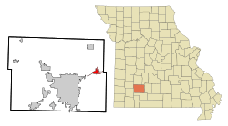 Location of Strafford, Missouri | |
| Coordinates: 37°16′12″N 93°7′19″W / 37.27000°N 93.12194°WCoordinates: 37°16′12″N 93°7′19″W / 37.27000°N 93.12194°W | |
| Country | United States |
| State | Missouri |
| County | Greene |
| Area[1] | |
| • Total | 2.63 sq mi (6.81 km2) |
| • Land | 2.63 sq mi (6.81 km2) |
| • Water | 0 sq mi (0 km2) |
| Elevation | 1,490 ft (454 m) |
| Population (2010)[2] | |
| • Total | 2,358 |
| • Estimate (2012[3]) | 2,364 |
| • Density | 896.6/sq mi (346.2/km2) |
| Time zone | Central (CST) (UTC-6) |
| • Summer (DST) | CDT (UTC-5) |
| ZIP code | 65757 |
| Area code(s) | 417 |
| FIPS code | 29-71062[4] |
| GNIS feature ID | 0727168[5] |
Strafford is a city in eastern Greene County, Missouri, United States. It is part of the Springfield, Missouri Metropolitan Statistical Area. The population was 2,358 at the 2010 census.
History
Strafford was laid out in 1870 when the railroad was extended to that point, and named after an original owner of the site.[6] A post office called Strafford has been in operation since 1870.[7]
Geography
According to the United States Census Bureau, the city has a total area of 2.63 square miles (6.81 km2), all of it land.[1]
Demographics
| Historical population | |||
|---|---|---|---|
| Census | Pop. | %± | |
| 1970 | 491 | — | |
| 1980 | 1,121 | 128.3% | |
| 1990 | 1,166 | 4.0% | |
| 2000 | 1,845 | 58.2% | |
| 2010 | 2,358 | 27.8% | |
| Est. 2015 | 2,361 | [8] | 0.1% |
2010 census
As of the census[2] of 2010, there were 2,358 people, 867 households, and 636 families residing in the city. The population density was 896.6 inhabitants per square mile (346.2/km2). There were 922 housing units at an average density of 350.6 per square mile (135.4/km2). The racial makeup of the city was 95.8% White, 0.5% African American, 0.8% Native American, 0.3% Asian, 0.1% from other races, and 2.5% from two or more races. Hispanic or Latino of any race were 1.9% of the population.
There were 867 households of which 40.8% had children under the age of 18 living with them, 54.1% were married couples living together, 14.3% had a female householder with no husband present, 5.0% had a male householder with no wife present, and 26.6% were non-families. 22.6% of all households were made up of individuals and 8.2% had someone living alone who was 65 years of age or older. The average household size was 2.64 and the average family size was 3.08.
The median age in the city was 34.2 years. 28.8% of residents were under the age of 18; 7.9% were between the ages of 18 and 24; 28.1% were from 25 to 44; 22.9% were from 45 to 64; and 12.4% were 65 years of age or older. The gender makeup of the city was 47.7% male and 52.3% female.
2000 census
As of the census[4] of 2000, there were 1,845 people, 683 households, and 499 families residing in the city. The population density was 789.9 people per square mile (304.4/km²). There were 720 housing units at an average density of 308.3 per square mile (118.8/km²). The racial makeup of the city was 97.67% White, 0.33% African American, 0.65% Native American, 0.05% Asian, 0.16% from other races, and 1.14% from two or more races. Hispanic or Latino of any race were 1.79% of the population. There are 9 Police officers, one for about every 200 citizens. And about the same for Firemen.
There were 683 households out of which 41.3% had children under the age of 18 living with them, 55.1% were married couples living together, 12.3% had a female householder with no husband present, and 26.9% were non-families. 22.7% of all households were made up of individuals and 8.5% had someone living alone who was 65 years of age or older. The average household size was 2.62 and the average family size was 3.08.
In the city the population was spread out with 28.9% under the age of 18, 9.1% from 18 to 24, 31.3% from 25 to 44, 20.4% from 45 to 64, and 10.3% who were 65 years of age or older. The median age was 32 years. For every 100 females there were 94.6 males. For every 100 females age 18 and over, there were 87.7 males.
The median income for a household in the city was $36,111, and the median income for a family was $39,722. Males had a median income of $28,167 versus $21,920 for females. The per capita income for the city was $14,858. About 9.9% of families and 12.3% of the population were below the poverty line, including 15.9% of those under age 18 and 12.0% of those age 65 or over.
Arts and culture
Route 66 is considered one of the most important highway links from the 20th century. Today, much of the road is decommissioned, yet some portions of the road still exist, also known as the Mother Road and America's Highway.
Route 66 is celebrated now by many towns along the original highway. Strafford's "Route 66" Days was established in 1991 as a festival to celebrate everything about the highway. It is hosted by the Strafford Area Chamber of Commerce.
References
- 1 2 "US Gazetteer files 2010". United States Census Bureau. Retrieved 2012-07-08.
- 1 2 "American FactFinder". United States Census Bureau. Retrieved 2012-07-08.
- ↑ "Population Estimates". United States Census Bureau. Retrieved 2013-05-30.
- 1 2 "American FactFinder". United States Census Bureau. Retrieved 2008-01-31.
- ↑ "US Board on Geographic Names". United States Geological Survey. 2007-10-25. Retrieved 2008-01-31.
- ↑ "Greene County Place Names, 1928–1945 (archived)". The State Historical Society of Missouri. Retrieved 3 October 2016.
- ↑ "Post Offices". Jim Forte Postal History. Retrieved 3 October 2016.
- ↑ "Annual Estimates of the Resident Population for Incorporated Places: April 1, 2010 to July 1, 2015". Retrieved July 2, 2016.
- ↑ "Census of Population and Housing". Census.gov. Retrieved June 4, 2015.
External links
Municipalities and communities of Greene County, Missouri, United States | ||
|---|---|---|
| Cities | 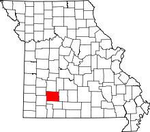 | |
| Townships |
| |
| Unincorporated communities | ||
| Footnotes | ‡This populated place also has portions in an adjacent county or counties | |