Stowupland
| Stowupland | |
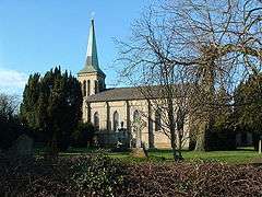 Holy Trinity Church, Stowupland |
|
 Stowupland |
|
| Population | 1,988 (2011)[1] |
|---|---|
| OS grid reference | TM064596 |
| District | Mid Suffolk |
| Shire county | Suffolk |
| Region | East |
| Country | England |
| Sovereign state | United Kingdom |
| Post town | Stowmarket |
| Postcode district | IP14 |
| EU Parliament | East of England |
Coordinates: 52°11′46″N 1°01′08″E / 52.196°N 1.019°E
Stowupland is a village 2 kilometres (1 mi) east of Stowmarket, Suffolk, England. Stowupland High School is found in the village.
Stowupland is centred on several village greens and was the winner of the Suffolk "Village of the Year" competition in 2006. The village has numerous amenities including, a petrol station, post office, two butchers, Chinese takeaway, chip shop and two public houses - The Crown and The Retreat. As well as the high school there is a primary school which has an attached pre-school. Sports are well catered for with football, cricket and bowls clubs available. A lottery grant funded gym and indoor sports facility is available for public use at the high school.
The village boasts a strong community spirit and implements a "Parish Plan" to help steer the development of the village. The plan was produced following the completion and analysis of a questionnaire that was sent to every dwelling in the parish and allows residents to have a degree of say in what happens in the village. One of the main aims is to try to maintain Stowupland's separation from the nearby market town of Stowmarket which has expanded considerably in recent years with just a single field now separating properties in Stowmarket from Stowupland. A monthly magazine, "The Telstar", is delivered free to every household and contains reports from parish and local council as well as various articles from residents, clubs and churches in the village. Every year a free "Music on the Green" event is held in the village where local bands perform on stage for the enjoyment of anyone.
The A1120 tourist route runs through the village and the A14 trunk road is located just to its south.
References
- ↑ "Civil Parish population 2011". Neighbourhood Statistics. Office for National Statistics. Retrieved 28 August 2016.
External links
| Wikimedia Commons has media related to Stowupland. |