A1120 road
| |
|---|---|
| Route information | |
| Length: | 26 mi (42 km) |
| Major junctions | |
| Northwest end: | Stowmarket |
|
| |
| Northeast end: | Yoxford |
| Location | |
| Primary destinations: | Stowupland, Earl Soham, Dennington, Peasenhall |
| Road network | |

The A1120 is an 'A' road in the English county of Suffolk.[1] It links Stowmarket to Yoxford passing through the centre of the county.[2] It is 26 miles (42 km) long.
Route
From west to east the road passes through the following settlements:
- Stowmarket A14
- Stowupland B1115 (incorrectly labelled as B1151 on some sat-nav devices)
- Stonham Earl
- Stonham Parva A140
- Stonham Aspal
- Pettaugh B1077
- Earl Soham
- Saxtead B1119
- Dennington B1116
- Badingham B1120
- Peasenhall
- Sibton
- Yoxford A12
History
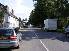
The A1120 in Peasenhall
At Badingham the route follows the line of a Roman road.[2] Due to this there have been numerous crashes at the end of the straight.[3] The A1120 number was created by the complete merger of the B1114, partial merger with the B1119 from Saxtead to Badingham and most of the B1120 from Badingham to Yoxford where it meets the A12.[4]
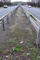
The short section of dual carriage way near Stowmarket.
References
- ↑ "Sabre".
- 1 2 Clark.R (2003) The long and winding road, The Telegraph, 2003-04-12. Retrieved 2011-04-05.
- ↑ "Crash at Badingham". BBC News. Retrieved 23 March 2013.
- ↑ 1932 Ten Mile Ordnance Survey. Ordnance Survey. 1932.
External links
This article is issued from Wikipedia - version of the 10/19/2016. The text is available under the Creative Commons Attribution/Share Alike but additional terms may apply for the media files.