Steele, North Dakota
| Steele, North Dakota | |
|---|---|
| City | |
|
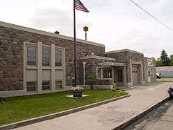
Steele Community Center in Steele | |
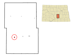 Location of Steele, North Dakota | |
| Coordinates: 46°51′22″N 99°55′00″W / 46.85611°N 99.91667°W | |
| Country | United States |
| State | North Dakota |
| County | Kidder |
| Area[1] | |
| • Total | 0.57 sq mi (1.48 km2) |
| • Land | 0.57 sq mi (1.48 km2) |
| • Water | 0 sq mi (0 km2) |
| Elevation | 1,860 ft (567 m) |
| Population (2010)[2] | |
| • Total | 715 |
| • Estimate (2015)[3] | 709 |
| • Density | 1,254.4/sq mi (484.3/km2) |
| Time zone | Central (CST) (UTC-6) |
| • Summer (DST) | CDT (UTC-5) |
| ZIP code | 58482 |
| Area code(s) | 701 |
| FIPS code | 38-75780 |
| GNIS feature ID | 1032298[4] |
| Website | www.steelend.com |
Steele is a city in Kidder County, North Dakota, United States. It is the county seat of Kidder County.[5] The population was 715 at the 2010 census.[6]
Although they bear the same name, the city of Steele is not in Steele County.
History
Steele was platted in 1878 by Wilbur F. Steele, and named for him.[7] The community had its start soon after the railroad was extended to that point.[8] A post office has been in operation at Steele since 1880.[9]
Geography
Steele is located at 46°51′22″N 99°55′00″W / 46.856066°N 99.916606°WCoordinates: 46°51′22″N 99°55′00″W / 46.856066°N 99.916606°W (46.856066, -99.916606).[10]
According to the United States Census Bureau, the city has a total area of 0.57 square miles (1.48 km2), all of it land.[1]
Climate
On July 6, 1936, the temperature in Steele soared to 121 °F (49.4 °C), the highest temperature ever recorded in the state of North Dakota. This event, during the 1936 North American heat wave, is even more remarkable in light of the fact that since 1948, the temperature has not exceeded 109 °F (42.8 °C). Never before or since has such extreme heat been recorded so far north on the North American continent. A prolonged period of extreme drought across the entire Great Plains contributed to the extreme heat. Record high temperatures for 15 states fell that summer. In the United States, higher temperatures have been recorded in only four states: California, Arizona, Nevada, and New Mexico. (Kansas set its own 121 °F record on July 24.)
Looking at the averages, Steele has a humid continental climate (Dfb) with warm to hot summers and very cold winters, typical of the Great Plains. Though summers highs average 83 °F (28.3 °C) there are still 17–18 days on average of above 90 °F (32.2 °C).[11] January nights average 2 °F (−16.7 °C), and subzero temperatures happen on multiple occasions every winter.
| Climate data for Steele, North Dakota, 1981–2010 normals, extremes 1894–present | |||||||||||||
|---|---|---|---|---|---|---|---|---|---|---|---|---|---|
| Month | Jan | Feb | Mar | Apr | May | Jun | Jul | Aug | Sep | Oct | Nov | Dec | Year |
| Record high °F (°C) | 55.0 (12.8) |
64.0 (17.8) |
80.0 (26.7) |
95.0 (35) |
110.0 (43.3) |
109.0 (42.8) |
121.0 (49.4) |
106.0 (41.1) |
105.0 (40.6) |
95.0 (35) |
76.0 (24.4) |
67.0 (19.4) |
121.0 (49.4) |
| Mean maximum °F (°C) | 41.2 (5.1) |
44.8 (7.1) |
59.2 (15.1) |
77.3 (25.2) |
86.4 (30.2) |
90.7 (32.6) |
96.9 (36.1) |
96.6 (35.9) |
91.7 (33.2) |
80.7 (27.1) |
61.3 (16.3) |
45.9 (7.7) |
100.6 (38.1) |
| Average high °F (°C) | 21.1 (−6.1) |
26.0 (−3.3) |
38.1 (3.4) |
56.0 (13.3) |
67.5 (19.7) |
75.6 (24.2) |
82.6 (28.1) |
82.2 (27.9) |
71.3 (21.8) |
56.9 (13.8) |
38.3 (3.5) |
24.1 (−4.4) |
53.3 (11.8) |
| Daily mean °F (°C) | 11.3 (−11.5) |
15.9 (−8.9) |
28.1 (−2.2) |
43.3 (6.3) |
55.0 (12.8) |
64.0 (17.8) |
70.0 (21.1) |
68.6 (20.3) |
58.1 (14.5) |
44.3 (6.8) |
28.1 (−2.2) |
14.9 (−9.5) |
41.9 (5.5) |
| Average low °F (°C) | 1.6 (−16.9) |
5.8 (−14.6) |
18.0 (−7.8) |
30.7 (−0.7) |
42.5 (5.8) |
52.3 (11.3) |
57.5 (14.2) |
55.1 (12.8) |
44.9 (7.2) |
31.7 (−0.2) |
17.9 (−7.8) |
5.8 (−14.6) |
30.4 (−0.9) |
| Mean minimum °F (°C) | −27.5 (−33.1) |
−23.7 (−30.9) |
−10.1 (−23.4) |
12.7 (−10.7) |
24.9 (−3.9) |
36.8 (2.7) |
43.9 (6.6) |
39.9 (4.4) |
26.6 (−3) |
14.3 (−9.8) |
−4.8 (−20.4) |
−22.2 (−30.1) |
−31.7 (−35.4) |
| Record low °F (°C) | −44.0 (−42.2) |
−50.0 (−45.6) |
−35.0 (−37.2) |
−7.0 (−21.7) |
11.0 (−11.7) |
26.0 (−3.3) |
32.0 (0) |
26.0 (−3.3) |
10.0 (−12.2) |
−12.0 (−24.4) |
−25.0 (−31.7) |
−42.0 (−41.1) |
−50.0 (−45.6) |
| Average precipitation inches (mm) | 0.53 (13.5) |
0.47 (11.9) |
1.04 (26.4) |
1.33 (33.8) |
2.65 (67.3) |
3.11 (79) |
3.19 (81) |
2.14 (54.4) |
1.92 (48.8) |
1.66 (42.2) |
0.81 (20.6) |
0.53 (13.5) |
19.38 (492.3) |
| Source: WRCC[12] | |||||||||||||
Demographics
| Historical population | |||
|---|---|---|---|
| Census | Pop. | %± | |
| 1890 | 133 | — | |
| 1900 | 185 | 39.1% | |
| 1910 | 500 | 170.3% | |
| 1920 | 550 | 10.0% | |
| 1930 | 519 | −5.6% | |
| 1940 | 721 | 38.9% | |
| 1950 | 762 | 5.7% | |
| 1960 | 847 | 11.2% | |
| 1970 | 696 | −17.8% | |
| 1980 | 796 | 14.4% | |
| 1990 | 762 | −4.3% | |
| 2000 | 761 | −0.1% | |
| 2010 | 715 | −6.0% | |
| Est. 2015 | 709 | [13] | −0.8% |
| U.S. Decennial Census[14] 2015 Estimate[3] | |||
2010 census
As of the census[2] of 2010, there were 715 people, 316 households, and 194 families residing in the city. The population density was 1,254.4 inhabitants per square mile (484.3/km2). There were 362 housing units at an average density of 635.1 per square mile (245.2/km2). The racial makeup of the city was 95.9% White, 0.7% African American, 0.3% Native American, 2.1% Asian, 0.7% from other races, and 0.3% from two or more races. Hispanic or Latino of any race were 1.5% of the population.
There were 316 households of which 27.5% had children under the age of 18 living with them, 47.8% were married couples living together, 7.9% had a female householder with no husband present, 5.7% had a male householder with no wife present, and 38.6% were non-families. 35.4% of all households were made up of individuals and 19.3% had someone living alone who was 65 years of age or older. The average household size was 2.26 and the average family size was 2.89.
The median age in the city was 41.9 years. 25.5% of residents were under the age of 18; 6.2% were between the ages of 18 and 24; 21.6% were from 25 to 44; 25.5% were from 45 to 64; and 21.4% were 65 years of age or older. The gender makeup of the city was 47.8% male and 52.2% female.
2000 census
As of the census of 2000, there were 761 people, 336 households, and 191 families residing in the city. The population density was 1,338.5 people per square mile (515.5/km²). There were 367 housing units at an average density of 645.5 per square mile (248.6/km²). The racial makeup of the city was 99.61% White, 0.13% African American and 0.26% Native American.
There were 336 households out of which 23.8% had children under the age of 18 living with them, 47.6% were married couples living together, 6.8% had a female householder with no husband present, and 42.9% were non-families. 40.5% of all households were made up of individuals and 28.0% had someone living alone who was 65 years of age or older. The average household size was 2.13 and the average family size was 2.88.
In the city the population was spread out with 22.6% under the age of 18, 4.9% from 18 to 24, 22.9% from 25 to 44, 17.9% from 45 to 64, and 31.8% who were 65 years of age or older. The median age was 45 years. For every 100 females there were 87.0 males. For every 100 females age 18 and over, there were 75.8 males.
The median income for a household in the city was $27,841, and the median income for a family was $37,778. Males had a median income of $35,250 versus $20,673 for females. The per capita income for the city was $16,767. About 8.7% of families and 14.1% of the population were below the poverty line, including 14.1% of those under age 18 and 20.0% of those age 65 or over.
References
- 1 2 "US Gazetteer files 2010". United States Census Bureau. Retrieved 2012-06-14.
- 1 2 "American FactFinder". United States Census Bureau. Retrieved 2012-06-14.
- 1 2 "Population Estimates". United States Census Bureau. Retrieved June 26, 2016.
- ↑ "US Board on Geographic Names". United States Geological Survey. 2007-10-25. Retrieved 2008-01-31.
- ↑ "Find a County". National Association of Counties. Retrieved 2011-06-07.
- ↑ "2010 Census Redistricting Data (Public Law 94-171) Summary File". American FactFinder. United States Census Bureau. Retrieved 2 May 2011.
- ↑ North Dakota: Counties, Towns & People. Watchmaker Publishing, Ltd. 2008. p. 111. ISBN 978-1-60386-191-5.
- ↑ Hellmann, Paul T. (14 February 2006). Historical Gazetteer of the United States. Routledge. p. 841. ISBN 1-135-94859-3.
- ↑ "Kidder County". Jim Forte Postal History. Retrieved 23 October 2015.
- ↑ "US Gazetteer files: 2010, 2000, and 1990". United States Census Bureau. 2011-02-12. Retrieved 2011-04-23.
- ↑ http://www.weatherbase.com/weather/weather.php3?s=663823&cityname=Steele-North-Dakota-United-States-of-America
- ↑ "STEELE, NORTH DAKOTA (328366)". Western Regional Climate Center. Retrieved April 24, 2016.
- ↑ "Annual Estimates of the Resident Population for Incorporated Places: April 1, 2010 to July 1, 2015". Retrieved July 2, 2016.
- ↑ United States Census Bureau. "Census of Population and Housing". Retrieved October 30, 2013.
External links
Municipalities and communities of Kidder County, North Dakota, United States | ||
|---|---|---|
| Cities | 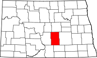 | |
| Townships |
| |
| Unorganized territories |
| |
| Unincorporated communities | ||