Steamboat Springs Airport
| Steamboat Springs Airport Bob Adams Field | |||||||||||
|---|---|---|---|---|---|---|---|---|---|---|---|
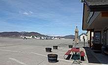 The runway and associated buildings in 2014. | |||||||||||
| IATA: SBS – ICAO: KSBS – FAA LID: SBS | |||||||||||
| Summary | |||||||||||
| Airport type | Public | ||||||||||
| Owner | City of Steamboat Springs | ||||||||||
| Serves | Steamboat Springs, Colorado | ||||||||||
| Elevation AMSL | 6,882 ft / 2,098 m | ||||||||||
| Coordinates | 40°30′58″N 106°51′59″W / 40.51611°N 106.86639°WCoordinates: 40°30′58″N 106°51′59″W / 40.51611°N 106.86639°W | ||||||||||
| Website | |||||||||||
| Map | |||||||||||
 SBS Location in Colorado | |||||||||||
| Runways | |||||||||||
| |||||||||||
| Statistics (2008) | |||||||||||
| |||||||||||
Steamboat Springs Airport (IATA: SBS, ICAO: KSBS, FAA LID: SBS) (Bob Adams Field) is a city owned airport three miles northwest of Steamboat Springs, in Routt County, Colorado.[1] The National Plan of Integrated Airport Systems for 2011–2015 categorized it as a general aviation facility.[2]
Larger aircraft land at the Yampa Valley Airport (HDN) 25 miles (40 km) west of Steamboat Springs near Hayden, Colorado which can handle Boeing 737 and 757 jetliners as well as Airbus A319 and A320 jets, and has mainline jet flights during ski season and year-round United Express regional jet and turboprop service to Denver.
Historical airline service
Steamboat Springs Airport had scheduled passenger flights to Denver (DEN) operated by Rocky Mountain Airways 50-passenger de Havilland Canada DHC-7 Dash 7s. The four engine Dash 7 turboprop had the short takeoff and landing (STOL) performance required due to Steamboat Springs' relatively short runway and high elevation. Rocky Mountain Airways later operated Dash 7 service into the airport on behalf of Continental Airlines via a code sharing agreement during the early and mid 1990s with up to ten flights a day to Denver.[3] In 1997, Maverick Airways was operating Dash 7 service to Denver on behalf of the current version of Frontier Airlines via a code sharing agreement.[4] However, the airport no longer offers commercial airline flights.
Facilities
The airport covers 436 acres (176 ha) at an elevation of 6,882 feet (2,098 m). Its one runway, 14/32, is 4,452 by 100 feet (1,357 x 30 m) asphalt.[1]
In 2008 the airport had 11,522 aircraft operations, average 31 per day: 95% general aviation and 5% air taxi. 82 aircraft were then based at this airport: 82% single-engine, 9% multi-engine, 2% jet, 6% helicopter, and 1% glider.[1]
There is a small terminal for private aviation and several hangars on the property. There are about 30 spots for aircraft on the tarmac.
The Civil Air Patrol has an office and aircraft at the airport. The Steamboat Springs Police Department provide security for the airport, while the Steamboat Springs Fire Department provides firefighting and emergency medical services. There are no Aircraft Rescue and Firefighting (ARFF) trucks at the airport. Snow removal equipment is operated by the airport operations department.
There is no air traffic control tower. Aircraft communicate on a Common Traffic Advisory Frequency (CTAF). The airport warns pilots about the wildlife that constantly wanders on and around airport property. Snow removal operations happen between 6:00am and 6:00pm during the winter season. The airport is closed when there is snow removal equipment on the runway.
References
- 1 2 3 4 FAA Airport Master Record for SBS (Form 5010 PDF). Federal Aviation Administration. Effective May 31, 2012.
- ↑ "2011–2015 NPIAS Report, Appendix A" (PDF, 2.03 MB). National Plan of Integrated Airport Systems. Federal Aviation Administration. October 4, 2010. External link in
|work=(help) - ↑ Feb. 1994 OAG Pocket Flight Guide, Steamboat Springs flight schedules
- ↑ Airways North American Airlines Handbook, 1997 edition, Maverick Airways
External links
- Steamboat Springs Airport at Colorado DOT website
- Aerial image as of September 1999 from USGS The National Map
- FAA Terminal Procedures for SBS, effective December 8, 2016
- Resources for this airport:
- FAA airport information for SBS
- AirNav airport information for KSBS
- ASN accident history for SBS
- FlightAware airport information and live flight tracker
- NOAA/NWS latest weather observations
- SkyVector aeronautical chart, Terminal Procedures