State House Historic District
|
State House District | |
|
| |
|
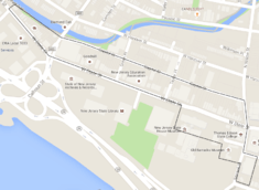
Map of the district | |
| Location | West State Street and Willow Street, Trenton, New Jersey |
|---|---|
| Coordinates | 40°13′13.9″N 74°46′11.9″W / 40.220528°N 74.769972°W |
| Area | 25 acres (10 ha) |
| Built | 18th-20th century |
| Architect | Multiple |
| Architectural style | Colonial, Florentine Renaissance |
| NRHP Reference # |
76001161 (original) 92000295 (increase) |
| NJRHP # | 1795[1] |
| Significant dates | |
| Added to NRHP | August 27, 1976 |
| Boundary increase | April 2, 1992 |
| Designated NJRHP | December 19, 1975 |
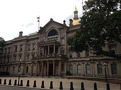
The State House Historic District encompasses many historic buildings along West State and Willow Streets in Trenton, New Jersey, including the New Jersey State House, Old Barracks Museum, and the Old Masonic Temple.[2]
Gallery
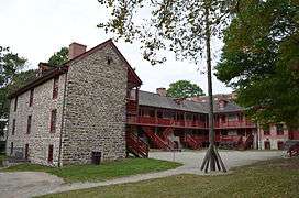 The Old Barracks Museum (1758)
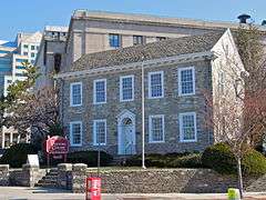 The Old Masonic Temple (1793)
 The New Masonic Temple (1927)
See also
References
- ↑ "New Jersey and National Registers of Historic Places — Mercer County" (PDF). New Jersey Department of Environmental Protection — Historic Preservation Office. January 22, 2015.
- ↑ Ferrazzi, Maureen; Blake, Channing. "State House District" (PDF). National Register of Historic Places. National Park Service.
This article is issued from Wikipedia - version of the 12/2/2016. The text is available under the Creative Commons Attribution/Share Alike but additional terms may apply for the media files.