Star Prairie, Wisconsin
| Star Prairie, Wisconsin | |
|---|---|
| Village | |
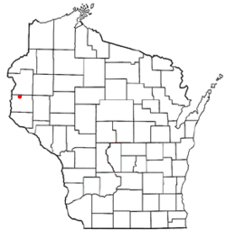 Location of Star Prairie, Wisconsin | |
| Coordinates: 45°10′3″N 92°35′13″W / 45.16750°N 92.58694°WCoordinates: 45°10′3″N 92°35′13″W / 45.16750°N 92.58694°W | |
| Country | United States |
| State | Wisconsin |
| County | St. Croix |
| Area[1] | |
| • Total | 2.16 sq mi (5.59 km2) |
| • Land | 2.16 sq mi (5.59 km2) |
| • Water | 0 sq mi (0 km2) |
| Elevation[2] | 879 ft (268 m) |
| Population (2010)[3] | |
| • Total | 561 |
| • Estimate (2012[4]) | 559 |
| • Density | 259.7/sq mi (100.3/km2) |
| Time zone | Central (CST) (UTC-6) |
| • Summer (DST) | CDT (UTC-5) |
| Area code(s) | 715 & 534 |
| FIPS code | 55-76850[5] |
| GNIS feature ID | 1584215[2] |
| Website |
villageofstarprairie |
Star Prairie is a village in St. Croix County in the U.S. state of Wisconsin. The population was 561 at the 2010 census. The village is located along the Apple River on the boundary between the Town of Star Prairie and the Town of Stanton.
Geography
Star Prairie is located at 45°11′53″N 92°31′55″W / 45.19806°N 92.53194°W (45.198274, -92.531987).[6]
According to the United States Census Bureau, the village has a total area of 2.16 square miles (5.59 km2), all of it land.[1] The Apple River flows through the center of town, where it is joined by a small stream called Saratoga Spring.
Demographics
| Historical population | |||
|---|---|---|---|
| Census | Pop. | %± | |
| 1910 | 253 | — | |
| 1920 | 265 | 4.7% | |
| 1930 | 250 | −5.7% | |
| 1940 | 250 | 0.0% | |
| 1950 | 288 | 15.2% | |
| 1960 | 331 | 14.9% | |
| 1970 | 362 | 9.4% | |
| 1980 | 420 | 16.0% | |
| 1990 | 507 | 20.7% | |
| 2000 | 574 | 13.2% | |
| 2010 | 561 | −2.3% | |
| Est. 2015 | 569 | [7] | 1.4% |
2010 census
As of the census[3] of 2010, there were 561 people, 230 households, and 155 families residing in the village. The population density was 259.7 inhabitants per square mile (100.3/km2). There were 248 housing units at an average density of 114.8 per square mile (44.3/km2). The racial makeup of the village was 96.6% White, 1.4% Native American, 0.9% Asian, and 1.1% from two or more races. Hispanic or Latino of any race were 1.6% of the population.
There were 230 households of which 33.5% had children under the age of 18 living with them, 47.4% were married couples living together, 12.2% had a female householder with no husband present, 7.8% had a male householder with no wife present, and 32.6% were non-families. 27.8% of all households were made up of individuals and 7.8% had someone living alone who was 65 years of age or older. The average household size was 2.44 and the average family size was 2.95.
The median age in the village was 36.1 years. 26.7% of residents were under the age of 18; 6.9% were between the ages of 18 and 24; 27.5% were from 25 to 44; 26.4% were from 45 to 64; and 12.5% were 65 years of age or older. The gender makeup of the village was 50.8% male and 49.2% female.
2000 census
As of the census[5] of 2000, there were 574 people, 212 households, and 145 families residing in the village. The population density was 273.3 people per square mile (105.5/km²). There were 215 housing units at an average density of 102.4 per square mile (39.5/km²). The racial makeup of the village was 97.74% White, 0.17% Black or African American and 2.09% Asian. 0.17% of the population were Hispanic or Latino of any race.
There were 212 households out of which 38.2% had children under the age of 18 living with them, 56.1% were married couples living together, 9.0% had a female householder with no husband present, and 31.6% were non-families. 23.6% of all households were made up of individuals and 9.0% had someone living alone who was 65 years of age or older. The average household size was 2.71 and the average family size was 3.28.
In the village the population was spread out with 28.0% under the age of 18, 11.3% from 18 to 24, 35.0% from 25 to 44, 17.1% from 45 to 64, and 8.5% who were 65 years of age or older. The median age was 32 years. For every 100 females there were 98.6 males. For every 100 females age 18 and over, there were 102.5 males.
The median income for a household in the village was $48,750, and the median income for a family was $49,000. Males had a median income of $36,583 versus $22,679 for females. The per capita income for the village was $19,414. About 2.9% of families and 4.0% of the population were below the poverty line, including 3.9% of those under age 18 and 4.9% of those age 65 or over.
References
- 1 2 "US Gazetteer files 2010". United States Census Bureau. Retrieved 2012-11-18.
- 1 2 "US Board on Geographic Names". United States Geological Survey. 2007-10-25. Retrieved 2008-01-31.
- 1 2 "American FactFinder". United States Census Bureau. Retrieved 2012-11-18.
- ↑ "Population Estimates". United States Census Bureau. Retrieved 2013-06-24.
- 1 2 "American FactFinder". United States Census Bureau. Retrieved 2008-01-31.
- ↑ "US Gazetteer files: 2010, 2000, and 1990". United States Census Bureau. 2011-02-12. Retrieved 2011-04-23.
- ↑ "Annual Estimates of the Resident Population for Incorporated Places: April 1, 2010 to July 1, 2015". Retrieved July 2, 2016.
- ↑ "Census of Population and Housing". Census.gov. Retrieved June 4, 2015.
External links
Municipalities and communities of St. Croix County, Wisconsin, United States | ||
|---|---|---|
| Cities | 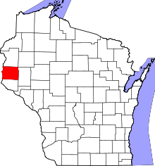 | |
| Villages | ||
| Towns | ||
| CDPs | ||
| Unincorporated communities | ||
| Footnotes | ‡This populated place also has portions in an adjacent county or counties | |