Standrod, Utah
| Standrod, Utah | |
|---|---|
| Unincorporated community | |
 Standrod Location within the state of Utah | |
| Coordinates: 41°59′38″N 113°25′09″W / 41.99389°N 113.41917°WCoordinates: 41°59′38″N 113°25′09″W / 41.99389°N 113.41917°W | |
| Country | United States |
| State | Utah |
| County | Box Elder |
| Settled | 1892 |
| Elevation[1] | 5,768 ft (1,758 m) |
| Time zone | Mountain (MST) (UTC-7) |
| • Summer (DST) | MDT (UTC-6) |
| ZIP code | 84329 |
| Area code(s) | 435 |
| GNIS feature ID | 1437693[1] |
| Historical population | |||
|---|---|---|---|
| Census | Pop. | %± | |
| 1920 | 36 | — | |
| 1930 | 19 | −47.2% | |
| 1940 | 21 | 10.5% | |
| Source: U.S. Census Bureau[2] | |||
Standrod is an unincorporated community in extreme northwestern Box Elder County, Utah, United States, very close to the state line with Idaho. Standrod is a rural community that is reached primarily by dirt roads. The residents of Standrod primarily rely on agriculture. The community is in the area of the Raft River Mountains. The climate of the area has four distinct seasons that occur in the northern Great Basin area.
Standrod was first settled in 1892. In 1898 a school house was built, placed deliberately on the state line so it was half in Idaho and half in Utah. The town was named for a judge in Idaho.[3]
Notes
- 1 2 U.S. Geological Survey Geographic Names Information System: Standrod, Utah. Retrieved May 19, 2011.
- ↑ "Census of Population and Housing". U.S. Census Bureau. Retrieved November 7, 2011.
- ↑ Andrew Jenson. Encyclopedic History of the Church. p. 832
External links
Municipalities and communities of Box Elder County, Utah, United States | ||
|---|---|---|
| Cities | 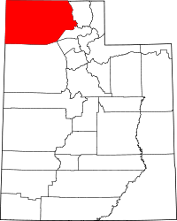 | |
| Towns | ||
| CDPs | ||
| Unincorporated areas | ||
| Ghost towns | ||
This article is issued from Wikipedia - version of the 4/25/2014. The text is available under the Creative Commons Attribution/Share Alike but additional terms may apply for the media files.