St. Mary's, Alaska
| St. Mary's Negeqliq | |
|---|---|
| City | |
 St. Mary's Location within the state of Alaska | |
| Coordinates: 62°2′43″N 163°13′7″W / 62.04528°N 163.21861°WCoordinates: 62°2′43″N 163°13′7″W / 62.04528°N 163.21861°W | |
| Country | United States |
| State | Alaska |
| Census Area | Kusilvak Census Area |
| Incorporated | August 2, 1967[1] |
| Government | |
| • Mayor | William F. Alstrom[2] |
| • State senator | Donald Olson (D) |
| • State rep. | Neal Foster (D) |
| Area | |
| • Total | 50.2 sq mi (130 km2) |
| • Land | 44.0 sq mi (114 km2) |
| • Water | 6.2 sq mi (16 km2) |
| Population (2000) | |
| • Total | 500 |
| ZIP code | 99658 |
| Area code | 907 |
St. Mary's (Negeqliq in Central Yup'ik) is a city in Kusilvak Census Area, Alaska, United States. By 2015 the population was 600.
Within Saint Mary's there are two federally-recognized tribes the Algaaciq Tribal Government and the Yuupiit of Andreafsky.[3]
Geography
St. Mary's is located at 62°2′43″N 163°13′7″W / 62.04528°N 163.21861°W (62.045305, -163.218629).[4]
According to the United States Census Bureau, the city has a total area of 50.2 square miles (130 km2), of which, 44.0 square miles (114 km2) of it is land and 6.3 square miles (16 km2) of it (12.47%) is water.
Demographics
| Historical population | |||
|---|---|---|---|
| Census | Pop. | %± | |
| 1960 | 225 | — | |
| 1970 | 384 | 70.7% | |
| 1980 | 382 | −0.5% | |
| 1990 | 441 | 15.4% | |
| 2000 | 500 | 13.4% | |
| 2010 | 507 | 1.4% | |
| Est. 2015 | 550 | [5] | 8.5% |

As of the census[7] of 2000, there were 500 people, 137 households, and 90 families residing in the city. The population density was 11.4 people per square mile (4.4/km²). There were 186 housing units at an average density of 4.2 per square mile (1.6/km²). The racial makeup of the city was 11.20% White, 87.20% Native American. 0.40% of the population were Hispanic or Latino of any race.
There were 137 households out of which 45.3% had children under the age of 18 living with them, 40.9% were married couples living together, 17.5% had a female householder with no husband present, and 34.3% were non-families. 28.5% of all households were made up of individuals and 2.2% had someone living alone who was 65 years of age or older. The average household size was 3.58 and the average family size was 4.60.
In the city the age distribution of the population shows 39.6% under the age of 18, 8.6% from 18 to 24, 30.4% from 25 to 44, 15.0% from 45 to 64, and 6.4% who were 65 years of age or older. The median age was 26 years. For every 100 females there were 122.2 males. For every 100 females age 18 and over, there were 111.2 males.
The median income for a household in the city was $39,375, and the median income for a family was $31,875. Males had a median income of $35,313 versus $22,250 for females. The per capita income for the city was $15,837. About 21.5% of families and 20.4% of the population were below the poverty line, including 28.2% of those under age 18 and 10.3% of those age 65 or over.
References
- ↑ 1996 Alaska Municipal Officials Directory. Juneau: Alaska Municipal League/Alaska Department of Community and Regional Affairs. January 1996. p. 129.
- ↑ 2015 Alaska Municipal Officials Directory. Juneau: Alaska Municipal League. 2015. p. 135.
- ↑ Nicole Herman-Mercer, 2010. Indigenous environmental knowledge: past cases and future prospects
- ↑ "US Gazetteer files: 2010, 2000, and 1990". United States Census Bureau. 2011-02-12. Retrieved 2011-04-23.
- ↑ "Annual Estimates of the Resident Population for Incorporated Places: April 1, 2010 to July 1, 2015". Retrieved July 2, 2016.
- ↑ "Census of Population and Housing". Census.gov. Retrieved June 4, 2015.
- ↑ "American FactFinder". United States Census Bureau. Retrieved 2008-01-31.
External links
- Andreafsky and Saint Mary's at the Community Database Online from the Alaska Division of Community and Regional Affairs
- Maps from the Alaska Department of Labor and Workforce Development: 2000, 2010
Municipalities and communities of Kusilvak Census Area, Alaska, United States | ||
|---|---|---|
| Cities | 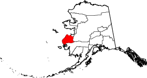 | |
| CDP | ||