St. David, Illinois
| St. David, Illinois | |
| Village | |
| Country | United States |
|---|---|
| State | Illinois |
| County | Fulton |
| Township | Buckheart |
| Elevation | 630 ft (192 m) |
| Coordinates | 40°29′30″N 90°3′7″W / 40.49167°N 90.05194°WCoordinates: 40°29′30″N 90°3′7″W / 40.49167°N 90.05194°W |
| Area | 0.30 sq mi (1 km2) |
| - land | 0.30 sq mi (1 km2) |
| - water | 0.00 sq mi (0 km2) |
| Population | 555 [1] (2015) |
| Density | 1,963.3/sq mi (758/km2) |
| Founded | July 25, 1885 |
| Village President | Rosella Wells |
| Timezone | CST (UTC-6) |
| - summer (DST) | CDT (UTC-5) |
| Postal code | 61563 |
| Area code | 309 |
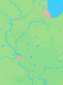
  Location of St. David within Illinois | |
| Wikimedia Commons: St. David, Illinois | |
St. David is a village in Fulton County, Illinois, United States. The population was 589 at the 2010 census.[2]
Geography
St. David is located in eastern Fulton County at 40°29′30″N 90°3′7″W / 40.49167°N 90.05194°W (40.491796, -90.051958).[3] Illinois Route 100 runs along the southeast edge of the village, leading southwest 10 miles (16 km) to Lewistown, the county seat. Canton, the largest city in Fulton County, is 5 miles (8 km) to the northeast via IL 100 and IL 78.
According to the 2010 census, St. David has a total area of 0.3 square miles (0.78 km2), all land.[4]
Demographics
| Historical population | |||
|---|---|---|---|
| Census | Pop. | %± | |
| 1900 | 481 | — | |
| 1910 | 915 | 90.2% | |
| 1920 | 1,189 | 29.9% | |
| 1930 | 977 | −17.8% | |
| 1940 | 859 | −12.1% | |
| 1950 | 812 | −5.5% | |
| 1960 | 862 | 6.2% | |
| 1970 | 773 | −10.3% | |
| 1980 | 786 | 1.7% | |
| 1990 | 603 | −23.3% | |
| 2000 | 587 | −2.7% | |
| 2010 | 589 | 0.3% | |
| Est. 2015 | 555 | [5] | −5.8% |
As of the census[7] of 2000, there were 587 people, 239 households, and 163 families residing in the village. The population density was 1,982.1 people per square mile(755.5/km²). There were 260 housing units at an average density of 877.9 per square mile (334.6/km²). The racial makeup of the village was 99.83% White and 0.17% African American.
There were 239 households out of which 28.0% had children under the age of 18 living with them, 54.8% were married couples living together, 9.6% had a female householder with no husband present, and 31.4% were non-families. 25.1% of all households were made up of individuals and 18.0% had someone living alone who was 65 years of age or older. The average household size was 2.46 and the average family size was 2.95.
In the village the population was spread out with 24.5% under the age of 18, 7.3% from 18 to 24, 27.1% from 25 to 44, 22.0% from 45 to 64, and 19.1% who were 65 years of age or older. The median age was 38 years. For every 100 females there were 107.4 males. For every 100 females age 18 and over, there were 96.9 males.
The median income for a household in the village was $30,625, and the median income for a family was $37,188. Males had a median income of $34,792 versus $18,250 for females. The per capita income for the village was $14,292. About 8.2% of families and 11.1% of the population were below the poverty line, including 12.8% of those under age 18 and 5.8% of those age 65 or over.
Local attractions
The village has one bank (Farmers State Bank of Fulton County), two taverns (Betty's Rite Bank Saloon and Phillips Station Tavern), the St. David Optimist Club, and three churches (St. Michaels Catholic Church, a Methodist church and a Nazarene church).
There are two parks. The Village Park located on Main Street contains a ball diamond (named in honor of John Perardi), playground area and the Village Memorial Board. 40 Acres Park is located on the western side of town and contains a ball diamond. It is also the location of the Village Hall.
Government
St. David is the home to the Buckheart Township government offices and garage. The township supervisor is Frank Shubert.
The village government consists of a board of trustees, Village President (Mayor), Village Clerk, treasurer, Ordinance and Zoning Officer, attorney. The village had a contract with the Fulton County Sheriff to patrol and enforce the laws.
- Village President: Rosella Wells
- Village Clerk: Jason Myetich
- Village Board of Trustees: Michael Keithley, Steve Nebergall, David Vaughn
- Village Treasurer: Julie Russell
- Village Attorney: Andrewe Johnson
- Village Ordinance & Zoning Officer: Gary Lightle
- Village Street Supervisor: Frank Shubert; Jerry Hart, Assistant
References
- ↑ http://www.census.gov/search-results.html?q=st+david%2C+Illinois&search.x=0&search.y=0&search=submit&page=1&stateGeo=none&searchtype=web
- ↑ "Geographic Identifiers: 2010 Census Summary File 1 (G001), St. David village, Illinois". American FactFinder. U.S. Census Bureau. Retrieved May 18, 2016.
- ↑ "US Gazetteer files: 2010, 2000, and 1990". United States Census Bureau. 2011-02-12. Retrieved 2011-04-23.
- ↑ "G001 - Geographic Identifiers - 2010 Census Summary File 1". United States Census Bureau. Retrieved 2015-12-25.
- ↑ "Annual Estimates of the Resident Population for Incorporated Places: April 1, 2010 to July 1, 2015". Retrieved July 2, 2016.
- ↑ "Census of Population and Housing". Census.gov. Retrieved June 4, 2015.
- ↑ "American FactFinder". United States Census Bureau. Retrieved 2008-01-31.