Stöðvarfjörður
| Stöðvarfjörður | |
|---|---|
| Village | |
|
Panoramic view | |
 Location of the Municipality of Fjarðabyggð | |
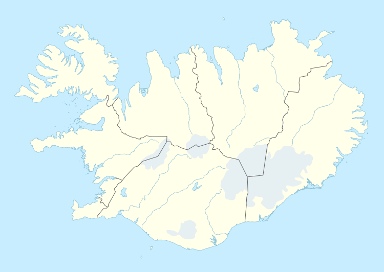 Stöðvarfjörður Location in Iceland | |
| Coordinates: 64°50′00″N 13°52′27.6″W / 64.83333°N 13.874333°W | |
| Country |
|
| Constituency[1] | Northeast Constituency |
| Region[2] | Eastern Region |
| Municipality |
|
| Population (2016) | |
| • Total | 197 |
| Time zone | GMT (UTC+0) |
| Website | Official website |

Stöðvarfjörður (formerly Kirkjuból) is a village in east Iceland. It sits on the Northern shore of the fjord of the same name, is part of the municipality of Fjarðabyggð and has 200 inhabitants.
Geography
Stöðvarfjörður has a harbour and lies on Route 96 (Suðurfjarðarvegur), at the foot of Hellufjall (859m). Most of the village lies on or close to the main street, Fjarðarbraut.
The other villages composing the municipality are: Eskifjörður (1,043 inh.), Fáskrúðsfjörður (662 inh.), Mjóifjörður (35 inh.), Neskaupstaður (1,437 inh.),[3] and Reyðarfjörður (1,102 inh.).[4]
The nearest weather station (with road webcams) is at Kambaskriður. The nearest airport with scheduled flights is Egilsstaðir Airport, which is 75 km (47 mi) away and can be reached within an hour's drive.[5] Air Iceland operates two or three daily flights from Reykjavík to Egilsstaðir or vice versa[6] and the flight is 1 hour long. There is an unscheduled and unused airport with a grass runway in Breiðdalsvík, 20 km (12 mi) from Stöðvarfjörður.[7] Hornafjörður Airport in Höfn, which is 180 km (112 mi) away and takes two hours to reach by car,[8] can also be used if one intends to see the other villages and witness the natural beauty of the east coast of Iceland. Eagle Air operates two daily flights from Reykjavík to Höfn on weekdays with the exception of Tuesday, and one flight on Sundays. Additional flights can be scheduled on specific days in the summer.[9] The flight is 1 hour long.
Reykjavík is 620 km (385 mi) away. It takes 7 hours and 30 minutes to drive from Reykjavík.[10] It takes 12 hours by bus as one needs to change the buses and take the bus to Reykjavík in Höfn.[11] The buses connecting Egilsstaðir to Höfn stop in Stöðvarfjörður alongside other villages.[12]
Climate
The climate seen in Stöðvarfjörður and nearby areas is Tundra climate (ET) because no month has a daily mean above 10 °C (50 °F). However, precipitation and winter temperatures have subpolar oceanic (Cfc) characteristics. Interestingly, from November to March, Stöðvarfjörður is warmer than Reykjavík, even though the fact that Reykjavík has an annual mean temperature 1 °C higher than Stöðvarfjörður.
| Climate data for Kambanes (30m),[13] 3.7 km (2.3 mi) from Stöðvarfjörður (1971–1990) | |||||||||||||
|---|---|---|---|---|---|---|---|---|---|---|---|---|---|
| Month | Jan | Feb | Mar | Apr | May | Jun | Jul | Aug | Sep | Oct | Nov | Dec | Year |
| Average high °C (°F) | 2.2 (36) |
2.7 (36.9) |
2.9 (37.2) |
4.5 (40.1) |
6.2 (43.2) |
8.5 (47.3) |
10.3 (50.5) |
10.4 (50.7) |
8.8 (47.8) |
6.3 (43.3) |
3.8 (38.8) |
2.8 (37) |
5.78 (42.4) |
| Daily mean °C (°F) | −0.2 (31.6) |
0.4 (32.7) |
0.6 (33.1) |
1.7 (35.1) |
3.6 (38.5) |
5.9 (42.6) |
7.6 (45.7) |
8.0 (46.4) |
6.5 (43.7) |
4.3 (39.7) |
1.5 (34.7) |
0.3 (32.5) |
3.35 (38.03) |
| Average low °C (°F) | −2.3 (27.9) |
−1.5 (29.3) |
−1.5 (29.3) |
−0.5 (31.1) |
1.7 (35.1) |
4.0 (39.2) |
5.7 (42.3) |
6.2 (43.2) |
4.6 (40.3) |
2.5 (36.5) |
−0.4 (31.3) |
−1.8 (28.8) |
1.39 (34.53) |
| Average precipitation mm (inches) | 128.8 (5.071) |
103.1 (4.059) |
105.1 (4.138) |
74.0 (2.913) |
83.0 (3.268) |
74.6 (2.937) |
110.0 (4.331) |
128.1 (5.043) |
142.3 (5.602) |
176.2 (6.937) |
118.3 (4.657) |
113.3 (4.461) |
1,356.8 (53.417) |
| Source: Icelandic Met Office[14] | |||||||||||||
Economy
Employment was once predominantly found in fishing, though now it is largely textile-based. Most of the young people have left,[15] thus the community youth hall has been closed due to disuse.
Steinasafn Petru (Petra's Stone Collection) accounts for a modest stream of visitors during the tourist season. There are also galleries (Gallerí Snærós and Svartholið) and a handicrafts market in the salthouse (Salthúsið). At Gallerí Snærós one can find a range of artwork, jewellery and textiles, including products from a local company that designs and manufactures a range of products made from recycled materials (MupiMup).
The town's formerly disused 2800m2 fish factory is currently being transformed into the HERE Creative Centre, which houses workshops for ceramics, wood and metal, art studio spaces, and a recording studio. The centre also hosts live music events, exhibitions, and visiting artists, providing a cultural hub for the town.[16]
Accommodation is available at: Kirkjubær, a former church converted into a guesthouse; at the café / bar / bed & breakfast (Saxa Guesthouse, formerly Kaffi Steinn), at a campsite, and at the Óseyri farmhouse (4 km west of the village). Several other holiday rentals are also available.
There is also an internet café / general store (Brekkan, formerly called Svarti Folinn), an outdoor swimming pool, self-service petrol station, ATM, bus stop and other services.
Notable residents
Footballer Ívar Ingimarsson is the best known former inhabitant of the town. His footballing career started at local youth club Súlan, but he is best known for his spell at Reading in England where he played 281 games, 72 of which were in the Premier League.
References
- ↑ Political division
- ↑ Mainly statistical division
- ↑ Located in the Norðfjörður
- ↑ (Icelandic) Infos on Fjarðabyggð municipal website
- ↑ "Stöðvarfjörður-Egilsstaðir Airport Distance". Google Maps. Retrieved 31 August 2016.
- ↑ "Reykjavik-Egilsstaðir Flight Schedule". Air Iceland. Retrieved 31 August 2016.
- ↑ "Stöðvarfjörður-Breiðdalsvík Airport Distance". Google Maps. Retrieved 31 August 2016.
- ↑ "Stöðvarfjörður-Hornafjörður Airport Distance". Google Maps. Retrieved 31 August 2016.
- ↑ "Reykjavik-Höfn Flight Schedule". Air Iceland. Retrieved 31 August 2016.
- ↑ "Reykjavík-Stöðvarfjörður Distance". Google Maps. Retrieved 31 August 2016.
- ↑ "Reykjavík to Stöðvarfjörður by bus, plane and car". rome2rio. Retrieved 31 August 2016.
- ↑ "ROUTE 62A: HÖFN - EGILSSTADIR - MYVATN - AKUREYRI". SBA-Norðurleid. Retrieved 31 August 2016.
- ↑ "Information about Kambanes Weather Station". Icelandic Meteorological Office. Retrieved 28 August 2016.
- ↑ "Monthly Temperature and Precipitation Averages for Kambanes". Icelandic Meteorological Office. Retrieved 28 August 2016.
- ↑ "The Reykjavik Grapevine Issue 3-2012 p.30". Retrieved 31 August 2016.
- ↑ "HERE Creative Centre". Retrieved 7 April 2014.
External links
![]() Media related to Stöðvarfjörður at Wikimedia Commons
Media related to Stöðvarfjörður at Wikimedia Commons
Coordinates: 64°50′00″N 13°52′27.6″W / 64.83333°N 13.874333°W