Spring Garden Lane
| 春園街 | |
|
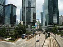
Southern end of Spring Garden Lane, viewed from Queen's Road East | |
| Length | 0.36 km[1] (0.22 mi) |
|---|---|
| Location | Wan Chai |
| South end | Kennedy Road |
| Major junctions | Queen's Road East |
| North end | Johnston Road |
| Construction | |
| Completion | 1840s |

| Spring Garden Lane | |||||||
| Traditional Chinese | 春園街 | ||||||
|---|---|---|---|---|---|---|---|
| Literal meaning | spring-season garden street | ||||||
| |||||||
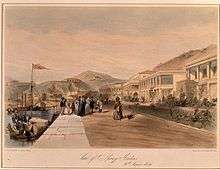

Spring Garden Lane is a street in Wan Chai, Hong Kong, connecting Queen's Road East to its south, and Johnston Road to the north. It was one of the first focal areas developed by the British in Hong Kong during the 1840s.
History
During the early development of Wan Chai, one of the focal area of development was Spring Gardens. The name was used by the British during the early Colonial Hong Kong era in the 1840s.[2] The word "spring" in "Spring Gardens" was supposed to be referring to a water spring. However, when the name "Spring Garden Lane" was translated into Chinese, the resulting name became "春園街", with the character "春" meaning spring season. The water spring mentioned possibly refers to the mountain creek beside Hopewell Centre in Queen's Road East.
In the early 1900s, Spring Garden Lane and Sam Pan Street (三板街) became a red-light district with western and eastern prostitutes. In order to attract attention, brothels were displaying large street number plates, and the area became known as "Big Number Brothels".[3][4]
During the founding of the People's Republic of China around 1948 to 1949, many of the Communist party guerrilla forces found their way to Hong Kong after World War II. One of them was the East River Guerrilla Force (東江縱隊), which formed a pro-Communist underground group called the Hailiushe (海流社). They were headquartered in the rooftop of a multi-story house on Spring Garden Lane. The area and group was raided by the Hong Kong police, while it was an operating network cell.[5]
Around Spring Garden Lane are Lee Tung Street, Swatow Street and Amoy Street where warehouses abounded, storing cargoes to be shipped to Chinese coastline cities.
Intersections
The entire street is in Wan Chai, Wan Chai District.
| km[1] | mi | Destinations | Notes | ||
|---|---|---|---|---|---|
| 0.00 | 0.00 | Kennedy Road | Pedestrianized | ||
| 0.10 | 0.062 | Cul-de-sac | Southern terminus for traffic | ||
| 0.15 | 0.093 | Queen's Road East | |||
| 0.25 | 0.16 | Cross Street | Closed to traffic | ||
| 0.36 | 0.22 | Johnston Road | Northern terminus | ||
1.000 mi = 1.609 km; 1.000 km = 0.621 mi
| |||||
See also
- Queen's Road East, for a list of lanes connecting Johnston Road and Queen's Road East
References
- 1 2 OpenStreetMap contributors. Spring Garden Lane (Map). OpenStreetMap. Retrieved 21 March 2016.
- ↑ Wordie, Jason (2002). Streets: Exploring Hong Kong Island. Hong Kong: Hong Kong University Press. ISBN 962-209-563-1.
- ↑ "Early Hong Kong Brothels", Exhibition at the University Museum and Art Gallery, 26 November 2003 to 29 February 2004
- ↑ Wan Chai Heritage Trail flyer. p.2
- ↑ Fung, Chi Ming (2005). Reluctant Heroes: Rickshaw Pullers in Hong Kong and Canton, 1874-1954. Royal Asiatic Society Hong Kong Branch Hong Kong studies series. Hong Kong University Press. ISBN 978-962-209-734-6.
External links
| Wikimedia Commons has media related to Spring Garden Lane. |
- Picture of "Big Number Houses" on gwulo.com
From East to West | ||||||||
| Queen's Road East |
|   | ||||||
| Queensway |
| |||||||
| Queen's Road Central |
| |||||||
| Queen's Road West | ||||||||
Coordinates: 22°16′32″N 114°10′22″E / 22.275425°N 114.172710°E