Central and Western District
| Central and Western 中西區 | ||
|---|---|---|
| District | ||
| Central and Western District | ||
|
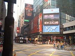
Day view of the Central and Western District skyline | ||
| ||
 Location within Hong Kong | ||
| Coordinates: 22°17′12″N 114°09′18″E / 22.28666°N 114.15497°ECoordinates: 22°17′12″N 114°09′18″E / 22.28666°N 114.15497°E | ||
| Country | Hong Kong | |
| Division | Hong Kong Island | |
| Government | ||
| • District Officer | Eliza Yau | |
| • District Council Chairman | David Yip | |
| Area | ||
| • Total | 12.52 km2 (4.83 sq mi) | |
| • Land | 12.40 km2 (4.79 sq mi) | |
| • Water | .12 km2 (0.05 sq mi) 1% | |
| Population (2011) | ||
| • Total | 251,519 | |
| • Density | 20,000/km2 (52,000/sq mi) | |
| Time zone | Hong Kong Time (UTC+8) | |
| Website | Central and Western District | |


The Central and Western District (Chinese: 中西區) located on northern part of Hong Kong Island is one of the 18 administrative districts of Hong Kong. It had a population of 251,519 in 2011. The district has the most educated residents with the second highest income and the third lowest population due to its relatively small size.
Central is the central business district and the core urban area of Hong Kong. Western District covers Shek Tong Tsui, Kennedy Town and Sai Ying Pun, and was part of the City of Victoria, the earliest urban settlement in colonial Hong Kong.
History
| Central and Western District | |||||||||||||
 | |||||||||||||
| Traditional Chinese | 中西區 | ||||||||||||
|---|---|---|---|---|---|---|---|---|---|---|---|---|---|
| Simplified Chinese | 中西区 | ||||||||||||
| |||||||||||||
Central District, as Victoria City, was the first area of planned urban development in Hong Kong during the colonial era. The British held a land sale in June 1841, six months after the flag was raised at Possession Point. A total of 51 lots of land were sold to 23 merchant houses to build offices and warehouses. The property buyers included Dent's, Jardine's, Russell's and Olyphant's. At the time, the two roads Albany Nullah (now Garden Road) and Glenealy Nullah (now Glenealy) were mainly used by the British. The streets later became known as Government Hill.[1]
In 1857, the British government expanded Victoria City and divided it into seven districts. Those located in present-day Central and Western are: Sai Ying Pun, Sheung Wan, Tai Ping Shan, Central. The area was essentially a European area until 1860 when Chinese merchants begin buying up European properties around Cochrane, Wellington and Pottinger Streets. The Central district was the principal European business district, hence the arrival of the first major bank HSBC. The Western district was the commercial centre for Chinese businesses. When property values in the district rose, a meeting was held in February 1866 to establish a "District Watch Force" to police and protect this specific area.[2]
In 1880, Shek Tong Tsui was established, followed by Kennedy Town in the 20th century. By the 1890s the majority of Hong Kong's population was concentrated in the district with about 200,000 residents, mostly in Victoria City.[3]
Politics
District councils in Hong Kong are primarily consultative bodies of the HKSAR government with very limited powers, primarily restricted to building and maintaining parks, open areas, recreational and cultural activities and tourist promotion. The corresponding body for the district is Central and Western District Council.
District council elections are held every four years; the last one was held on November 7, 2011, for terms beginning January 1, 2012. 15 constituency members are elected while 4 are appointed by the government. The constituency areas are smaller than the commonly used geographic areas, which are in turn based on the old 1857 and 1880 divisions.
Demographics
In Hong Kong's 2011 Census the district population was 251,519, down four percent from 261,884 in the 2001 census, and with an average of 2.7 people for each of the 89,529 households. Among the 18 districts, Central and Western has the second highest median household income in the territory (behind only Wan Chai District). In terms of average size of households, it is third smallest at 2.8 persons, behind only Wan Chai and Yau Tsim Mong District, at 2.7 each.
Central and Western District has a relatively ethnically diverse population. 83% of the district's residents are Chinese, and the largest ethnic groups are Filipinos (6%) and white people (5%). 72% of the district's residents speak Cantonese as their primary language, while 14% use English and 3% use Mandarin.[4]
Geography and political subdivisions
The district is located at 22°17′00″N 114°09′00″E / 22.28333°N 114.15000°E, based on the location of the General Post Office in Central. With an area of 12.4 km², the district occupies the northwestern portion of Hong Kong Island. It is surrounded by Wan Chai District on the east, Southern District on the south, and Victoria harbour in the north. The district also encompasses Green Island and Little Green Island, two uninhabited islands to the west of Hong Kong Island.
Areas from west to east along Victoria Harbour are: Kennedy Town, Sai Ying Pun, Sheung Wan, Central, Admiralty.
Neighbourhoods within the district are listed from east to west.
Admiralty
Central
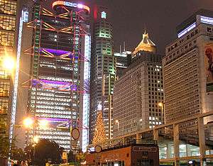
Central is the business centre of Hong Kong, and many multinational financial services corporations have their headquarters there. Government Hill, the site of the government headquarters, is also in Central.
Central mid-levels escalator

The Central-Mid-levels escalator in Hong Kong is the longest outdoor covered escalator system in the world. The system is 800 metres (2,600 ft) long, connecting Des Voeux Road Central, in Central with Conduit Road in the Mid-levels, passing through narrow streets in Soho.
The escalator runs downhill from 6 am to 10 am and uphill from 10:20 am to 12:00 am (midnight) every day. Apart from its significance in transport linkage, it is also a tourist attraction, with many restaurants, bars, and shops lining its route.
Bank of China Tower
The Bank of China Tower in Central houses the headquarters of BOCHK. Designed by I. M. Pei, the 70 storey building's height is 315 metres (1,033 ft) with two masts reaching 369 metres (226 ft). Construction began in 1985 and the building was completed in 1989. It was the first building outside the United States to exceed 1,000 feet (300 m) and to exceed 300 metres (980 ft). It was the tallest building in Hong Kong and Asia from 1989 to 1992, when the nearby, taller Central Plaza was completed.
City Hall
Built in 1962, the City Hall complex housed the old central library of Hong Kong, as well as concert halls, restaurants and a marriage registry. The conference room of the former Urban Council was also at the lower building of the City Hall.
The garden at the north-western side of the complex includes a memorial to those killed in Hong Kong during World War II.
Chinese People's Liberation Army Forces Hong Kong Building
The funnel-shaped Chinese People's Liberation Army Forces Hong Kong Building (formerly, and still commonly known as the Prince of Wales Building) housed the headquarters of the British garrison in Hong Kong until the territory's handover to the People's Republic of China on June 30, 1997. It now houses the local garrison of the People's Liberation Army and is formally known as Central Barracks, in line with PLA convention for naming barracks after the name of the locality.
Other landmarks
- Cenotaph, Hong Kong
- Chater Garden
- Chinese People's Liberation Army Forces Hong Kong Building (formerly the Prince of Wales Building)
- Edinburgh Place, Hong Kong – including Queen's Pier and the Star Ferry pier
- Exchange Square
- Former Supreme Court Building
- Harcourt Garden
- Hong Kong Zoological and Botanical Gardens
- Hong Kong Club
- Hong Kong Park
- HSBC Hong Kong headquarters building
- International Finance Centre
- Jardine House
- Lan Kwai Fong
- Legislative Council building
- Lippo Centre
- Old Bank of China Building
- Peak Tram terminus
- St. John's Cathedral, Hong Kong
- St. Joseph's Church, Hong Kong
- St. Joseph's College, Hong Kong
- St. Paul's Church, Hong Kong
- St. Paul's Co-educational College
- Soho
- Statue Square
- The First Church of Christ, Scientist, Hong Kong
- Union Church, Hong Kong
Mid-levels
Sai Ying Pun
Sheung Wan
Secondary schools
Arranged by alphabetical order of their full names in each category.
Government-administered schools
Aided schools
- Caritas St. Francis Secondary School
- Lok Sin Tong Leung Kau Kui College
- Raimondi College
- St. Clare's Girls' School
- St. Joseph's College
- St. Louis School
- St. Stephen's Church College
- St. Stephen's Girls' College
- Ying Wa Girls' School
Schools under Direct Subsidy Scheme (DSS)
- Hon Wah Middle School ,
- St. Margaret's Girls' College, Hong Kong
- St. Paul's Co-educational College
- St. Paul's College
International schools
- Carmel School
- German Swiss International School
- Hong Kong International School
- Island School (under funding of English Schools Foundation, subsidised by government)
- King George V School
- Lycée Français International Victor Segalen
- Sear Rogers International School, Hong Kong Island
- Sha Tin College
- Singapore International School
- South Island School
- West Island School
Vocational and night schools (privately funded)
- Sacred Heart Canossian College of Commerce
- St. Paul's Secondary Evening School
Tertiary institutions
Transport
Link
Major roads that serves the area include:
- Harcourt Road
- Connaught Road Central, Connaught Road West
- Queensway, Queen's Road Central, Queen's Road West
- Des Voeux Road Central, Des Voeux Road West
- Hill Road Flyover
- Caine Road
- Robinson Road
- Park Road
- Bonham Road
- Western Harbour Tunnel
Public transport
- Island Line: Sheung Wan Station, Central Station, Admiralty Station
- Tsuen Wan Line: Central Station, Admiralty Station
- Tung Chung Line: Hong Kong Station
- Airport Express: Hong Kong Station
- (franchised) bus
- NWFB: 2, 3A, 4, 4X, 13, 15, 15A, 15B, 15C, 18, 18P, 23, 23A, 23B, 25, 26, 30X, 43X, 46X, 66, 91, 93, 93A, 94, 94X, 590, 590A, 720, 720A, 720P, 722
- Citybus: 1, 3B, 5, 5B, 5C, 5P, 5S, 5X, 6, 6A, 6X, 7, 10, 10S, 11, 12, 12A, 12M, 37A, 37B, 37X, 40, 40M, 40P, 70, 70P, 71, 71P, 75, 90, 90B, 90C, 93C, 97, 260, 347, 511, 629, 629A, 780, 780P, 788, 789, M47, N8X, N90, A10, A11, A12, E11, N11
- Harbour-crossing routes : 101, 103, 104, 109, 111, 111P, 113, 115, 115P, 182, 182P, 301, 302, 305, 307, 336, 373, 373A, 601, 601P, 603, 603P, 603S, 619, 619P, 619X, 680, 680A, 680P, 680X, 681, 681P, 690, 690P, 692, 692P, 904, 905, 914, 914X, 930, 930A, 934, 935, 948, 948P, 960, 960A, 960B, 960P, 960S, 961, 962, 962A, 962A, 962B, 962C, 962P, 962S, 962X, X962, 967, 967X, 968, 969, 969A, 969B, 969C, 970, 970X, 971, 973, 973P, N121, N182, N368, N619, N680, N691
See also
References
- ↑ Wordie, Jason (2002). Streets: Exploring Hong Kong Island. Hong Kong: Hong Kong University Press. ISBN 962-209-563-1.
- ↑ Tsai Jung-fang. [1995] (1995). Hong Kong in Chinese History: community and social unrest in the British Colony, 1842-1913. Columbia University Press. ISBN 0-231-07933-8
- ↑ Sanderson, Edgar (1897–1898). The British Empire in the nineteenth century: its progress and expansion at home and abroad. IV. London: Blackie and Son. p. 339. LCCN 02002538. OCLC 11625716.
- ↑ 2011 Population Census - Fact Sheet for Central and Western District Council District, Hong Kong Census
External links
| Wikivoyage has a travel guide for Hong Kong/Central. |
- Central and Western District Council
- List and map of electoral constituencies (large PDF file)
- Coordinates are courtesy of the GNS system of the National Imagery and Mapping Agency.
 |
Kwai Tsing District, Sham Shui Po District | Yau Tsim Mong District | | |
| Islands District | |
Wan Chai District | ||
| ||||
| | ||||
| Southern District |