Spodnji Žerjavci
| Spodnji Žerjavci | |
|---|---|
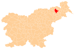
 Spodnji Žerjavci Location in Slovenia | |
| Coordinates: 46°36′21.47″N 15°51′30.88″E / 46.6059639°N 15.8585778°ECoordinates: 46°36′21.47″N 15°51′30.88″E / 46.6059639°N 15.8585778°E | |
| Country |
|
| Traditional region | Styria |
| Statistical region | Drava |
| Municipality | Lenart |
| Area | |
| • Total | 2.41 km2 (0.93 sq mi) |
| Elevation | 287.5 m (943.2 ft) |
| Population (2002) | |
| • Total | 320 |
| [1] | |
Spodnji Žerjavci (pronounced [ˈspoːdnji ʒɛˈɾjaːu̯tsi]) is a settlement in the Municipality of Lenart in northeastern Slovenia. It lies in the Slovene Hills (Slovene: Slovenske gorice), just off the road from Lenart towards Benedikt. The area was part of the traditional region of Styria. It is now included in the Drava Statistical Region.[2]
There are two small chapels in the settlement. One dates to 1869 and the second dates to the early 20th century.[3]
References
- ↑ Statistical Office of the Republic of Slovenia
- ↑ Lenart municipal site
- ↑ Slovenian Ministry of Culture register of national heritage reference number ešd 3823 & 1872
External links
| Settlements | Administrative centre: Lenart v Slovenskih Goricah
|  | ||||||
|---|---|---|---|---|---|---|---|---|
| Landmarks |
| |||||||
This article is issued from Wikipedia - version of the 2/11/2016. The text is available under the Creative Commons Attribution/Share Alike but additional terms may apply for the media files.