South Carolina Highway 49
| ||||
|---|---|---|---|---|
| Route information | ||||
| Maintained by SCDOT | ||||
| Length: | 78.7 mi[1] (126.7 km) | |||
| Existed: | 1937 – present | |||
| Major junctions | ||||
| South end: |
| |||
|
| ||||
| North end: |
| |||
| Location | ||||
| Counties: | Laurens, Spartanburg, Union, Chester, York | |||
| Highway system | ||||
| ||||

South Carolina Highway 49 is a primary state highway in the U.S. state of South Carolina. It traverses north–south from Watts Mill to the North Carolina state line, in Lake Wylie.
Route description
SC 49 is part of a three-state highway 49, that totals 325 miles (523 km), from Watts Mill, South Carolina to Crewe, Virginia.[2]
History
Established in 1937 as a renumbering of SC 163; it ran from U.S. Route 321, in York, to the North Carolina state line, in Lake Wylie. In 1956, SC 49 was extended southwest to its current southern terminus at US 221, in Watts Mill; replacing SC 91 from York to Monarch, SC 92 from Monarch to Cross Anchor, and SC 30 from Cross Anchor to Watts Mill.[3]
In 1960 or 1961, SC 49 was rerouted from Lockhart to Mount Tabor. At an unknown date, SC 49 was rerouted north around downtown Union.[3]
One previous SC 49 existed from around 1927-1935, from Myrtle Beach to the North Carolina state line in Little River. In 1932, most of SC 49 north of Myrtle Beach was replaced by US 117; by 1935, the rest of SC 49 (and US 117) was replaced by US 17.[3]
Junction list
| County | Location | mi[1] | km | Destinations | Notes |
|---|---|---|---|---|---|
| Laurens | Watts Mill | 0 | 0.0 | Southern terminus | |
| | 2.5 | 4.0 | I-385 exit 5. | ||
| | 5 | 8.0 | |||
| Spartanburg | | 9 | 14 | I-26 exit 44. | |
| | 10 | 16 | |||
| Cross Anchor | 12.5 | 20.1 | |||
| Union | Union | 28 | 45 | South end of US 176 and SC 215 overlap | |
| 29 | 47 | North end of US 176 and SC 215 overlap | |||
| 30 | 48 | ||||
| | 39 | 63 | |||
| Lockhart | 41 | 66 | North end of SC 9 overlap | ||
| Chester | | 42 | 68 | South end of SC 9 overlap | |
| York | Bullock Creek | 47 | 76 | ||
| | 50 | 80 | |||
| Sharon | 55.5 | 89.3 | |||
| York | 61.5 | 99.0 | |||
| 60 | 97 | South end of US 321 Business overlap | |||
| 62.5 | 100.6 | ||||
| 63 | 101 | North end of US 321 Business overlap | |||
| 64 | 103 | ||||
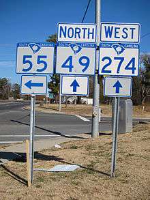
| | 73.5 | 118.3 | South end of SC 274 overlap | ||
| | 73.7 | 118.6 | |||
| Lake Wylie | 76 | 122 | North end of SC 274 overlap | ||
1.000 mi = 1.609 km; 1.000 km = 0.621 mi
| |||||
See also
References
- 1 2 Google (2011-07-04). "SC 49" (Map). Google Maps. Google. Retrieved 2011-07-04.
- ↑ Google (2011-07-04). "SC,NC,VA 49" (Map). Google Maps. Google. Retrieved 2011-07-04.
- 1 2 3 "Mapmikey's South Carolina Highways Page". Retrieved 2011-07-04.
External links
-
 Media related to South Carolina Highway 49 at Wikimedia Commons