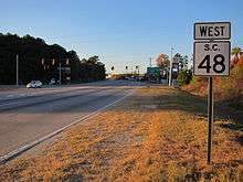
South Carolina Highway 48
| ||||
|---|---|---|---|---|
| Route information | ||||
| Maintained by SCDOT | ||||
| Length: | 29.0 mi[1] (46.7 km) | |||
| Existed: | 1930 – present | |||
| Major junctions | ||||
| West end: |
| |||
|
| ||||
| East end: |
| |||
| Location | ||||
| Counties: | Richland | |||
| Highway system | ||||
| ||||

South Carolina Highway 48 (SC 48) is a primary state highway in the U.S. state of South Carolina. It serves southern Richland County and access to the Congaree National Park.
Route description
SC 48 begins in downtown Columbia, along Assembly Street. It traverses west, passing alongside the South Carolina State House and the University of South Carolina, before turning onto Rosewood Drive and then onto Bluff Road. After leaving the Columbia city limits, it continues through southeastern Richland County as a two-lane rural highway to US 601.
History
Established in 1930 as a new primary routing, it originally traversed from Gervais Street, going east along Assembly Street, to US 601 in Wateree. Various adjustments in its downtown routing have been made between 1937-46. In 1950, SC 48 was straightened out between Gadsden and Wateree, leaving behind Old Bluff Road. In 1978, SC 48 was extended west to its current western terminus at Elmwood Avenue.[2]
Junction list
The entire route is in Richland County.
| Location | mi[1] | km | Destinations | Notes | |
|---|---|---|---|---|---|
| Columbia | 0.0 | 0.0 | |||
| 0.5 | 0.80 | To Fort Jackson | |||
| 1.0 | 1.6 | ||||
| 1.5 | 2.4 | To Columbia Metropolitan Airport To Fort Jackson | |||
| 2.5 | 4.0 | ||||
| 5.4 | 8.7 | ||||
| 5.6 | 9.0 | I-77 exit 5. | |||
| | 17.7 | 28.5 | Mountain View Road | To Congaree National Park | |
| Gadsden | 21.2 | 34.1 | |||
| Wateree | 29.0 | 46.7 | |||
| 1.000 mi = 1.609 km; 1.000 km = 0.621 mi | |||||
References
| Wikimedia Commons has media related to South Carolina Highway 48. |
- 1 2 Google (November 23, 2012). "South Carolina Highway 48" (Map). Google Maps. Google. Retrieved November 23, 2012.
- ↑ "Mapmikey's South Carolina Highways Page (SC 40-49)". Retrieved November 23, 2012.