Sorthat-Muleby
| Sorthat-Muleby | |
|---|---|
| Village | |
|
Road into Sorthat-Muleby, Bornholm | |
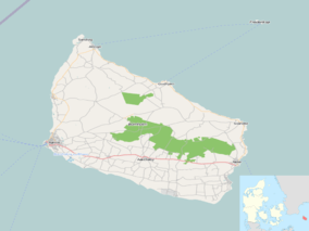 Sorthat-Muleby Location on Bornholm | |
| Coordinates: 55°09′03″N 14°43′13″E / 55.15083°N 14.72028°E | |
| Country | Denmark |
| Region | Capital (Hovedstaden) |
| Municipality | Bornholm |
| Population (2014) | |
| • Total | 541 |
| Time zone | CET (UTC+1) |
| • Summer (DST) | CEST (UTC+2) |

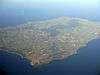
Sorthat-Muleby is a village in the southwest of the Danish island of Bornholm, 6 kilometres (3.7 mi) north of Rønne and 4 kilometres (2.5 mi) south of Hasle. Muleby to the north and Sorthat to the south now form a single urban area. As of 2014, it has a population of 541.[1][2]
Description
Sorthat-Muleby is essentially a satellite town serving Rønne and Hasle. It enjoys an attractive location close to forests and the coast. Sorthat consists of rows of residential housing parallel to Nyker Strandvej and the Sahara summer house development at the southern end of the settlement. Muleby, north of the stream known as Mulebyå, is also a residential town with a number of small houses from the 1950s built for those working in the nearby clay mineral deposits and tile factory Hasle Klinker- og Chamottestensfabrik, which made heat refractoring tiles for ovens. This factory closed in 1997. The yellow tiles are used as pavement stones in the towns on the island. On the eastern side of Muleby, there is a cement factory, opened in 1947, which employs about 50.[2] The coastal strip known as Sorthat Odde has an impressive array of wild plants including crowberry, heather, linnea and smyrnium.[3]
History
The area still bears traces of the earlier quarrying of coal, gravel, clay and lake chalk, leaving three pleasant lakes in the Hasle Lystskov woods. There are also the remains of old coastal defences including entrenchments, batteries and a beacon. On the beach next to Klinkerskoven woods, the old Sorthat Battery with its cannons has been preserved.[4] In the fields to the east of Sorthat, there are prehistorical remains including a bronze age grave site.[2]
References
- ↑ "Statistikbanken Table BEF44", Danmarks Statistik. Retrieved 8 November 2012.
- 1 2 3 "411 - Sorthat - Muleby", Bornholms Regionskommune. (Danish) Retrieved 8 November 2012.
- ↑ "Sorthat Odde", På 367 ture i Bornholms natur. (Danish) Retrieved 8 November 2012.
- ↑ "Sorthat Strand", Destination Bornholm. (Danish) Retrieved 8 November 2012.
 | |
| Towns & villages | |
| Localities | |
| Churches | |
| Culture | |
| Fortifications | |
| Lighthouses | |
| Windmills | |
| Beauty spots |
|
| Transport | |
| Attractions | |
Coordinates: 55°09′035″N 14°43′13″E / 55.15972°N 14.72028°E