Hammeren Lighthouse
 Hammeren Lighthouse | |
 Hammeren Lighthouse Hammer fyr Denmark | |
| Location |
Hammeren, Bornholm Denmark |
|---|---|
| Coordinates | 55°17′13″N 14°45′34″E / 55.286902°N 14.759334°E |
| Year first constructed | 1872 |
| Deactivated | 1990 |
| Construction | granite tower |
| Tower shape | cylindrical tower with balcony and lantern attached to 1-story keeper’s house |
| Markings / pattern | unpainted tower, greenish lantern dome |
| Height | 21 metres (69 ft) |
| Focal height | 91 metres (299 ft) |
| Original lens | 1st order Fresnel lens |
| ARLHS number | DEN-012 |
| Managing agent | Hammerfyr[1] |
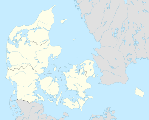
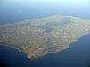
Hammeren Lighthouse (Danish: Hammeren Fyr) is located on the Hammeren peninsula on the northwestern tip of the Danish island of Bornholm.
History
An older, coal-fired lighthouse built in 1802 and modernized in 1837 was taken out of operation in 1872 when it was decided to build a new, taller replacement close to the very highest point on Hammeren, Stejlebjerg. Its height, however, proved to be a problem as it could not always be seen from the sea in foggy weather. It was therefore decided in 1895 to build a second lighthouse, Hammer Odde Lighthouse.[2]
The lighthouse
Inactive since 1990,[3] it is situated on the heights of Stejlebjerg. Its lantern, 14 feet (4.3 m) in diameter, is 280 feet (85 m) above sea level. When operational, its fixed lamplight was visible at a distance of 23 miles (37 km).[4] The lighthouse is located on the northwestern tip of Bornholm, with GPS coordinates 55°17'N, 14°55'E, at the end of the Fyrvej about 2.5 kilometres (1.6 mi) west of Sandvig. It is a circular granite tower (built beside a 1-1/2 storied keeper's house in brick) and stands in a very scenic natural area (surrounded by small coniferous vegetation) with many old monuments. This lighthouse replaced the Stejlebjerg Lighthouse, established in 1802, which was closer to Hammerodde. Built in 1871, Hammeren Lighthouse was functional between 1872 and 1990, with electrification provided in 1947. The masonry tower is 21 metres (69 ft) in height but the total height of the lighthouse, including its beaming lantern dome (with a greenish metallic colour) and fixtures, is 91 metres (299 ft). This was considered too high to be seen in foggy weather. Visitors are permitted to enter the tower during the summer period.[5] On a clear day, views extend to the Swedish coast.[4][6]
See also
References
| Wikimedia Commons has media related to Hammeren Lighthouse. |
- ↑ Rowlett, Russ. "Lighthouses of Denmark: Bornholm". The Lighthouse Directory. University of North Carolina at Chapel Hill. Retrieved January 16, 2016.
- ↑ "Hammeren Fyr", Den Store Danske. (Danish) Retrieved 30 October 2012.
- ↑ "Lighthouses of Denmark: Bornholm". University of North Carolina. Retrieved 23 October 2012.
- 1 2 Norie, John William (1846). Piloting directions for the Cattegat and Baltic, or East sea; also for the Sound and Belts (Public domain ed.). Wilson. pp. 39–. Retrieved 22 October 2012.
- ↑ "Lighthouse pages: Lighthouse Hammeren Fyr". Leuchtturmseiten. Retrieved 22 October 2012.
- ↑ Backpacker. Active Interest Media, Inc. 1978. p. 36. Retrieved 22 October 2012.
 | |
| Towns & villages | |
| Localities | |
| Churches | |
| Culture | |
| Fortifications | |
| Lighthouses | |
| Windmills | |
| Beauty spots |
|
| Transport | |
| Attractions | |
Coordinates: 55°17′11″N 14°45′55″E / 55.28639°N 14.76528°E