Smoky Hill Township, Geary County, Kansas
| Smoky Hill Township | |
|---|---|
| Township | |
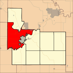 Location in Geary County | |
| Coordinates: 39°01′27″N 096°50′26″W / 39.02417°N 96.84056°WCoordinates: 39°01′27″N 096°50′26″W / 39.02417°N 96.84056°W | |
| Country | United States |
| State | Kansas |
| County | Geary |
| Area | |
| • Total | 65.25 sq mi (168.99 km2) |
| • Land | 57.52 sq mi (148.97 km2) |
| • Water | 7.73 sq mi (20.02 km2) 11.85% |
| Elevation | 1,138 ft (347 m) |
| Population (2000) | |
| • Total | 4,974 |
| • Density | 86.5/sq mi (33.4/km2) |
| GNIS feature ID | 0476557 |
Smoky Hill Township is a township in Geary County, Kansas, USA. As of the 2000 census, its population was 4,974.
History
Smoky Hill Township was organized in 1872.[1]
Geography
Smoky Hill Township covers an area of 65.25 square miles (169.0 km2) and contains one incorporated settlement, Fort Riley-Camp Whiteside. According to the USGS, it contains three cemeteries: Alda, Alida and Saint Johns.
The streams of Curtis Creek, Fourmile Creek, Onemile Creek, Republican River, School Creek and Smoky Hill River run through this township.
Transportation
Smoky Hill Township contains one airport or landing strip, Ritter Airport (historical).
References
- ↑ "Geary County History (archived)". Geary County Historical Society. Archived from the original on October 12, 2013. Retrieved 10 June 2014.
External links
Municipalities and communities of Geary County, Kansas, United States | ||
|---|---|---|
| Cities | 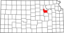 | |
| CDP |
| |
| Unincorporated communities | ||
| Townships | ||
| Footnotes | ‡This populated place also has portions in an adjacent county or counties | |
This article is issued from Wikipedia - version of the 4/2/2016. The text is available under the Creative Commons Attribution/Share Alike but additional terms may apply for the media files.